


Refine your search for walks in Baisse de la Déa
Baisse de la Déa walks


 La Baisse de Camp d'Argent – Sospel
 Visorando Member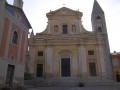
 13.53 mi
 +1,670 ft
 -6,289 ft
 10 hrs
 Very difficult
 Departure from La Bollène-Vésubie (Alpes-Maritimes)
The sixth stage ofthe GR®52, where the landscapes change dramatically. Due to its length and significant descent of nearly 2,000 metres, the stage is very difficult. The descent to Sospel, which makes up two-thirds of the route, puts a real strain on the knees and ankles. Please note, it gets very hot in summer on this section.
Mercantour route via the GR®52
 65.54 mi
+21,585 ft
-24,639 ft
7 days
Very difficult
Departure from Saint-Martin-Vésubie (Alpes-Maritimes)
65.54 mi
+21,585 ft
-24,639 ft
7 days
Very difficult
Departure from Saint-Martin-Vésubie (Alpes-Maritimes)
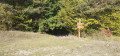
TheGR® 52 is a route that crosses the Mercantour National Park, through the Alpes-Maritimes from Saint-Dalmas-de-Valdeblore to Menton.
ThisGR® route is very challenging due to the varied terrain and significant elevation changes.
You’ll reach altitudes of up to 2,700m, where you can admire the high-mountain landscapes, flora and fauna. Then, in the second half of the route, you’ll encounter panoramas that are more southern in character but just as extraordinary.
Walks near Baisse de la Déa
Sospel - Menton
10.24 mi
+3,691 ft
-4,767 ft
7h 55
 Difficult
Departure from Sospel (Alpes-Maritimes)
Difficult
Departure from Sospel (Alpes-Maritimes)
This is the last stage ofthe GR® 52. It is certainly not the highest in altitude, but it is difficult due to its distance and the passage of certain passes with steep ascents and descents. The Mediterranean views are splendid, especially those from the Col du Razet and Col du Berceau, which rises to 1,100 metres above the town of Menton, the end point of theGR®. You walk along the Italian border throughout the route.
Be warned, in summer this stage is very challenging due to the heat, especially the descent from the Col du Berceau.
Sospel – Menton
 12.54 mi
+3,671 ft
-4,816 ft
7 hrs
Very difficult
Departure from Sospel (Alpes-Maritimes)
12.54 mi
+3,671 ft
-4,816 ft
7 hrs
Very difficult
Departure from Sospel (Alpes-Maritimes)
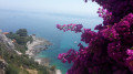
This route leaves theGR® 52 to head for Grammondo and cross over to the Italian side.
On the descent, there are almost constant views of the sea, ending in the very pretty town of Grimaldi.
Saorge – Breil-sur-Roya
 5.75 mi
+2,343 ft
-3,009 ft
4h 40
5.75 mi
+2,343 ft
-3,009 ft
4h 40
 Moderate
Departure from Saorge (Alpes-Maritimes)
Moderate
Departure from Saorge (Alpes-Maritimes)
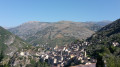
This is the Valléen trail, an easy route along the Roya.
Both towns are served by the ‘Train des Merveilles’. From Breil to Sospel: one stop (15 mins).
From the Refuge des Merveilles to L'Authion via the Pas du Diable
 6.11 mi
+1,850 ft
-2,159 ft
4h 25
Moderate
Departure from Tende (Alpes-Maritimes)
6.11 mi
+1,850 ft
-2,159 ft
4h 25
Moderate
Departure from Tende (Alpes-Maritimes)
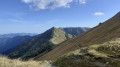
A beautiful classic route on theGR®®52. As you progress along this three-part itinerary, you will appreciate the beauty of the lakes up to the Pas du Diable, then the very chaotic landscape at the foot of the Cime du Diable and Mont Capelet Supérieur. Finally, after the Baisse Cavaline, you will enter a more Mediterranean setting to discover the Authion massif, a historic site during the end of the Second World War.
From the Refuge Merveilles to the Refuge Nice via the Baisses de Valmasque and the Basto
5.79 mi
+2,464 ft
-2,129 ft
4h 50
Difficult
Departure from Tende (Alpes-Maritimes)
Third stage of the five-day Vievola–Saint-Martin-Vesubie hike.
On the itinerary: a crossing of the Vallée des Merveilles and several lovely high-altitude lakes.
Refuge des Merveilles - Baisse de Camp
 8.26 mi
+1,946 ft
-3,150 ft
5h 30
Difficult
Departure from Tende (Alpes-Maritimes)
8.26 mi
+1,946 ft
-3,150 ft
5h 30
Difficult
Departure from Tende (Alpes-Maritimes)
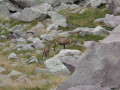
The fifth stage ofthe GR®52, where southern landscapes give way to mountain scenery. Challenging due to its elevation gain, this stage follows the old Italian border, where you’ll discover numerous military remains. Notably at Authion, where one of the last battles in France took place, resulting in the deaths of 273 French soldiers just a few weeks before the armistice of 8 May 1945. The views here are fabulous.
Refuge des Merveilles – Castérino
 8.31 mi
+2,703 ft
-4,058 ft
8 hrs
Very difficult
Departure from Tende (Alpes-Maritimes)
8.31 mi
+2,703 ft
-4,058 ft
8 hrs
Very difficult
Departure from Tende (Alpes-Maritimes)
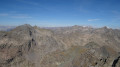
This final stage will take you back to Castérino via the ascent of Mont Bégo. From the summit, you’ll look out over the Vallée des Merveilles. You’ll catch sight of the neighbouring peak opposite, the Grand Capelet. You’ll enjoy a 360° panorama stretching from the Argentera to the Mediterranean.
You’ll need to be careful on the first part of the descent towards the Baisse de Valmasque (rated T3).
From the Baisse de Valmasque, the return journey follows the classic route that runs alongside the Lacs du Basto, Noir and Vert.
Refuge des Merveilles - Refuge de Nice
 5.43 mi
+2,543 ft
-2,201 ft
4h 45
Difficult
Departure from Tende (Alpes-Maritimes)
5.43 mi
+2,543 ft
-2,201 ft
4h 45
Difficult
Departure from Tende (Alpes-Maritimes)
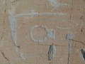
This itinerary allows you to discover the wonders of this valley. In particular, the famous engravings such as Christ, the Tribal Chief and the Altar Rock. But be careful, these areas are monitored!
Merveilles Rest House – Merveilles Mountain Hut
 5.68 mi
+3,688 ft
-1,909 ft
5h 50
Difficult
Departure from Belvédère (Alpes-Maritimes)
5.68 mi
+3,688 ft
-1,909 ft
5h 50
Difficult
Departure from Belvédère (Alpes-Maritimes)
The aim of this fourth stage is to reach the Merveilles mountain refuge. The route is less well-travelled than the classic one via the Pas de l’Arpette. You’ll discover the Verrariers valley and the Pas du Trem. This small pass lies at the foot of the Cime du Diable, which you simply must climb. This magnificent viewpoint offers a 360° panorama of the Mercantour, as well as the Authion, the Col de Turini and all the way to the sea. You’ll then walk alongside the lakes of La Muta, Le Trem and Fourca.
From Castillon-village to Monti via Mont Mulacié
 9.66 mi
+3,589 ft
-4,764 ft
7h 35
Difficult
Departure from Castillon (Alpes-Maritimes)
9.66 mi
+3,589 ft
-4,764 ft
7h 35
Difficult
Departure from Castillon (Alpes-Maritimes)
A cross-country hike through the Menton region along a little-used route, passing through wild and unspoilt areas where traces of human habitation still remain.
The route also provides access to the summit of Mont Mulacié, the second-highest peak in the Menton region, which is very little visited as it lies off the official marked trails. The view from this summit is interesting, although less spectacular than that from its neighbour, the Grammondo.