Sospel – Menton

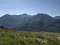
This route leaves theGR® 52 to head for Grammondo and cross over to the Italian side.
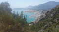
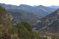
On the descent, there are almost constant views of the sea, ending in the very pretty town of Grimaldi.

This walk is part of a multi-day hike: Variante de la GTA Briançon - Menton

Details

2423496
Creation:
Last update:
Last review:
  • Walking
    Activity: Walking
  • ↔
    Distance: 12.54 mi
  • ◔
    Duration according to the author: 7 hrs 
  • ▲
    Difficulty: Very difficult

  • ⚐
    Back to start: No
  • ↗
    Ascent: + 3,671 ft
  • ↘
    Descent: - 4,816 ft

  • ▲
    Highest point: 4,518 ft
  • ▼
    Lowest point: 13 ft

Photos

Description of the walk

(S) In Sospel, follow the Route d’Erc towards the Col de Castillon. Cross the railway line. TheGR® 52 cuts across a hairpin bend to the right. Continue straight ahead on the road to the Fontan district.

(1) The road turns into a track. Shortly after the Vallon de Plan German, take the path on the right which climbs through the forest before rejoining the track. Follow it to marker 107.

(2) Immediately turn right onto theGR® along a path that heads south-east and quickly turns south towards the Col du Razet. You’ll reach a track junction at marker 107a.

(3) Keep to the left on theGR®, crossing several streams, including the Ruisseau de l’Albaréa, shortly before reaching the Col du Razet at marker 90, a junction of several paths

(4) Continue straight ahead, ignoring the path that descends. A gentle climb leads to Colla Bassa, marker 95.

(5) Leave theGR® 52 and take a track on the left that climbs. Pass the hairpin bend on the right until you reach the sign marking the border.

(6) Turn right without crossing the border. The track turns into a path. Follow the trail, which soon heads east towards the summit marked by a cross. Descend along the ridge due east to a hairpin bend on the right at the foot of Punta Renuit.

(7) Turn right, almost 180°, onto the path that descends south-west beneath the summit. Return to the French-Italian border and follow it to the Pas de la Corne, marked by marker 94a and an electricity pylon.

(8) Ignore the path that crosses the border to the west and continue south-east. At the next junction, turn right towards Motorola. You’ll reach a wooded area.

(9) Turn left and take the red and white marked path – this is the ‘Alpi – Mare’ route, which heads east and passes south of Monté Fuga. Continue until you reach a Y-shaped junction of paths.

(10) Take the path on the right, heading due south along a ridge. You’ll reach a large network of tracks.

(11) Turn left and then follow the track heading due south until you reach another crossroads.

(12) Turn right onto the path, first turn left then right, then continue the descent due south. You will reach the hamlet of Ciotti.

(13) As soon as you reach the first houses, turn right and stay on the Alpi-Mare path. Pass through a group of ruins, continue above the motorway and reach the heights of Grimaldi.

(14) Head down the cobbled alleyways amongst the greenhouses towards the sea. Turn right before the railway line to rejoin the Via Aurelia coastal path, continuing to the border post and Menton (E).


Waypoints

  1. S : mi 0 - alt. 1,168 ft - Sospel. Near the - Bévéra (rivière)
  2. 1 : mi 0.86 - alt. 1,562 ft - Fontan district
  3. 2 : mi 1.6 - alt. 2,051 ft - Marker 107
  4. 3 : mi 2.19 - alt. 2,651 ft - Marker 90
  5. 4 : mi 3.54 - alt. 3,386 ft - Le col du Razet
  6. 5 : mi 4.5 - alt. 3,632 ft - Colla Bassa
  7. 6 : mi 4.77 - alt. 3,891 ft - Border
  8. 7 : mi 5.46 - alt. 4,255 ft - Punta Renuit
  9. 8 : mi 6.96 - alt. 3,363 ft - Pas de la Corne
  10. 9 : mi 7.82 - alt. 2,986 ft - Follow Motorola
  11. 10 : mi 8.75 - alt. 2,126 ft - Y-junction
  12. 11 : mi 9.45 - alt. 1,486 ft - Crossroads of trails
  13. 12 : mi 9.98 - alt. 1,243 ft - Zigzag crossroads
  14. 13 : mi 10.44 - alt. 1,030 ft - Ciotti
  15. 14 : mi 10.89 - alt. 794 ft - Grimaldi
  16. E : mi 12.54 - alt. 13 ft - Gare de Menton-Garavan

Notes

Caution: there is no water on the Italian side and the landscape is arid.

Worth a visit

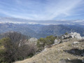
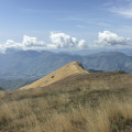
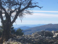
Stunning views from the summit of Grammondo.
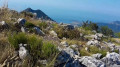
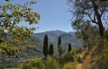
Path with sea views.
A flower-filled arrival at Grimaldi.

Always be cautious and plan ahead when you're outdoors. Visorando and the author of this route cannot be held responsible for any accidents occurring on this route.

The GR® and PR® markings are the intellectual property of the Fédération Française de Randonnée Pédestre.

Reviews and comments

4.8 / 5
Based on 3 reviews

Reliability of the description
4.7 / 5
Ease of following the route
4.7 / 5
Route interest
5 / 5
bernard bb
bernard bb

Thank you, Louisel, for your review
Best wishes, B.

Machine-translated

Louisel
Louisel

Overall rating : 4.3 / 5

Date of your route : Mar 21, 2024
Reliability of the description : ★★★★☆ Good
Ease of following the route : ★★★★☆ Good
Route interest : ★★★★★ Very good
Very busy route : No

I loved this walk, although on the Italian side the path is less well signposted, so keep a close eye on your GPS. The scenery at the top of the peak is magnificent.

Machine-translated

bernard bb
bernard bb

Overall rating : 5 / 5

Date of your route : Jan 19, 2021
Reliability of the description : ★★★★★ Very good
Ease of following the route : ★★★★★ Very good
Route interest : ★★★★★ Very good
Very busy route : No

A lovely walk.

Means of transport used: the train
- So we set off from Nice station, and the trip ended at Menton station.

Machine-translated

gege 10
gege 10
• Edited:

Overall rating : 5 / 5

Date of your route : Jul 25, 2019
Reliability of the description : ★★★★★ Very good
Ease of following the route : ★★★★★ Very good
Route interest : ★★★★★ Very good

Hello, I’ve already done the route via the GR trail and then the summit of Grammondo several times, but I wasn’t familiar with this alternative route via Garibaldie. I’ll give it a go as soon as the lockdown (Covid) comes into effect. However, I’ve done the Sospel to Sospel route via Grammondo and then descended to Olivetta – it’s a lovely walk if you get the chance.

Machine-translated

Other walks in the area

For more walks, use our search engine .

The GPS track and description are the property of this route's author. Please do not copy them without permission.