Country:
 City:
City:


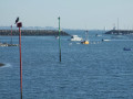
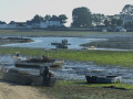
Starting point: Place de la Baie in La Forêt-Fouesnant.
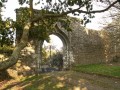
(S/E) From the car park, head left and then turn right onto the Route de Mesmeur leading to the Odet golf course. After passing the entrance to the course (a charming 18th-century manor house now converted into the clubhouse), continue along the path running alongside Anse de la Forêt-Fouesnant. Opposite the jetties at Port-la-Forêt, turn right and follow them as they lead to the Îlot de Skoen with its bandstand and benches (the jetty for the Glénan Archipelago).
(1) Continue on to the footbridge which takes you across the cove to the Corniche de la Cale.
GR® 34 + Blue and Yellow signposting
(2) Turn left, follow this coastal path and walk past the slipway of the old harbour. You’ll come to a Fork in the road.
GR 34 + Yellow signposting
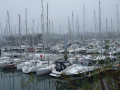
Ignore the blue-marked path heading up to the right and continue straight on towards an oyster farm where the road ends. Carry on along the cove (with a view of the forest of masts at the marina) and veer right along a wall to go round a property. You’ll arrive facing Anse de Penfoulic.
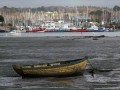
(3) Continue along the beach at low tide or via the right of way provided for high tide. Follow the coastal path that runs alongside the cove, where you can see the oyster beds at low tide. This path is lined with old oak trees and leads to a sea wall.
Yellow markings + MTB
(4) Leave theGR® as it heads onto the sea wall and continue straight on along a wide, tree-lined path which runs alongside the Penfoulic Ponds on your left – these were once used for mussel farming. Continue to the junction with a road near a wash house on your right, where there is a picnic table.
(5) Leave the road and take a newly created path on the left: the purple route shown on the map is no longer in use. Follow this tree-lined path, which leads to houses at the hamlet marked Pontérec on the map. Turn right to head back up the road. At the Stop sign, carry on straight ahead, ignoring the Impasse des Hortensias on the left, until you reach a crossroad (signposted ‘Route de Pontérec’). First turn left then right.
Blue signposting (La Haie circular)
(6) Leave the yellow markings for the blue ones and follow the Chemin de Pontigou southwards. Ignore the two streets on your left and continue along this road, which is signposted as a dead end. At the end of the road, turn left against the flow of traffic and make a right-left turn to join a narrow tarmac path near a property called “les Korrigans”. At the bottom, turn left, leaving the blue markings which head down to the right.
No signposting
(7) Continue straight ahead along a wide grassy strip, go round a property and carry on across a grassy area, then follow a track suitable for vehicles alongside the houses on your right. At the road, turn right to head down towards the cove.
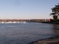
(2) Head left, following the path for pedestrians and cyclists alongside the road at the edge of the cove. Pass a cross on your left and you’ll arrive opposite the École Notre-Dame d’Izel Vor.
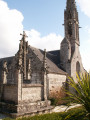
(8) Turn slightly left, then take a narrow lane on the right which leads uphill towards the church. Walk round the church on the left and note the16th-century granite pulpit cross with its three steps and the entrance that allowed the preacher to access the pulpit. Turn right and, via Rue Charles De Gaulle, head for the car park on the right (S/E).



 Visorando Member

 Moderate