Around the River Blaise between Blaise, Daillancourt and Guindrecourt

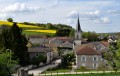
A walk around the Blaise river allows you to explore three villages in this valley.

Details

n°762171
Creation:
Last update:
Last review:
  • Walking
    Activity: Walking
  • ↔
    Distance: 6.52 mi
  • ◔
    Average duration: 3h 25 
  • ▲
    Difficulty: Moderate

  • ⚐
    Back to start: Yes
  • ↗
    Ascent: + 512 ft
  • ↘
    Descent: - 512 ft

  • ▲
    Highest point: 974 ft
  • ▼
    Lowest point: 778 ft

Photos

Description of the walk

The route starts from the village hall in Blaise.

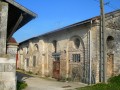
(S/E) Follow Rue du Château de Blaise past the castle’s former outbuildings, then at the junction turn left onto the D233 towards Champcourt.

(1) At the entrance to the village of Champcourt, turn left onto Rue de la Mairie towards the church, then turn right onto Rue de l’Église and right again onto Route de Blaise, which leads to the wash house.

(2) Turn left onto the path leading up to La Garenne and stay on it until you reach the Croix de Champcourt.

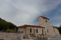
(3) Follow the road down towards Daillancourt, passing the washhouse, the cemetery and the church, then turn right to follow the Grande Rue to the edge of the village, crossing the old metal bridge over the River Blaise.

(4) Cross the D2 county road and take the path that climbs up the hillside. At the end, turn right, skirting the vineyard, and head back down towards the village of Guindrecourt-sur-Blaise.

(5) At the entrance to the village, turn right to head down the Grande Rue and pass to the left of the church.

(6) At the next junction, leave the Grande Rue and turn left onto Rue Lacrout; continue to the end of the street, which climbs towards the cemetery on the outskirts of the village and then descends back towards the D2 departmental road.

(7) Turn right and walk along the D2 county road until you reach the first junction.

(8) Turn left and follow the Grande Rue back to the village of Blaise, after crossing the river of the same name, until you reach the town hall (S/E).

Waypoints

  1. S/E : mi 0 - alt. 817 ft - Blaise Town Hall
  2. 1 : mi 0.97 - alt. 886 ft - Entrance to Champcourt
  3. 2 : mi 1.25 - alt. 886 ft - Washing house
  4. 3 : mi 2.81 - alt. 879 ft - Croix de Champcourt. Towards the metal bridge at the - Blaise (rivière) - Affluent de la Marne
  5. 4 : mi 3.55 - alt. 810 ft - Crossing the D2
  6. 5 : mi 4.34 - alt. 889 ft - Guindrecourt-sur-Blaise
  7. 6 : mi 4.52 - alt. 856 ft - Rue Lacrout
  8. 7 : mi 5.16 - alt. 817 ft - Turn right onto the D2
  9. 8 : mi 5.56 - alt. 810 ft - Grande Rue
  10. S/E : mi 6.52 - alt. 817 ft - Blaise Town Hall

Notes

After Guindrecourt, when you come out onto the D2 departmental road (7), you can shorten the walk by turning left straight towards the village of Blaise.

Since 1 January 1973, Blaise has had neither a mayor nor a local council. Following a merger with Colombey-les-Deux-Églises, decisions are taken by the latter’s local council. Since 1 January 2017, its status has been changed to that of a delegated commune.

In Guindrecourt-sur-Blaise, you’ll find the Les Ecuries Lalye equestrian centre, where you can also go on horse rides.

Worth a visit

You will pass close to two wash houses: one in Daillancourt opposite the church, and another before leaving Champcourt (2); and three old water mills in Daillancourt – the last house on the right as you leave the village, and the first two houses on the left as you return towards Blaise.

Between Blaise and Daillancourt, at Val Roquet, you will pass close to the only alkaline marsh in the north-western quarter of the Haute-Marne. It consists of a reed bed and a megaphorbiaie – a meadow of tall perennial herbaceous plants – where the monkshood (Aconitum napellus) blooms, a wildflower protected at regional level. Two butterfly species protected in France can also be found here: the marsh fritillary and the bog fritillary, both listed in the Red Book of Threatened Fauna in France and on the Red List of Insects in Champagne-Ardenne.

On your return to Blaise, you’ll pass close to a private pond. Depending on the season and the height of the surrounding vegetation, you may spot geese, ducks, swans, herons or egrets.

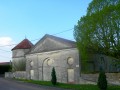
In Blaise, on both the outward and return journeys, you’ll pass by the former outbuildings of the now-demolished Château de Blaise, notably its dovecote, which has been listed as a historic monument since 1987.

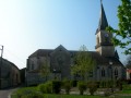
You can carry on as far as the church, which has also been listed as a historic monument since 1925.

Reviews and comments

4 / 5
Based on 2 reviews

Reliability of the description
4.5 / 5
Ease of following the route
4.5 / 5
Route interest
3 / 5
User 26888012

Overall rating : 3 / 5

Date of your route : Oct 05, 2026
Reliability of the description : ★★★★☆ Good
Ease of following the route : ★★★★☆ Good
Route interest : ★☆☆☆☆ Very disappointing
Very busy route : No

Path rather than road

Machine-translated

Marie -France
Marie -France

Overall rating : 5 / 5

Date of your route : Feb 14, 2022
Reliability of the description : ★★★★★ Very good
Ease of following the route : ★★★★★ Very good
Route interest : ★★★★★ Very good
Very busy route : No

Thank you for this route. We’re planning to walk it before heading to the farm inn with the walkers from our club.

Machine-translated

Other walks in the area

For more walks, use our search engine .

The GPS track and description are the property of this route's author. Please do not copy them without permission.