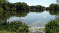
At the foot of Montigny Castle

Between Chartres, with its cathedral, and the châteaux of the Loire Valley, Cloyes-les-Trois-Rivières lies on the green, wooded banks of the River Loir, at the confluence of several of its tributaries: the Egvonne, the Yron, the Aigre and the Yerre.

Details

n°22868154
Creation:
Last update:
Last review:
  • Walking
    Activity: Walking
  • ↔
    Distance: 3.94 mi
  • ◔
    Average duration: 1h 50 
  • ▲
    Difficulty: Easy

  • ⚐
    Back to start: Yes
  • ↗
    Ascent: + 26 ft
  • ↘
    Descent: - 30 ft

  • ▲
    Highest point: 348 ft
  • ▼
    Lowest point: 315 ft

Description of the walk

Park on Place Gambetta in Cloyes-les-Trois-Rivières.

(S/E) Walk round the town hall and cross the footbridge.

(1) Go straight on, cross the park, then cross a second footbridge (GR® 655 to the Chemin des Longères). After the car park, join the D15; follow it to the right for 200 m.

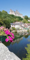
(2) Turn right onto the Chemin des Longères. Continue straight on along the River Loir to the bridge at the entrance to Montigny (view of the château: historic residence of the Prince-Duke of Montmorency-Laval, French ambassador under Louis XVIII and Charles X). Cross the bridge over the River Loir to reach a junction.

(3) Take the path on the left which runs alongside a pond (the two ponds you’ll come across are former gravel pits where stone and gravel were extracted; they’re open for fishing and water sports). At the end, follow the path which turns right, then left, and joins a track in front of a second pond.

(4) Take the track on the right.

(5) At the junction, turn left (GR® 655). Then follow the bend to the right towards the Ponceaux factory. You’ll arrive near the D 23 road.

(6) Turn left, between the road and a small building, to walk along the pond. At the end, turn right and you’ll reach the D23; take it to the left, towards the centre of Cloyes. Walk past the fire station buildings.

(7) Turn right onto the arboretum path. Cross the river and turn left.

(1) Take the footbridge on the left to return to the rear of the town hall (S/E).

Waypoints

  1. S/E : mi 0 - alt. 322 ft - Cloyes-les-Trois-Rivières Town Hall
  2. 1 : mi 0.03 - alt. 315 ft - Footbridge
  3. 2 : mi 0.28 - alt. 348 ft - Chemin des Longères
  4. 3 : mi 1.28 - alt. 318 ft - Path along the edge of the pond - Château de Montigny le Gannelon
  5. 4 : mi 2.01 - alt. 322 ft - Path on the right - Plan d'eau des Tirelles
  6. 5 : mi 2.49 - alt. 318 ft - GR junction
  7. 6 : mi 2.86 - alt. 322 ft - Path along the edge of the pond
  8. 7 : mi 3.52 - alt. 322 ft - Arboretum Trail
  9. S/E : mi 3.94 - alt. 318 ft - Cloyes-les-Trois-Rivières Town Hall

Notes

This route was created in collaboration with the Eure-et-Loir Departmental Hiking Committee. Follow the yellow markings

Worth a visit

Les Trois Rivières Water Sports Centre
Cloyes-sur-le-Loir Canoe and Kayak Club
Cloyes Sailing Club
Le Val Fleuri Leisure Park
Bicycle Hire Point – Cloyes Tourist Office
“Le Val Fleuri” Bike Hire Point
Three Rivers and Perche Tourist Information Centre

Local produce
La Boîte à Présent
Léonard’s Farm

Cultural site
Romanesque Chapel of Notre-Dame d’Yron
Montigny-le-Gannelon Castle

Always be cautious and plan ahead when you're outdoors. Visorando and the author of this route cannot be held responsible for any accidents occurring on this route.

The GR® and PR® markings are the intellectual property of the Fédération Française de Randonnée Pédestre.

Reviews and comments

4.7 / 5
Based on 1 review

Reliability of the description
5 / 5
Ease of following the route
5 / 5
Route interest
4 / 5
bj41
bj41

Overall rating : 4.7 / 5

Date of your route : Dec 02, 2023
Reliability of the description : ★★★★★ Very good
Ease of following the route : ★★★★★ Very good
Route interest : ★★★★☆ Good
Very busy route : No

A pleasant, easy walk, but why not suggest walking round the second pond as well, rather than just sticking to one? That would make the walk a bit longer without changing the circular route on the way back.

Machine-translated

Other walks in the area

For more walks, use our search engine .

The GPS track and description are the property of this route's author. Please do not copy them without permission.