Country:
 City:
City:


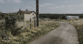

The walk starts at the car park on Rue de la Gare in Saint-Hilaire-la-Gravelle. To get there from the town hall, keep to the right, continue along Rue Léon Cibie and take the first street on the left, Rue de la Cavée. The car park is signposted.
(S/E) From the car park, head along Rue de la Gare; the station is on your right. This street bends to the left and joins Rue Léon Cibie, which you should take to the right.
(1) Leave the main road after 75 m, keeping to the right towards Clairefontaine onto Rue du Bouillon. This turns right to cross the railway line, then left, at which point it becomes Rue de Clairefontaine. At the Fork in the road, keep to the right onto the less-travelled path. Ignore any side paths. The path eventually runs alongside the railway line.
(2) When you reach the hamlet of Villez, go round the houses on the right, taking the wide, hard-surfaced track. Turn right at the junction with the lane known as La Pièce du Four. This crosses the level crossing before becoming the Route de Villez. At the hamlet of Les Cercueils, take the hairpin bend to the left towards the Étang de Saint-Lubin.
White-and-red markings (GR® 35)
(3) Take the first path on the right, then walk round the pond, keeping to the left at the junction. The wide path runs between the Étang de Saint-Lubin and the River Loir. Continue straight on as you leave the pond. The path bends to the right before joining Rue de l’Étang.
(4) Turn left at the junction. Rue de l’Étang leads into the village of Fréteval. Pass the first set of junctions, then keep left at the Fork in the road near the church.
No signposting
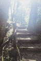
(5) At the crossroads, turn left onto Rue du Pont, then right onto Rue de Courcelles after crossing the River Loir, and finally left onto Impasse de la Tour to reach the castle ruins. To do this, turn left about a hundred metres after the tarmac ends, and climb the steps up to the feudal tower.
(6) Turn back to reach Rue de Courcelles, turn right onto it, then turn left to cross the River Loir.
White-and-red markings (GR® 35)
(5) At the junction – which you’ve already passed on the way out – carry on straight ahead, pass Rue des Prêtres, then turn left onto Rue du Mail, following the shaded path to the end.
(7) Turn right onto Rue du Plessis, just after the school. This road crosses the railway line. Keep to the right at the Fork in the road onto Rue de la Fontaine, signposted ‘dead end’, just before leaving the village. The tarmac gives way to a path.
(8) Turn left onto the grassy path, following the boundary wall of the Domaine Beauregard. At the junction, continue straight on along the Route de la Montbalière.
End of signposting
(9) Keep to the right, going uphill, at the Fork in the road as you leave the hamlet of La Montbalière. At the junction, continue along the grassy path then, at the next crossroads, turn onto the lane, with your back to the water tower. The lane becomes tarmac as you pass through the hamlet of Le Plessis.
(10) Keep heading north, following a grassy path. Ignore the first turn-off on the right, then keep to the right at the Fork in the road.
(11) Turn left onto the grassy path, heading towards the main road. 150 metres before you reach it, head right, downhill, towards a dry valley. The entrance to the path is difficult to spot; look for the cultivated fields to guide you. Cross the dry valley and continue straight ahead, uphill. The grassy path is followed by a compacted track which turns left, running alongside the railway line. Turn right at the junction, then right again shortly after the level crossing, to return to the starting point (S/E).


 Visorando Member

 Association / Club / Walk leader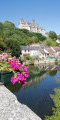
 Difficult
  Easy
Easy