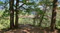
In the Sarrebourg region

A circular route between Bébing, Imling and Rinting in the Sarrebourg area, suitable for everyone.

Details

2128839
Creation:
Last update:
Last review:
  • Walking
    Activity: Walking
  • ↔
    Distance: 4.51 mi
  • ◔
    Average duration: 2h 15 
  • ▲
    Difficulty: Easy

  • ⚐
    Back to start: Yes
  • ↗
    Ascent: + 200 ft
  • ↘
    Descent: - 203 ft

  • ▲
    Highest point: 1,060 ft
  • ▼
    Lowest point: 820 ft
  • ⚐ Country: France
  • ⚐ City: Bébing (57830)
  • ⚑
    Start/End: N 48.712017° / E 6.999206°
  • Accessible from the train station Gare de Bébing.
  • ❏
    IGN map(s): Ref. 3614ET, 3615O, 3715OT
  • Hour-by-hour weather

Photos

Description of the walk

At the entrance to the village of Bébing on the D955, coming from Sarrebourg, there is a car park where you can start this short walk.

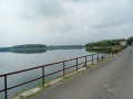
(S/E) Follow the cycle path on your right along the Chemin de la Forge towards Imling (south-east).

(1) On the bridge over the railway line, you can learn about the history and principle of the ‘Saut de mouton’. Cross the bridge and, at the junction, turn left to reach the old Sarrixin Mill, which has been converted into a private residence.

(2) At the junction, turn left onto the cycle path towards Imling, running alongside the railway line; pass a boules court and you’ll reach thefirst houses in the village.

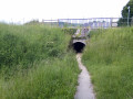
(3) Head down to the right to pass under the railway line through the tunnel provided for this purpose. Then continue along Rue du Faubourg, heading north-west, until you reach the D955.

(4) Go under the road through the tunnel. Take the road between the two houses on Rue des Forêts, which is quite steep. Go under the power lines.

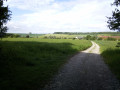
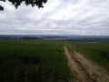
(5) On the Chemin du Haut de Kerprich, take in the scenery with a view of the Vosges mountain range (the Donon) in the background, and the village of Imling and the town of Sarrebourg in the foreground. Take a moment to rest on the ‘Louise’ bench before entering the woods.

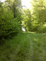
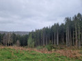
(6) At the first crossroads, turn left onto the Route Forestière des Moutons. With a bit of luck, you might spot some wildlife there.

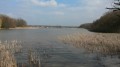
(7) As you emerge from the woods, you’ll see the Rinting farm. Carry on straight ahead to the Étang de Rinting. At the bend before the pond, keep to your left towards Bébing to the south, via the Route de Rinting. Enter the village and continue to the D955, the Rue Principale.

(8) Turn left onto the Rue Principale, then cross it carefully and head for the car park via the cycle path, where you’ll find a table and benches to help you prepare for your return journey (S/E).

Waypoints

  1. S/E : mi 0 - alt. 906 ft - Car park, Rue Principale
  2. 1 : mi 1 - alt. 850 ft - Bridge over the railway line.
  3. 2 : mi 1.18 - alt. 837 ft - Turn left at the junction
  4. 3 : mi 2.13 - alt. 827 ft - Tunnel under the railway line - Sarre (rivière)
  5. 4 : mi 2.31 - alt. 853 ft - Tunnel under the road
  6. 5 : mi 2.69 - alt. 1,024 ft - Chemin du Haut de Kerprich
  7. 6 : mi 2.88 - alt. 1,060 ft - At the crossroads, turn left.
  8. 7 : mi 3.36 - alt. 1,014 ft - Exit from the forest
  9. 8 : mi 4.37 - alt. 896 ft - Turn left at the junction
  10. S/E : mi 4.51 - alt. 906 ft - Car park, Rue Principale

Reviews and comments

4.5 / 5
Based on 2 reviews

Reliability of the description
5 / 5
Ease of following the route
4.5 / 5
Route interest
4 / 5
Denis26
Denis26 ★

Thank you, Leepix, for pointing that out. I’ve just clarified the description.
Kind regards,

Machine-translated

LeePix
LeePix

Overall rating : 4.7 / 5

Date of your route : May 01, 2024
Reliability of the description : ★★★★★ Very good
Ease of following the route : ★★★★☆ Good
Route interest : ★★★★★ Very good
Very busy route : No

A nice little walk, mostly flat, with one climb that was a bit steeper.
The directions were easy to follow, and we found our way round easily.
However, be careful: on the cycle path alongside the railway line, we nearly missed the ‘tunnel under the railway’ we were looking for on our left, but whose entrance is actually to the right of the cycle path, a little lower down. Luckily there was a sign from the Club Vosgien, otherwise we wouldn’t have tried to go into this tunnel where you can’t quite stand upright! It’s just past the pétanque court, to give you a further clue.

Machine-translated

peapol
peapol

Overall rating : 4.3 / 5

Date of your route : Apr 02, 2021
Reliability of the description : ★★★★★ Very good
Ease of following the route : ★★★★★ Very good
Route interest : ★★★☆☆ Average
Very busy route : No

An easy route with no difficulties. Clear route map, precise descriptions.

Walking at a brisk pace, we completed it in 1 hour 30 minutes.

Apart from the section on the cycle path, which is not as good as the rest, the walk is pleasant. The tarmac sections are almost exclusively for bikes and pedestrians, so that’s fine.

Machine-translated

Other walks in the area

For more walks, use our search engine .

The GPS track and description are the property of this route's author. Please do not copy them without permission.