To the hamlet of Le Chatenay via the plain from Marcollin

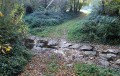
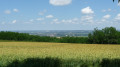
This walk takes you across fields and through woods, offering lovely views of the villages around Beaurepaire. The path through the forest is muddy, particularly after heavy rain.
TO ALL HIKERS (SES) WHO FOLLOW MY HIKES: you can post photos, indicating their location along the route.

Details

n°4551983
Creation:
Last update:
Last review:
  • Walking
    Activity: Walking
  • ↔
    Distance: 6.61 mi
  • ◔
    Average duration: 3h 35 
  • ▲
    Difficulty: Moderate

  • ⚐
    Back to start: Yes
  • ↗
    Ascent: + 577 ft
  • ↘
    Descent: - 568 ft

  • ▲
    Highest point: 1,447 ft
  • ▼
    Lowest point: 899 ft

Description of the walk

Car park at the junction next to Marcollin church.

(S/E) From the car park, head north and, after about 120 m, turn left just after the small bridge over the stream. Continue alongside the stream and turn right onto the Route de Beaurepaire (D130A). Carry on and leave the village after crossing the Ruisseau du Dollure.

(1) Turn onto thefirst track between the fields on the left. At the first junction, turn left and walk past the farm.

(2) Turn right and follow the Dollure stream until you reach a T-junction.

(3) Turn left and cross the stream again. Carry on straight ahead, crossing the D801 with care to reach the hamlet of Chatenay. Turn right and ignore the path continuing straight ahead. Head up towards the forest.

(4) Turn left, ignoring the path that continues to the right. At the first Y-junction, take the left-hand path; carry on, ignoring a path that climbs to the right, until you reach a fork.

(5) Turn left and carry on straight ahead, then reach the road leading to the cemetery.

(6) Turn right onto this road and immediately right again to pass by the cemetery. Head uphill through the woods. At thefirst junction, turn left, carry on and continue uphill to the plateau at a major junction.

(7) Take the path on the left, which leads back into the woods for a short while. Continue for about 450 m. Turn left at a right angle, leaving the path that continues straight ahead. Continue downhill until you rejoin the D130a.

(8) Cross this road carefully and take thefirst path on the left, then carry on until you rejoin the D130a.

(9) Continue to the right on this road, heading down towards Marcollin via the Route de Lentiol (D130a) to reach the car park (S/E).


Waypoints

  1. S/E : mi 0 - alt. 1,033 ft - Car park next to Marcollin church
  2. 1 : mi 1.06 - alt. 948 ft - Turn left at the fork
  3. 2 : mi 1.73 - alt. 928 ft - Bord de la Dollure
  4. 3 : mi 2.47 - alt. 902 ft - Turn left onto the road
  5. 4 : mi 3.08 - alt. 1,102 ft - Turn left at the fork
  6. 5 : mi 3.79 - alt. 1,168 ft - Turn left at the fork
  7. 6 : mi 4.58 - alt. 1,112 ft - Cemetery
  8. 7 : mi 5.09 - alt. 1,447 ft - Important junction
  9. 8 : mi 5.61 - alt. 1,276 ft - Crossing the D130a
  10. 9 : mi 6.28 - alt. 1,132 ft - Turn right onto the Route de Lentiol
  11. S/E : mi 6.61 - alt. 1,030 ft - Car park next to Marcollin church

Notes

No special equipment required, but avoid doing this walk after heavy rain.

Reviews and comments

4.3 / 5
Based on 2 reviews

Reliability of the description
5 / 5
Ease of following the route
3.5 / 5
Route interest
4.5 / 5
Klaudius33
Klaudius33

Hello,
thank you for your feedback; this route can sometimes be more difficult because farmers do not keep a distance of 2 metres from hedges or forest edges.
Kind regards
Claudius

Machine-translated

acamay
acamay

Overall rating : 4.7 / 5

Date of your route : Sep 11, 2024
Reliability of the description : ★★★★★ Very good
Ease of following the route : ★★★★☆ Good
Route interest : ★★★★★ Very good
Very busy route : No

A lovely walk with stunning views into the distance

Machine-translated

MJC Bellegarde Poussieu

Overall rating : 4 / 5

Date of your route : Feb 13, 2023
Reliability of the description : ★★★★★ Very good
Ease of following the route : ★★★☆☆ Average
Route interest : ★★★★☆ Good
Very busy route : Yes

Hello
A pleasant route, but one section is no longer accessible as the farmer has ploughed up the path running alongside the stream;
you can take another path a little further on...

Machine-translated

Other walks in the area

For more walks, use our search engine .

The GPS track and description are the property of this route's author. Please do not copy them without permission.