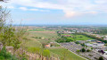
Grand Ballon d’Alsace

A challenging route to explore the highest peak in the Vosges. Reach the Grand Ballon d’Alsace from the Huttopia campsite via the Vosges massif, the Vieil Armand, the Col Amic and the Route des Crêtes.

Details

n°99205238
Creation:
Last update:
Last review:
–
  • Mountain biking
    Activity: Mountain biking
  • ↔
    Distance: 10.73 mi
  • ◔
    Duration according to the author: 3 hrs 
  • ▲
    Difficulty: Difficult

  • ⚐
    Back to start: No
  • ↗
    Ascent: + 3,819 ft
  • ↘
    Descent: - 965 ft

  • ▲
    Highest point: 4,403 ft
  • ▼
    Lowest point: 1,447 ft
  • ⚐ Country: France
  • ⚐
  • ⚐ City: Wattwiller (68700)
  • ⚑
    Start: N 47.834417° / E 7.165459°
  • ⚑
    End: N 47.904571° / E 7.103325°
  • ❏
    IGN map(s): Ref. 3619OT, 3619OTR, 3620ET, 3719OT, 3719OTR

  • ◶
    Type of surface:
  •  
     
     
    ■ 7% Road ■ 29% Byway ■ 64% Path
  • ⇧
    Bike carrying: Not specified
  • ▲
    Difficulty: Not specified
  • Hour-by-hour weather

Description of the route

Start from the Huttopia campsite car park.

(S) With your back to the car park, head right, then take the first path on the left.

Signposting: Red Rectangle with a white cross

(1) At the junction, turn right and head downhill to the next junction.

Signpost: Red Ring

(2) Keep to the left, ignore a path branching off to the left, and continue to the fork in the valley. Turn right and follow the track until you reach a path on the right.

Blue Ring markings

(3) Continue along the track, pass a hairpin bend to the right, and reach a fork.

Red Triangle signpost

(4) Turn left and carry on straight ahead until you reach a road.

No markings

(5) Follow it to the right and climb up to the site ofthe Franco-German Historial at Vieil Armand and the Hartmannswillerkopf National Monument at the Col du Silberloch.

Red Rectangle signposting

(6) Continue along the path that starts on the right, just after the bend in the road. You’ll reach a junction of tracks, near a road on your left.

No markings

(7) Turn right and continue slightly downhill, then along the mountainside, until you reach the road. Turn right and you’ll soon arrive at the Col Amic.

Red Rectangle Markings

(8) Take the path that climbs to the right of the memorial stone, running alongside the D431, and follow it to the Col de Firstacker. Note the Chapelle du Sudel, dedicated to Joan of Arc, situated higher up on the right.

Red Triangle markings

(9) Continue to the three-way junction in the path and turn left onto the track. Follow it to the car park for the Chalet du Club Vosgien de Soultz and the Refuge de la Glashütte.

Blue Triangle Markings

(10) Take the path on the left, just after the car park, and follow it straight on to the multi-way junction at the Col de Judenhut.

Red Rectangle with a white cross

(11) Continue almost straight ahead, uphill, and pass to the right and below the Abri de Judenhut. Head straight on to the Refuge du Roedelen – Ski Club Guebwiller.

(12) Turn left and climb up to the road, then on to the Col du Grand Ballon car park (E).

Waypoints

  1. S : mi 0 - alt. 1,549 ft - Huttopia Wattwiller Campsite
  2. 1 : mi 0.16 - alt. 1,608 ft - Crossroads
  3. 2 : mi 0.42 - alt. 1,457 ft - Crossroads
  4. 3 : mi 1.44 - alt. 2,021 ft - Path on the right
  5. 4 : mi 1.97 - alt. 2,247 ft - Crossroads
  6. 5 : mi 2.86 - alt. 2,812 ft - Route
  7. 6 : mi 3.24 - alt. 2,969 ft - Col du Silberloch – Vieil Armand - Roche Fendue (Vieil Armand)
  8. 7 : mi 4.92 - alt. 2,815 ft - Crossroads of trails - Freundstein
  9. 8 : mi 5.99 - alt. 2,720 ft - Col Amic - Col Amic
  10. 9 : mi 6.84 - alt. 3,133 ft - Col du Firstacker
  11. 10 : mi 7.86 - alt. 2,720 ft - Car park - Refuge de la Glashütte
  12. 11 : mi 8.72 - alt. 3,192 ft - judenhut
  13. 12 : mi 10.19 - alt. 4,114 ft - Roedelen Mountain Hut – Guebwiller Ski Club - Ferme auberge du Roedelen
  14. E : mi 10.73 - alt. 4,403 ft - Grand Ballon d’Alsace - Col du Grand Ballon (1341m)

Notes

You can return by following the same route back or by arranging for a car to be waiting at the Col du Grand Ballon car park.

Other walks in the area

For more walks, use our search engine .

The GPS track and description are the property of this route's author. Please do not copy them without permission.