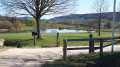
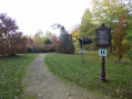
Setting off from Lalœuf Puxe towards Étreval Castle

A walk in the western Saintois region, starting from Lalœuf Puxe, to see the village and Étreval Castle, then the hamlet of Lalœuf Velle

Details

n°16471888
Creation:
Last update:
Last review:
  • Walking
    Activity: Walking
  • ↔
    Distance: 7.51 mi
  • ◔
    Average duration: 3h 45 
  • ▲
    Difficulty: Moderate

  • ⚐
    Back to start: Yes
  • ↗
    Ascent: + 361 ft
  • ↘
    Descent: - 354 ft

  • ▲
    Highest point: 1,066 ft
  • ▼
    Lowest point: 879 ft

Photos

Description of the walk

Car park opposite the church in Lalœuf Puxe.

(S/E) Facing the church, turn right and then immediately left onto Rue Saint Rémy towards Vitrey, and continue along the D 51.

(1) After the 12-kilometre marker, take a field track on the right alongside a hedge and carry on straight ahead to join the D 5.

(2) Cross the road carefully and continue along the new track. Walk alongside the small copse, take the S-bend and head down towards another copse.

(3) When you reach the fence at the end of the track, take the field path on the right.

(4) At the T-junction, carry on straight ahead to head down into the woodland.

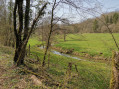
(5) Cross the Brénon via the footbridge, join the Grande Rue in Étreval, then turn right and walk through the village, passing the fountain.

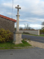
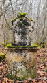
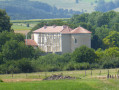
(6) Leave the village by continuing straight on along the road leading uphill towards Thorey-Lyautey and pass the entrance to Étreval Castle: you can walk closer to the castle as far as the boundary of the private estate and the wayside cross.

(7) At the Tanrière crossroads, turn onto the small road on the right and join another road at a place called Chaveaux, north of Thorey-Lyautey.

(8) Turn right, pass through the hamlet of Moulin de l’Étanche, cross over the Brénon and continue along the uphill road to a four-way junction.

(9) Turn left and head towards the village of Laloœuf Velle via Rue des Mésanges.

(10) At the end of the road, turn right into Rue des Rosiers (D 51) and walk through the village. Cross the D 5 at the pedestrian crossings and continue straight on to return to the starting point (S/E).

Waypoints

  1. S/E : mi 0 - alt. 978 ft - Saint-Rémy Church in Lalœuf Puxe
  2. 1 : mi 1.39 - alt. 925 ft - Path running alongside the hedge
  3. 2 : mi 2.22 - alt. 1,004 ft - D5
  4. 3 : mi 2.8 - alt. 1,017 ft - End of the trail, fence
  5. 4 : mi 3.18 - alt. 1,014 ft - T-junction, go straight on
  6. 5 : mi 3.41 - alt. 879 ft - The - Brénon (rivière)
  7. 6 : mi 3.58 - alt. 889 ft - Heading towards Thorey Lyautey
  8. 7 : mi 4.46 - alt. 1,047 ft - La Tanrière
  9. 8 : mi 5.21 - alt. 942 ft - Chaveaux
  10. 9 : mi 6.08 - alt. 1,001 ft - Road junction, turn left
  11. 10 : mi 7.09 - alt. 984 ft - Rue des Mésanges
  12. S/E : mi 7.51 - alt. 978 ft - Saint-Rémy Church in Lalœuf Puxe

Worth a visit

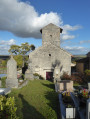
Saint-Rémy Church, a listed building at the start of the route in Lalœuf Puxe.
Étreval: crossing the Brénon and passing by the fountain; there’s the option to take a short detour to visit the little church
The Renaissance castle at Étreval and its wayside cross.
The hamlet of Moulin de l’Étanche.
The village of Lalœuf Velle.

Reviews and comments

4 / 5
Based on 2 reviews

Reliability of the description
4.5 / 5
Ease of following the route
4.5 / 5
Route interest
3 / 5
baladin54
baladin54

Overall rating : 4.7 / 5

Date of your route : Oct 28, 2026
Reliability of the description : ★★★★★ Very good
Ease of following the route : ★★★★★ Very good
Route interest : ★★★★☆ Good
Very busy route : No

A lovely walk for anyone who loves nature and the countryside. The downside: too much tarmac and very few shaded areas… Not to be done in the blazing summer sun…

Machine-translated

aimée
aimée

Overall rating : 3.3 / 5

Date of your route : Mar 28, 2022
Reliability of the description : ★★★★☆ Good
Ease of following the route : ★★★★☆ Good
Route interest : ★★☆☆☆ Disappointing
Very busy route : No

It’s a shame it wasn’t made clear that three-quarters of the walk was along small tarmac roads.

Machine-translated

Other walks in the area

For more walks, use our search engine .

The GPS track and description are the property of this route's author. Please do not copy them without permission.