Through the villages of Ognéville, Étreval, Vroncourt, Quevilloncourt and Vézelise

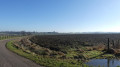
The route starts at the edge of the woods in the Brénon Valley and returns via the Rabogey plateau, offering a 360° view of the Saintois region.

Details

17516350
Creation:
Last update:
Last review:
  • Walking
    Activity: Walking
  • ↔
    Distance: 8.49 mi
  • ◔
    Average duration: 4h 15 
  • ▲
    Difficulty: Moderate

  • ⚐
    Back to start: Yes
  • ↗
    Ascent: + 433 ft
  • ↘
    Descent: - 417 ft

  • ▲
    Highest point: 1,102 ft
  • ▼
    Lowest point: 840 ft
  • ⚐ Country: France
  • ⚐ City: Ognéville (54330)
  • ⚑
    Start/End: N 48.474533° / E 6.064919°
  • Accessible from the train station Gare de Vézelise-J.-Leclerc.
  • Hour-by-hour weather

Photos

Description of the walk

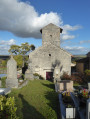
Starting point: Ognéville Church; parking is available in the streets around the church.

(S/E) Facing the church gate, turn right onto the Rue de Saint-Blaise, which leads downhill. Pass the Saint-Blaise Fountain and you’ll soon reach the bridge over the Brénon.

(1) Then turn right, go through a barrier and follow a track heading south (do not take the bridge). Cross the Brénon via a footbridge and continue straight on along a path. You’ll soon come out onto a track; follow it as it continues, keeping the river on your right. Join a road and follow it to the left to enter the village of Étreval.

(2) Above the fountain, turn left and head up Rue de l’Église. At the top of the hill, at the junction, carry on straight on towards Chaouilley, passing between the buildings and in front of the Chapelle de Villars. Join the D53.

(3) Turn left onto it and, in the middle of the woods, turn right onto forest track no. 10. At the Y-junction, turn left. At the second Y-junction, turn right, join a track and turn left to leave the woods.

(4) On leaving the woods, turn left, then right, and continue straight on to reach Vroncourt via the Route des Vignes.

(5) At the end of the road, turn right into Rue Saint-Joseph, then turn right into Grande Rue. Turn right twice to reach the church.

(6) At the church, retrace your steps and, at the roundabout, carry on straight ahead. Join Rue de Forcelles and turn left at the end of the street, then right onto Rue de Poitou and carry on straight ahead to reach the village of Quevilloncourt via the D53.

(7) At the junction with Rue du Petit Café, turn left, then left again onto Rue de Neaux.

(8) Take the first track on the right, Chemin des Neaux, then Chemin de Vezelise; cross over the Ruisseau du Grand Rupt
and carry on along Chemin de l’Étang. Join a track, carry on straight ahead along Chemin de Chauvaut and join the D50.

(9) Turn right onto it, cross over the Brénon and continue along Rue de Vaudémont.

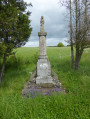
(10) At the end of the street, carry on straight ahead for 20 metres, turn left up the steps, and follow the Chemin des Capucins alongside the cemetery. At the end of this path, keep to the right, pass the statue, turn left to go round the farm and join the Route d’Ognéville.

(11) Follow it to the right, leave the village and turn onto the first track on the right, at the fire hydrant. Join a track, turn right and, at the next junction, turn left.

(12) At the end of the track, turn left onto Chemin de Qua, a track that becomes a road. At the wayside shrine, turn right onto Rue du Maréchal Lyautey, cross the village and return to the starting point (S/E).

Waypoints

  1. S/E : mi 0 - alt. 955 ft - Église Saint-Blaise (Ognéville)
  2. 1 : mi 0.26 - alt. 856 ft - Brénon (rivière)
  3. 2 : mi 1.59 - alt. 896 ft - Fountain - Église Sainte-Anne (Étreval)
  4. 3 : mi 2.51 - alt. 1,073 ft - D53 road
  5. 4 : mi 3.15 - alt. 1,089 ft - Emerging from the woods
  6. 5 : mi 4 - alt. 1,010 ft - Rue Saint-Joseph
  7. 6 : mi 4.39 - alt. 974 ft - Église de la Nativité de la Vierge (Vroncourt)
  8. 7 : mi 5.49 - alt. 965 ft - Rue du Petit Café
  9. 8 : mi 5.67 - alt. 951 ft - Chemin des Neaux
  10. 9 : mi 6.59 - alt. 840 ft - D50 road
  11. 10 : mi 6.9 - alt. 843 ft - Rue de Vaudémont
  12. 11 : mi 7.25 - alt. 912 ft - Ognéville Road (D5)
  13. 12 : mi 8.21 - alt. 984 ft - Chemin de Qua
  14. S/E : mi 8.49 - alt. 958 ft - Église Saint-Blaise (Ognéville)

Worth a visit

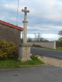
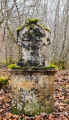
In Ognéville, the Saint-Blaise Fountain with its calvary and its strange statue.
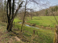
The Brénon Valley, its waterfall and its owl.
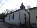
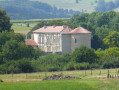
The Chapel of Villars, with Étreval Castle visible in the distance opposite.
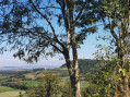
In Rabogey, the 360° view over the Saintois region.
The villages of Ognéville, Étreval, Vroncourt and Quevilloncourt, with a stop in Vézelise.
The Virgin of Voeu in Vézelise.

Reviews and comments

3.8 / 5
Based on 3 reviews

Reliability of the description
4.5 / 5
Ease of following the route
4 / 5
Route interest
3 / 5
patptout
patptout

Overall rating : 3.3 / 5

Date of your route : Jul 14, 2025
Reliability of the description : ★★★★☆ Good
Ease of following the route : ★★★★☆ Good
Route interest : ★★☆☆☆ Disappointing
Very busy route : No

A quiet route at first, then lots of roads. I modified it slightly, starting from the cemetery in Vézelise and avoiding Quevilloncourt, which means there are more trails. You can often see the hill of Sion.

Machine-translated

dominiquel
dominiquel

Overall rating : 4.7 / 5

Date of your route : Mar 27, 2023
Reliability of the description : ★★★★★ Very good
Ease of following the route : ★★★★☆ Good
Route interest : ★★★★★ Very good
Very busy route : No

:

Machine-translated

ferveur
ferveur

Overall rating : 2 / 5

Date of your route : Dec 11, 2022
Reliability of the description : Not used / Not applicable
Ease of following the route : Not used / Not applicable
Route interest : ★★☆☆☆ Disappointing
Very busy route : No

Why do people always want to walk on tarmac roads rather than the many paths in this area?

Machine-translated

Other walks in the area

For more walks, use our search engine .

The GPS track and description are the property of this route's author. Please do not copy them without permission.