A circular walk between Hammeville and Parey-Saint-Césaire

A circular walk between the villages of Hammeville and Parey-Saint-Césaire, passing through the Govillers and Serres state-owned forests
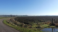
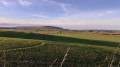
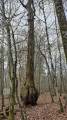
Remarkable oak trees and scenic views await
Unfortunately, some of the paths have disappeared, so you’ll need to take a few minor roads.

Details

30048518
Creation:
Last update:
Last review:
  • Walking
    Activity: Walking
  • ↔
    Distance: 9.13 mi
  • ◔
    Average duration: 4h 25 
  • ▲
    Difficulty: Moderate

  • ⚐
    Back to start: Yes
  • ↗
    Ascent: + 249 ft
  • ↘
    Descent: - 249 ft

  • ▲
    Highest point: 1,033 ft
  • ▼
    Lowest point: 886 ft

Photos

Description of the walk

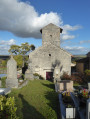
The walk starts at Hammeville church, Rue René Martin; parking is available along the street near the church.

(S/E) Facing the church, turn left

(1) At the end of the street, continue left onto Rue Sainte-Libaire, leave the village and carry on along the small road to join the D51.

(2) Cross it carefully and continue along the stony track opposite. In the Bois de Vitrey, at the T-junction, carry straight on.

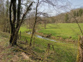
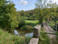
(3) You’ll come out into a small meadow; cross it diagonally, follow a woodland track to reach a second small meadow. Go to the right of the stream and follow it until you reach a stony track, which you should follow.

(4) Join a track, turn right onto it and, at the Saint-Ouen roundabout, turn right onto the Tranchée de l’Étang until you reach the first woodland track on the left.

(5) Turn onto the Tranchée de Thélod and, after the bend, take the fourth track on the left.

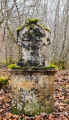
(6) At the signpost for the fourth track, turn left to see the remarkable oak tree known as the ‘Seigneur du Bois Bas’. Return to the track and continue to the right.
At the signpost, take the first path on the left to see the ‘Chêne Loupe’, then continue along this path.

(7) At the end of the track, turn left onto La Tranchée de l’Étang. At the end of the trench, take the sharp right-hand bend onto the Tranchée de Parey towards the vehicle barrier.

(8) After the barrier, turn left onto Chemin des Vaches and head towards the village of Parey-Saint-Césaire.

(9) Join Rue Georges Clémenceau and turn left. At the end of the street, turn right onto Rue du Maréchal Foch, continue straight on along this street to leave the village and carry on along the Route d’Houdreville (D52). You’ll arrive near an electricity substation.

(10) Just before this, turn off onto the track on the right and pass under the power lines.

(11) At the bend, leave the stony track and carry straight on along the grassy track. In the middle of the meadow, turn left at a 90° angle to enter the woodland between plot numbers 4 and 5 and join a wide woodland path, which you should follow until you reach a wide track.

(12) Turn right for 50 m, then turn left onto a wide woodland track and continue along this track until you exit the woods onto a small road.

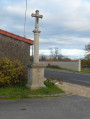
(13) Turn right towards the village of Hammeville. At the junction with the wayside cross, carry on straight ahead.

(1) Turn left to reach the church (S/E).

Waypoints

  1. S/E : mi 0 - alt. 1,024 ft - Église Sainte-Libaire (Hammeville)
  2. 1 : mi 0.06 - alt. 1,030 ft - Rue Sainte Libaire
  3. 2 : mi 0.87 - alt. 988 ft - D51 road
  4. 3 : mi 1.78 - alt. 919 ft - Pre
  5. 4 : mi 2.55 - alt. 1,001 ft - Junction with the track
  6. 5 : mi 2.76 - alt. 1,001 ft - Thélod Trench
  7. 6 : mi 3.23 - alt. 938 ft - Le Seigneur des Bois Bas
  8. 7 : mi 3.7 - alt. 958 ft - Tranchée de l’Étang. Near the - Chêne à la loupe
  9. 8 : mi 4.58 - alt. 938 ft - Chemin des Vaches
  10. 9 : mi 5.33 - alt. 942 ft - Rue Georges Clémenceau
  11. 10 : mi 6.72 - alt. 948 ft - Electrical substation
  12. 11 : mi 7.14 - alt. 997 ft - Pâquis, behind the woods
  13. 12 : mi 7.41 - alt. 968 ft - Bois de Cerf
  14. 13 : mi 8.38 - alt. 965 ft - Road junction
  15. S/E : mi 9.13 - alt. 1,024 ft - Église Sainte-Libaire (Hammeville)

Notes

This walk should be undertaken in dry weather or with good high-top shoes, as the section at point (3) can be very wet.

Worth a visit

The route passes through the two villages of Hammeville and Parey-Saint Césaire.
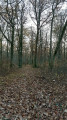
A walk through the two state-owned forests, featuring two remarkable oak trees
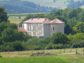
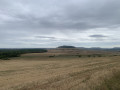
At a place called Pâquis, behind the woods, there are views over Bainville-sur-Mâdon and Ludres

Reviews and comments

4.5 / 5
Based on 2 reviews

Reliability of the description
5 / 5
Ease of following the route
4.5 / 5
Route interest
4 / 5
Christecol
Christecol

Overall rating : 4 / 5

Date of your route : Feb 21, 2025
Reliability of the description : Not used / Not applicable
Ease of following the route : ★★★★★ Very good
Route interest : ★★★☆☆ Average
Very busy route : No

A walk offering varied scenery, best undertaken in good walking boots as the ground is particularly soggy in places. I avoided Parey-St-Césaire by taking the route through the orchards before entering the village, to avoid the tarmac road. There are plenty of linear trails, but it’s difficult to do it any other way.

Machine-translated

Artisou
Artisou
• Edited:

Overall rating : 4.7 / 5

Date of your route : Jan 28, 2024
Reliability of the description : ★★★★★ Very good
Ease of following the route : ★★★★☆ Good
Route interest : ★★★★★ Very good
Very busy route : No

A lovely walk in an area I’m completely unfamiliar with, taken on a clear, freezing winter’s day (27 January 2024). Varied scenery: woodland, pastures and farmland. A stop at the church in Parey-Saint-Césaire, which looks rather unassuming but is quite moving.
Good route description, particularly at two points (points 3 and 11) where the path is neither very visible nor the one I would have chosen instinctively.

Machine-translated

Other walks in the area

For more walks, use our search engine .

The GPS track and description are the property of this route's author. Please do not copy them without permission.