Country:
 City:


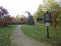


Park in the car park at the Jardin d’Eau de l’Aubépré, at the end of Rue Saint-Florentin in Gélaucourt.
(S/E) As you leave the car park, facing the Jardin d’Eau, turn right onto the small road, which curves sharply to the right. Ignore thefirst track on the left.
(1) Take thesecond track, marked by three posts, which veers to the left. Join the small road and turn left. Follow it to the bridge over the Ruisseau de Rosière.
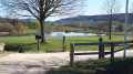
(2) Just before the bridge, take the path on the right, blocked by two stones, and carry on straight ahead. Join a track and turn left onto it to walk along the bank of the pond. At the end of the track, turn left for a few dozen metres, pass the car park and, after the barrier, turn left again to leave the leisure centre. Join Rue du Vallon behind Jolive.
(3) Follow it to the right. At the end of the street, turn right into Rue du Docteur Liebault. At the next Y-junction, keep right and continue to the end of the street, passing to the right of the chapel.
(4) Turn left, then right back onto Rue du Docteur Liebault. After a left-hand bend, at the Y-junction, keep left to reach the junction with Rue du Saintois.
(5) Cross Rue du Saintois and continue straight on along Rue de Saulxerotte. At the right-hand bend, leave the street and go straight on along the farm track, then turn left towards the church at Saulxerotte.
(6) Walk past the church and continue along Rue Sainte-Claire. At the junction with the Sainte-Claire Chapel, turn left onto the street called Sous la Côte Renaud. Walk past the old sawmill and you’ll reach Rue Sébastien Bottin (D 12).
(7) Turn right onto this road, then turn left at the next junction. Then take thesecond street on the right.
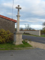
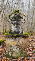
(8) Turn right onto Rue Huges III. After the wayside cross, take a small path on the left, Ruelle Merdelle. At the end of the path, turn right onto Rue de Rinchard and continue for a few hundred metres.
(9) Take the forest track on the left and enter the woods. At the next junction, turn right then carry on straight ahead. At the end of the track, turn right and then immediately left. At the end of the track, by the small stone marker, turn right onto the sunken path then immediately left. Pass the pumping station and, about a hundred metres further on, join a wide track.
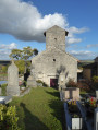
(10) Continue along the track to the left, then follow the small road downhill to reach the village of Battigny. Pass the church on your left and continue to the cross near the fountain.
(11) Go round the back of the box trees to join a footpath. At the low stone wall, turn right onto Ruelle de l’Église. At the end of the lane, continue to the left and reach the junction with the D5 at the town hall. Follow it to the right towards Gélaucourt: take care for over 1 km. Take thefirst road on the left.
(12) Enter the village of Gélaucourt. At the end of the road, turn left then keep right onto Rue Saint-Florentin. After the bridge over the Ruisseau de Velle, leave the street and take the path on the left to visit the Jardin d’Eau. After exploring the garden, head back to the car park (S/E).



 Visorando Member

 Easy