To the west of the Saintois region to visit the villages of Vandeléville and Battigny

Through fields and woods to visit the villages of Vandeléville and Battigny to the west of the Saintois region.
Castle, churches, wash house, fountain and calvaries.

Details

16122871
Creation:
Last update:
Last review:
  • Walking
    Activity: Walking
  • ↔
    Distance: 8.42 mi
  • ◔
    Average duration: 4h 25 
  • ▲
    Difficulty: Moderate

  • ⚐
    Back to start: Yes
  • ↗
    Ascent: + 630 ft
  • ↘
    Descent: - 627 ft

  • ▲
    Highest point: 1,535 ft
  • ▼
    Lowest point: 951 ft

Photos

Description of the walk

Park near the church in Thorey-Lyautey.

(S/E) Facing the church, head left; at the junction by the castle, turn left onto the D 5.

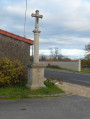
(1) Take the first small road on the left opposite the calvary. It joins the D 51.

(2) At the end of the road, turn left towards the village and pass the wash house, the fountain and the castle.

(3) After the castle, turn right onto Rue de l’Église, go down this street and continue along the small road. At the end of the street, turn right onto Rue de l’Étang and leave the village by continuing straight on.

(4) At the start of the pond, turn into the small, uphill street on the right and carry on straight ahead.

(5) At the top of the hill, take the second track on the right, then, at the bend, take the track on the left.

(6) At the first Fork in the road, turn onto the second track on the right and enter the woods, continuing straight on past a small stone marker.

(7) At the junction with a track, keep to the right and carry on straight ahead; at the next junction with a small street, turn right and head down towards the village.

(8) At the entrance to the village, turn left into the cemetery, head down towards the church, turn right onto Rue de l’Église and continue downhill.

(9) At the end of the street, turn right onto Rue-Saint Germain, then left onto the D 5 towards Gélaucourt.

(10) After the stone wayside cross, at the junction where the road enters the village of Gélaucourt, take the track on the right.

(11) At the end of the track, carry on straight ahead along the field path until you reach the D51.

(12) Follow this departmental road to the left until you reach the junction with the D 56.

(13) Turn right and carry on straight ahead to return to the starting point (S/E).
Waypoints

  1. S/E : mi 0 - alt. 955 ft - Church at Thorey-Lyautey. Towards the - Brénon (rivière)
  2. 1 : mi 0.24 - alt. 951 ft - Calvary
  3. 2 : mi 1.77 - alt. 1,063 ft - D 51
  4. 3 : mi 2.19 - alt. 1,129 ft - After the castle
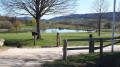
  5. 4 : mi 2.63 - alt. 1,188 ft - Pond
  6. 5 : mi 3.03 - alt. 1,440 ft - At the top of the hill
  7. 6 : mi 3.35 - alt. 1,486 ft - Vaditan Wood
  8. 7 : mi 3.95 - alt. 1,526 ft - Thorey Woods
  9. 8 : mi 5.04 - alt. 1,234 ft - Village entrance
  10. 9 : mi 5.25 - alt. 1,138 ft - Rue Saint Germain
  11. 10 : mi 6.3 - alt. 984 ft - Stone wayside cross
  12. 11 : mi 6.87 - alt. 1,001 ft - Field path
  13. 12 : mi 7.22 - alt. 1,024 ft - Return via the D 51
  14. 13 : mi 7.56 - alt. 1,030 ft - D 56
  15. S/E : mi 8.42 - alt. 958 ft - Church at Thorey-Lyautey

Worth a visit

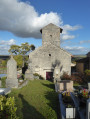
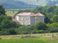
Church and castle at Thorey Lyautey.
Washhouse, fountain, castle and church in Vandeléville.
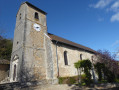
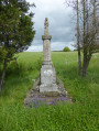
Church and Calvary with a statue of Saint Nicholas in Battigny.

Reviews and comments

4.5 / 5
Based on 2 reviews

Reliability of the description
4 / 5
Ease of following the route
4.5 / 5
Route interest
5 / 5
fanfan
fanfan

Overall rating : 5 / 5

Date of your route : Feb 27, 2026
Reliability of the description : Not used / Not applicable
Ease of following the route : ★★★★★ Very good
Route interest : ★★★★★ Very good
Very busy route : No

Hello

To ease ourselves back into hiking after a long break due to bad weather, we shortened this route. We set off from Vandeléville and returned via the old railway line. This meant we didn't go via Torrey Lyautey.
Our goal, besides getting back into shape, was to visit the fountains of Vandeléville and Battigny with the aim of creating a slideshow about water in general.
The part of the route we did was very good and we enjoyed it a lot. The paths were still a little muddy, but this didn't hinder our progress too much.
The entire route must be interesting; we really liked the two villages we passed through. You have to slow down and look around.

We didn't use the description as we use GPS for navigation. This didn't cause us any problems.

Thanks to the author.

Machine-translated

patptout
patptout

Overall rating : 4.3 / 5

Date of your route : May 13, 2025
Reliability of the description : ★★★★☆ Good
Ease of following the route : ★★★★☆ Good
Route interest : ★★★★★ Very good
Very busy route : No

A very lovely route alternating between road and footpath. Take care: the road is quiet but vehicles travel at high speeds. The end of the last footpath is overgrown with tall grass.

Machine-translated

danielrollet
danielrollet

Unable to download the GPX file for this walk.
Daniel Rollet

Machine-translated

Other walks in the area

For more walks, use our search engine .

The GPS track and description are the property of this route's author. Please do not copy them without permission.