Country:
 City:


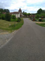
Car park in the heart of the satellite village, on the road towards Mont-de-Marsan.
(S/E) Leave this spot and enter the new housing estate on the left. Take the no-entry road (Rue de l’Écureuil); at the circular bend, turn left onto the Sentier des Écoliers, between the houses, and you’ll reach a cross-road.
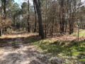
(1) Turn right and follow this long lane towards the woods. At the first path, turn left, between the pine groves. At the next junction, turn right, then left, until you reach the Route de Cère to Canenx and Réaut; follow it to the right until you reach a bend.
(2) At the bend, leave the road and take a wide, sandy track (signposted ‘DFCI water point’) and head south.
(3) Leave this track and take the path on the left towards the Lagune de Paulin. Keep to the right through the woodland until you reach the wide avenue marking the boundary between the municipalities (Cère and Canenx et Réaut).
(4) Turn right, heading almost due south, and follow this track for some time. Ignore the turn-offs to the left and right and follow a field fence on your left until you reach the crossroads.
(5) Take the track on the right (DFCI Cère No. 4) until you reach the second path on the left.
(6) Turn left onto this track (signposted ‘water point’), through the woodland, and then quickly turn right. Make your way through the pine trees, first to the left then to the right, and continue for a long way north-west until you reach the D651 (Route de Mont-de-Marsan).
(7) Cross the road carefully and follow the small Pouilla road opposite (private property). Turn right onto the paved track, head down towards Rue du Lavoir and turn left onto it. Go downhill, then back up towards the village crossroads.
(8) Turn right onto Rue Gilbert Beray, pass between the sports grounds and the cemetery, and continue straight on. Cross the D651 with care and head for the car park (S/E).
 Visorando Member
 Moderate