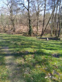
Routes to the south-west of Labrit

Unmarked route

This route, to the south-west of Labrit, follows the Estrigon and Bernin streams to the village of Vert – with its wash house, beginner’s mountain bike (hybrid) trails and orienteering courses – before returning to Labrit. You’ll be alone amidst the moorland, in complete tranquillity.

Details

982868
Creation:
Last update:
Last review:
  • Walking
    Activity: Walking
  • ↔
    Distance: 5.76 mi
  • ◔
    Average duration: 2h 40 
  • ▲
    Difficulty: Easy

  • ⚐
    Back to start: Yes
  • ↗
    Ascent: + 46 ft
  • ↘
    Descent: - 46 ft

  • ▲
    Highest point: 285 ft
  • ▼
    Lowest point: 240 ft

Description of the walk

Car park at Labrit Secondary School.

(S/E) Head towards the kerb of the paved path (due west), follow it to the right and continue straight on along the Chemin de Navarre.

(1) Turn left onto Chemin de la Grange, pass the airials and continue along the sandy track. At Moulin du Roi, keep left.

(2) At a place called Marions, turn right, walk alongside the lagoons and carry on straight ahead through the pine trees. Cross the first junction. Continue to the next junction.

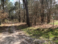
(3) Turn right. Follow this wide track, cross the bridge over the Estrigon and walk up the gentle slope.

(4) Turn right, continue along this path and cross a stream. Stay on this path between the pine plantations.

(5) Carry on straight ahead along this path, ignoring the paths to the right and left. At the Y-junction, keep left.

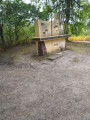
(6) Turn right, passing close to a contemporary art installation, a spring and between the sheepfold and the wash house on the Bernin.

Cross the D57 and carry on straight ahead to the Vert picnic area.

(7) Head right towards the footbridge over the Bernin. Cross to the other bank, under the pine trees, and cross the road in this housing estate slightly to the left of the turning area.

(8) Take the mountain bike (hybrid bike) beginners’ trail; follow the white arrow.

(9) Leave this trail to the north-east, near the access road to the Jautan neighbourhood.
Join the D57 (Route de Labrit) and follow it to the left as far as Labrit.

(10) Turn right onto Chemin de Navarre and cross the Estrigon.

(1) Carry on straight ahead until you reach the car park (S/E).

Waypoints

  1. S/E : mi 0 - alt. 285 ft - Labrit Secondary School car park
  2. 1 : mi 0.15 - alt. 285 ft - Chemin de La Grange
  3. 2 : mi 0.94 - alt. 269 ft - Marions
  4. 3 : mi 1.69 - alt. 259 ft - Turn right at the four-way junction
  5. 4 : mi 2.5 - alt. 259 ft - Turn right at the fork
  6. 5 : mi 2.75 - alt. 262 ft - Straight ahead
  7. 6 : mi 3.39 - alt. 266 ft - Turn right at the fork
  8. 7 : mi 3.67 - alt. 256 ft - Aire de pique nique, ruisseau, lavoir, ponton de pêche pour handicapé.
  9. 8 : mi 3.78 - alt. 266 ft - Mountain bike trail car park
  10. 9 : mi 4.11 - alt. 266 ft - On the right
  11. 10 : mi 5.31 - alt. 266 ft - Chemin de Navarre. Cross the - Estrigon (ruisseau) - Affluent de la Midouze
  12. S/E : mi 5.76 - alt. 285 ft - Labrit secondary school car park

Notes

In the centre of Labrit.
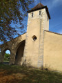
- Behind the church, there are toilet facilities with a water tap and toilets.
- All shops and services.
- In the centre of Vert: an inn.

Alternative Route 01:
(S/E) Leave the car park heading towards the recycling centre, go round it on the right; after the hillock, follow the fence around the football pitch, then past the municipal workshops. Carry on straight ahead, cross the first road, and follow the Lucmon airial to the junction opposite “Maquin”. Turn onto the track on the right and, at the junction, turn left towards (3).

Alternative Route 02:
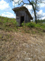
After the Pont de L’Estrigon (between (3) and (4)), turn right. This path, which initially runs alongside the stream, then heads westwards, first under the pine trees and then through newly planted plots. Ignore the two paths on your right which lead to a pidgeon hunting hut. At the junction (5), turn right.

Route 03:
Just before you reach the junction, at the large noticeboard, head slightly down to the right towards the wash house, Le Bernin and its footbridge. Cross over and follow the D57 (Route de Labrit) on its right-hand side until you reach the road leading to the housing estate. Cross the D57 (transformer, rubbish bins) and head into the woodland; you’ll come to the mountain bike trail. Keep to the right, going slightly uphill, until you reach a hairpin bend. Leave the mountain bike trail at (9).

Worth a visit

During the walk:
__Le Bernin____ L’Estrigon__.
A work from the “Forest of Contemporary Art”

Nearby:
In Labrit, visit the Château de Terre site (with its information boards).
In Brocas-les-Forges: The Forges Museum
In Sabre: Marquèse Museum

Along the route, at (car park) (8), there are two short introductory trails (orange signs: 3.3 km; white signs: 2.2 km) for mountain biking (hybrid bikes).
Starting from the centre of the village of Vert, set off to explore the orienteering trails, created in collaboration with SAPAL and the primary school (map available from the town hall; please note opening hours; near (7) and (8) you will find marked waypoints).

Other walks in the area

For more walks, use our search engine .

The GPS track and description are the property of this route's author. Please do not copy them without permission.