Country:
 City:
City:


Start from the square behind the village hall or behind the museum.
Blue Rectangle signposting.
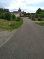
(S/E) Head towards the village of Brocas, south-south-east, along the small country road (D353).
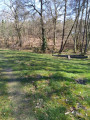
(1) On leaving the village, take the small nature trail on your right and follow it to the end.
(2) At the junction, turn right, passing pine plantations of varying ages; cross the footbridge to reach a picnic area and the site where seeds for future pine trees are being planted.
(3) Retrace your steps, cross the footbridge again and turn right onto the road (D353), then immediately turn left, heading almost due north.
(4) Turn right and then left twice along this track, then right, heading due north.
(5) At the junction, turn right, heading almost due east, until you reach a junction with a wide track.
(6) Turn left and stay firmly on this track until you reach a junction with signposted routes coming from Brocas.
(7) At the junction of tracks, turn left, still heading due north; take care not to take the wrong route – there is an underground tank nearby.
(8) At the four-way junction, leave the main track and turn left towards the west. Stay firmly on this track, which curves to the right and continues north-north-west, until you reach the D57. Continue left along this road.
(9) Quite soon, turn right onto a well-maintained track. Cross the ‘Le Geloux’ stream and continue along this track until you reach a four-way crossroads.
(10) Leave the wide track and turn left, heading due south. Go round the Airial du Piat and carry on in the same direction, skirting the Airial Perrot with the stream ‘Le Geloux’ on your left. Enter the village and continue to the D57.
(11) Turn right and follow the road to the centre of the village (S/E).
 Visorando Member
 Easy
Easy