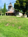
Amongst airials and pine trees around Le Sen

This charming little village, full of things to discover, is situated in the heart of the Landes de Gascogne, in a peaceful setting far from the hustle and bustle of civilisation. Its pond and beautiful tracks – some of which are sandy – invite you to enjoy a complete change of scenery.

This route can be completed on a mountain bike or hybrid bike.

Details

n°19636026
Creation:
Last update:
Last review:
  • Walking
    Activity: Walking
  • ↔
    Distance: 5.30 mi
  • ◔
    Average duration: 2h 30 
  • ▲
    Difficulty: Easy

  • ⚐
    Back to start: Yes
  • ↗
    Ascent: + 30 ft
  • ↘
    Descent: - 30 ft

  • ▲
    Highest point: 361 ft
  • ▼
    Lowest point: 302 ft

Description of the walk

There are several car parks available in the village centre. Park in the car park near the town hall.

Unmarked route

(S/E) Leave the car park heading south-south-west towards Labrit, follow the road, carry on and leave the village.

(1) Turn right onto Chemin du Moulin, continue to the pond, go round it on the right and reach the metal footbridge spanning the Ruisseau de l’Estrigon.

(2) Head slightly to the left towards the road. Take this road, pass in front of the ‘airial le Piou’ and carry on straight ahead along Route de l’Étang. Continue and stay firmly on this track. Near several houses, the road turns into a wide track (DFCi No. 9 from Le Sen). Continue to a crossroads where there is a pidgeon hunting hut.

(3) Turn right, head due east and ignore any turn-offs to the right or left until you reach the road (D392). Keep to the right, cross the stream and carry on to the bend.

(4) Take the Chemin de Lauchet almost directly opposite, follow this very well-marked track as it winds its way to the Layraou clearing, turn right in front of it and walk between these two points until you reach the road.

(5) Turn left then right and follow the Chemin de Mary (tarmac road).

(6) Pass the hamlet of Lasserre and continue along the road to the Domaine de Mary.

(7) Take a right/left/right at the boundary of this property and head due south. Ignore the paths to the right and left. Keep to the right as you approach Garlande, then turn due west.

(8) At the three-way junction, carry on straight south until you reach the junction with a wide, groomed track; turn right and cross this part of the village until you reach the road.

(9) Turn right and follow the road until you reach the centre of the village and the car park (S/E).

Waypoints

  1. S/E : mi 0 - alt. 331 ft - Car park near the town hall
  2. 1 : mi 0.18 - alt. 335 ft - Junction: Chemin du Moulin
  3. 2 : mi 0.56 - alt. 308 ft - Junction on the road after the - Estrigon (ruisseau) - Affluent de la Midouze
  4. 3 : mi 1.47 - alt. 348 ft - Crossroads (pidgeon hunting hut)
  5. 4 : mi 2.16 - alt. 341 ft - Lauchet Path
  6. 5 : mi 2.98 - alt. 338 ft - Road junction
  7. 6 : mi 3.16 - alt. 341 ft - Lasserre
  8. 7 : mi 3.58 - alt. 361 ft - Mary’s Estate
  9. 8 : mi 4.31 - alt. 335 ft - Three-way junction
  10. 9 : mi 4.82 - alt. 335 ft - Small road
  11. S/E : mi 5.3 - alt. 331 ft - Car park near the town hall

Notes

The route can be shortened.
At Wpt (6), turn right, take the path; at the three-way junction, keep right and head for Wpt (8).

Worth a visit

Inn in the centre of the village.
A pond with tables and benches.

Reviews and comments

4.3 / 5
Based on 2 reviews

Reliability of the description
4.5 / 5
Ease of following the route
4.5 / 5
Route interest
4 / 5
User 8018629
• Edited:

Overall rating : 4 / 5

Date of your route : Jul 31, 2025
Reliability of the description : ★★★★☆ Good
Ease of following the route : ★★★★☆ Good
Route interest : ★★★★☆ Good
Very busy route : No

a pleasant route through woodland with a mix of shade and sun, very easy to follow using the Visorando app.

Machine-translated

Marianne et Heidi
Marianne et Heidi
• Edited:

Overall rating : 4.7 / 5

Date of your route : Dec 17, 2023
Reliability of the description : ★★★★★ Very good
Ease of following the route : ★★★★★ Very good
Route interest : ★★★★☆ Good
Very busy route : No

A lovely walk through the woods and along quiet stretches of road, on a lovely, cool but sunny day. A lovely picnic in the sunshine by the pond. The route was easy to follow; there are plenty of paths, so it might have been trickier without the GPS. There were a few flooded sections following the week’s heavy rain, but we got through them without any trouble. Just a quick note: we didn’t see any pidgeon hunting huts at point 3.

Machine-translated

Other walks in the area

For more walks, use our search engine .

The GPS track and description are the property of this route's author. Please do not copy them without permission.