


Refine your search for walks in Antoing
Antoing walks


 Old Canal via Morlies, starting from Your Nature
 Visorando Member
 3.00 mi
 +43 ft
 -39 ft
 1h 25
1h 25
 Easy
Easy
 Departure from Antoing (Hainaut)
Walk through the hamlet of Morlies and along a short stretch of the Vieux Canal.
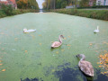
On the banks of the Nimy Canal in Peronnes
 9.97 mi
+167 ft
-177 ft
4h 45
9.97 mi
+167 ft
-177 ft
4h 45
 Moderate
Departure from Antoing (Hainaut)
Moderate
Departure from Antoing (Hainaut)
A walk along the towpaths of the new and old canals from Nimy to Péronnes.
At the start, you can admire the two giant locks that have replaced the eight locks that you will then pass as you walk down the old canal.
Admire the old lock houses on the old canal.
However, be careful in strong winds between points (8) and (9) as the trees are fragile and it is best to avoid this section.
The entire hike is on tarmac or paved paths.
Wiers – Belœil
 10.17 mi
+325 ft
-151 ft
4h 55
Moderate
Departure from Péruwelz (Hainaut)
10.17 mi
+325 ft
-151 ft
4h 55
Moderate
Departure from Péruwelz (Hainaut)
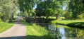
Starting from the random point given at the end of the previous stage, we will explore the Belgian-French border region in southern Hainaut, moving back and forth between France and Belgium, including the curious town of Bon-Secours with its cathedral situated right on the border. This stage ends in the municipality of Belœil at a holiday let booked for the occasion.
Tournai – Wiers
 14.22 mi
+171 ft
-226 ft
6h 40
14.22 mi
+171 ft
-226 ft
6h 40
 Difficult
Departure from Tournai (Hainaut)
Difficult
Departure from Tournai (Hainaut)
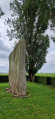
Setting off to explore the Pierre Brunehaut, an imposing menhir in the Hollain area, requires a detour; but for enthusiasts of megalithic sites, it is a detour well worth taking. To reach it, the walk follows the old Tournai–Cambrai Roman road, then crosses a small section of French territory to reach Belgium at Wiers.
Pont de l'Imbécile
 5.86 mi
+13 ft
-13 ft
2h 40
Easy
Departure from Château-l'Abbaye (Nord)
5.86 mi
+13 ft
-13 ft
2h 40
Easy
Departure from Château-l'Abbaye (Nord)
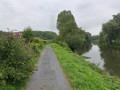
Take a short trip to Château-l'Abbaye along the Scheldt and Scarpe rivers to cross the Pont de l'Imbécile bridge!
 From Taintignies to Lac du Héron
34.67 mi
+236 ft
-262 ft
3 hrs
Moderate
Departure from Rumes (Hainaut)
Gravel or hybrid bike route from Taintignies to the Marais de Fretin and Lac du Héron. The route is mainly on tarmac at the start, then there are quite a few ‘white’ tracks. A very lovely ride, with Lac du Héron as the highlight.
Explore the village of Orcq via the Trieu des Pouriaux
 Association / Club / Walk leader5.21 mi
+105 ft
-105 ft
2h 30
Easy
Departure from Tournai (Hainaut)
Association / Club / Walk leader5.21 mi
+105 ft
-105 ft
2h 30
Easy
Departure from Tournai (Hainaut)
The aim of this walk is to help residents (re)discover the village of Orcq, as well as anyone interested in local history and heritage.
Due to the nature of this document, it cannot be exhaustive. Further information can be found in our magazines, which have already covered certain topics.
Exploring the village of Orcq
4.29 mi
+98 ft
-98 ft
2h 05
Easy
Departure from Tournai (Hainaut)
The aim of this walk is to help residents (re)discover the village of Orcq, as well as anyone interested in local history and heritage. Due to the nature of this document, it cannot be exhaustive. Further information can be found in our magazines, which have already covered certain topics.
Circular walk around Froyennes
 3.88 mi
+135 ft
-148 ft
1h 55
Easy
Departure from Tournai (Hainaut)
3.88 mi
+135 ft
-148 ft
1h 55
Easy
Departure from Tournai (Hainaut)
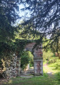
A walk to discover Froyennes (church, Château Beauregard, Saint-Éloi fountain, watermill) and the surrounding area. Please note: muddy paths in wet weather!
Circular route from Mont-Saint-Haubert
14.15 mi
+902 ft
-902 ft
7h 20
Difficult
Departure from Tournai (Hainaut)
The iconic hill of Tournaisis and its slopes offer panoramic views and trails or paths that you can walk, run or climb. Your steps will take you through countryside dotted with hamlets and farms towards the Scheldt and its Léaucourt cut (a former meander of the river). You will discover a discreet and modest countryside that is not lacking in charm.
Coqueréaumont – Pecq
14.89 mi
+686 ft
-801 ft
7h 25
Difficult
Departure from Frasnes-lez-Anvaing (Hainaut)
With this fourth stage, it’s time to tackle the westernmost part of the Tour de Wallonie as you head towards the Scheldt, but not before climbing the area’s toughest hill, Mont-Saint-Aubert.
Around Landas
 5.60 mi
+36 ft
-36 ft
2h 35
Easy
Departure from Landas (Nord)
5.60 mi
+36 ft
-36 ft
2h 35
Easy
Departure from Landas (Nord)
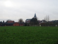
Discover the beauty of the countryside around Landas on a picturesque walk that will take you through the charming streets, lanes and paths of this delightful village in the Pévèle region. This walk is suitable for everyone and offers a chance to relax in the heart of the countryside.
The Ramegnies-Chin circular route
6.68 mi
+39 ft
-43 ft
3h 05
Easy
Departure from Pecq (Hainaut)
This circular route takes you through the Scheldt plain between the two villages of Esquelmes and Ramegnies-Chin. It is a rural route along paths and small country roads. Take care when crossing the Tournai road. You will discover the pretty church of Esquelmes near the Scheldt, lined with trees, and the many calvaries and chapels. You will walk along paths lined with hedges and take small passages. At the edge of the Scheldt, you will see Mont Saint-Aubert on the other bank.
Circular Chabaud-Latour in Bonsecours
 11.72 mi
+230 ft
-240 ft
5h 35
Moderate
Departure from Condé-sur-l'Escaut (Nord)
11.72 mi
+230 ft
-240 ft
5h 35
Moderate
Departure from Condé-sur-l'Escaut (Nord)
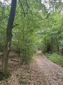
This circular route connects the Chabaud-Latour Pond to the Bonsecours Forest in Péruwelz. Along the route, you can see the Fosse Ledoux headframe and its slag heap, the Bernissart Fire Machine and the Basilica of Our Lady of Bon-Secours in Péruwelz.
Pecq – Tournai
 7.19 mi
+115 ft
-30 ft
3h 25
Moderate
Departure from Pecq (Hainaut)
7.19 mi
+115 ft
-30 ft
3h 25
Moderate
Departure from Pecq (Hainaut)
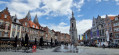
The fifth stage is short and straightforward to describe. Starting from Pecq, it runs to Tournai, following the Scheldt. It is by no means monotonous, however, as the river lies on one side, whilst the scenery on the other side is ever-changing. And the centre of Tournai is well worth a visit.
Mare à Goriaux circuit
 6.02 mi
+79 ft
-72 ft
2h 50
Easy
Departure from Hasnon (Nord)
6.02 mi
+79 ft
-72 ft
2h 50
Easy
Departure from Hasnon (Nord)
This route takes you through the mythical 'Trouée d'Arenberg' (Arenberg gap), the venue for the Paris-Roubaix race, and then on to the Mare à Goriaux bird sanctuary.
Trails in the Pays des Collines towards Buquet
1.90 mi
+203 ft
-203 ft
1h 05
Easy
Departure from Frasnes-lez-Anvaing (Hainaut)
Village lanes and footpaths starting from the Maison du Parc du Pays des Collines. Very quiet village roads where you’ll come across various animals (cows, meadows with magnificent horses, goats, peacocks, chickens, etc.). Dogs must be kept on a lead, except on the footpaths (watch out for cats, which are often found on the footpaths in this area).