Country:
 City:
City:


(S/E) On leaving “La Marmite” (info A), take the Vieux Chemin de Willems on the right.
(1) At the first junction, on the right, take the Chemin Vert (info B), continue along this path and, at the crossroads where the Moulin du Diable and La Marlière paths meet (info C), carry on straight ahead
(2) Carefully cross the Chaussée de Lille using the pedestrian crossing opposite “la Barrière” (info D) and continue along the Chemin Vert.
(3) Turn right onto the Chemin de Bouvines (info E).
(4) Turn right onto Rue Victor Crombez (info G) and walk down to No. 1 (hairdresser’s) then turn left
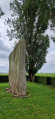
(5) Then turn left straight away towards the Résidence Charles Lelubre and its memorial stone (info H). Next, carry on straight ahead, turn right at No. 9, then left to join Rue de la Chapelle (info M), walk alongside the football pitch and continue straight ahead along Rue de la Chapelle until you reach the Chaussée de Lille...
(6) On the left, walk as far as No. 500 (keystone in the façade (info I)). Cross the road carefully and head back the other way to the petrol station, then take the Vieux Chemin de Lille, veering slightly to the left as you pass the Notre-Dame Chapel (info J).
(7) Then continue left onto Rue de la Fontaine d’Arnouville (info K) and, at the end, go round the hill on the left (the stream is below) to return to the Vieux Chemin de Lille.
(7) Turn left and carry on.
(8) Walk to the village square (info L), then turn right and, immediately after, turn right again to take the section of the Vieux Chemin de Lille leading to the Chaussée de Lille, before turning left. Look across the road at the commemorative plaque for Victor Crombez on the wall of No. 438B and, further on, the Notre-Dame de la Paix chapel (info M).
(9) Turn left, before the ruined tower (info M), to rejoin the Vieux Chemin de Lille as you head back towards the village square.
(8) Opposite the farm run by the non-profit organisation Ensemble (info N), turn right onto Rue de l’Église Sainte-Agathe (info O). Turn left onto Rue Gaston Horlait (info P), and stop for refreshments at the Glorieux farm (info Q).
(10) At the cemetery (info R), turn round, then turn left onto Rue de l’Église Sainte-Agathe. Pass the Vieux Maire farm (info S) and continue to the edge of the Marlière estate (info T).
(11) Turn left onto path no. 29 and follow the Rieu de Maire (info U). Turn right to reach “La Marmite” (S/E).
 Association / Club / Walk leader
 Visorando Member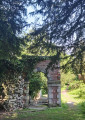
 Difficult
 Moderate