


Refine your search for walks in Ance du Nord (rivière)
Ance du Nord (rivière) walks


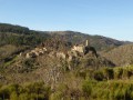
 Chalencon, a feudal village in the heart of the Ance valley
 Visorando Member
 6.95 mi
 +1,611 ft
 -1,631 ft
 4h 35
 Moderate
 Departure from Saint-André-de-Chalencon (Haute-Loire)
A circular route allowing you to explore the feudal castle of Chalencon (Barony of Chalencon), perched on its promontory, nestled in the Ance valley, at the heart of a 25-hectare protected siteAt its foot lies the feudal village, and spanning the River Ance are two bridges: the Pont du Diable, with its two arches—one of which is 15 metres high—certainly dating from the 12th century, and the 15th-century Bounery Bridge.
The volcanic crater of Montpeloux
 4.68 mi
+554 ft
-541 ft
2h 40
 Easy
Departure from Saillant (Puy-de-Dôme)
A beautiful trail with, halfway through the hike, the discovery of the Montpeloux volcanic crater and its many informative panels (geology, history of the volcano, fauna, flora, etc.), an undeniable bonus for curious children!
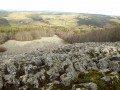
The Bourianne lava flow
 3.71 mi
+653 ft
-653 ft
2h 15
Moderate
Departure from Saint-Julien-d'Ance (Haute-Loire)
The Bourianne lava flow is the result of an interesting geological phenomenon. Halfway through this hike, walkers will discover an imposing scree slope of basalt columns at their feet and, in the distance, the Forez Massif.
Le Creux de l’Oulette and the Montpeloux rock formations
8.18 mi
+1,240 ft
-1,237 ft
4h 50
Moderate
Departure from Saillant (Puy-de-Dôme)
This circular walk takes in two sites not to be missed if you’re in the area: the Creux de l’Oulette and its waterfall, and the Volcan de Montpeloux, a former basalt quarry converted into an open-air geological museum. Towards the end of the walk, the route follows a lovely path along the River Ance.
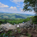
From the Coulée de la Bourianne to Saint-Julien-d’Ance
 2.33 mi
+636 ft
-640 ft
1h 35
Moderate
Departure from Saint-Julien-d'Ance (Haute-Loire)
This walk offers the chance to discover the natural and historical heritage around the village of Saint-Julien-d’Ance, particularly the Coulée de la Bourianne.This walk was organised as part of the ECHO project, which ended on 1 October 2023. It can still be undertaken to explore the local heritage.

Walks near Ance du Nord (rivière)
 Col des Supeyres to Col du Béal
 8.78 mi
+1,178 ft
-1,099 ft
3 hrs
Easy
Departure from Valcivières (Puy-de-Dôme)
Spend two days discovering one of the most beautiful destinations in “France à cheval”.
Col du Béal – Col des Supeyres
 10.70 mi
+1,503 ft
-1,591 ft
6h 15
Moderate
Departure from Saint-Pierre-la-Bourlhonne (Puy-de-Dôme)
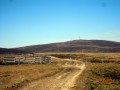
Stage 2: the most beautiful stage of the route. Spectacular, with heathland stretching as far as the eye can see, a boundless 360° view where stunted pines bend under the “burle”. Photos, scents – set aside the whole day.
GR®3route, partly well signposted.
Col des Pradeaux – Col des Supeyres
6.88 mi
+1,020 ft
-440 ft
4h 05
Moderate
Departure from Grandrif (Puy-de-Dôme)
This is stage 1 of a mini-trek that can be completed in two days, linking two iconic passes in the Forez region. From the Col des Pradeaux, you’ll make your way to the Col des Supeyres. During this walk, you’ll be able to admire the Pradeaux Dam, the Hautes Chaumes and the iconic shepherd's huts.
Tour du Teilhet
4.14 mi
+853 ft
-827 ft
1.5 hrs
Easy
Departure from Marat (Puy-de-Dôme)
If you’re on holiday in Marat, here’s a short route for a walk or a horse ride starting from La Ramie.
La Renaudie – Sainte-Agathe
 Association / Club / Walk leader12.96 mi
+1,673 ft
-2,661 ft
7h 25
 Difficult
Departure from La Renaudie (Puy-de-Dôme)
This fourth stage of the route is the longest and most challenging. We will often be walking at high altitudes (highest point: 1,153 m). We will follow the River Couzon before descending along good paths through the woodland towards Vollore-Montagne. The walk through the Ayguebonne Forest, near the Grun de Chignore, will take us to Sainte-Agathe.
Olliergues – La Renaudie
11.84 mi
+2,933 ft
-1,230 ft
8h 00
Difficult
Departure from Olliergues (Puy-de-Dôme)
Starting from Olliergues town hall, we head uphill along the cobbled path. Most of this third stage follows the white and green-marked ‘Tour de Pays’ trail as far as Le Brugeron. From Le Brugeron, head towards Le Grun de Batailler, passing the Begue mill (waterfall). Cross Le Clef. At La Croix de Sainte-Agathe, take a small road, pass through the hamlet of Rochefolle to reach the village of La Renaudie, where you’ll find the communal lodge.