Col des Pradeaux – Col des Supeyres

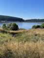
This is stage 1 of a mini-trek that can be completed in two days, linking two iconic passes in the Forez region. From the Col des Pradeaux, you’ll make your way to the Col des Supeyres. During this walk, you’ll be able to admire the Pradeaux Dam, the Hautes Chaumes and the iconic shepherd's huts.

Details

102737903
Creation:
Last update:
Last review:
  • Walking
    Activity: Walking
  • ↔
    Distance: 6.88 mi
  • ◔
    Average duration: 4h 05 
  • ▲
    Difficulty: Moderate

  • ⚐
    Back to start: No
  • ↗
    Ascent: + 1,020 ft
  • ↘
    Descent: - 440 ft

  • ▲
    Highest point: 4,554 ft
  • ▼
    Lowest point: 3,914 ft

Description of the walk

Park in the car park at the Col des Pradeaux – the starting point for numerous hikes, with easy access and ample parking for cars and motorhomes.

(S) Follow the road to the right towards Ambert, then turn right after the inn and, just before the next houses, take a path that climbs to the right, due north, into the forest. Follow it to reach the Barrage des Pradeaux.

(1) Walk along the left-hand side of the lake, cross the Ruisseau Noir, and you will then come to a crossroads of footpaths.

(2) Leave the lakeshore and take the path on the left, heading due north. Continue uphill, passing the first shepherd's huts – notably the Grand Fayevie hut – until you reach a forest track.

(3) Turn left onto this track and continue to the Col des Allebasses.

(4) Take thefirst track on the right and continue along the edge of the woodland to reach the Hautes-Chaumes

(5) Cross the gate – be careful: you may encounter cows here – and reach a crossroads with several routes in the middle of the meadow.

(6) Turn right, then left, heading roughly north, to walk alongside the forest and reach the Borne Seigneuriale du Pialoux.

(7) Turn left, towards the west, onto the Chemin des Colporteurs de Jasseries. At the next crossroads, keep left to go round the Jasseries de Supeyres. You will come to another fence.

(8) Continue downhill, still on the Chemin des Colporteurs de Jasseries, to reach the Col des Supeyres (E).

Waypoints

  1. S : mi 0 - alt. 3,914 ft - Col des Pradeaux car park
  2. 1 : mi 1.03 - alt. 4,144 ft - Barrage des Pradeaux
  3. 2 : mi 1.62 - alt. 4,163 ft - Crossroads by the lake
  4. 3 : mi 2.33 - alt. 4,386 ft - Chemin de la Fayevie
  5. 4 : mi 2.63 - alt. 4,367 ft - Col des Allebasses
  6. 5 : mi 3.14 - alt. 4,449 ft - Hautes-Chaumes barrier
  7. 6 : mi 3.49 - alt. 4,436 ft - Meadow
  8. 7 : mi 4.87 - alt. 4,537 ft - Pialoux seigneurial boundary stone
  9. 8 : mi 6.34 - alt. 4,528 ft - Barriers
  10. E : mi 6.88 - alt. 4,475 ft - Col des Supeyres (1365m)

Notes

(S) At the Col des Pradeaux: a large car park, the stopover lodge of Pradeaux , and numerous other walks start from this point.
There is no drinking water along the route, nor any picnic tables or other facilities; please bring sufficient water or a water filter, as there are manylovely shepherd's huts near Les Jasseries.
(E)
Col des Supeyres: you can eat and stay overnight at the Chalet/Snack des Gentianes, which has a large car park; numerous other hiking trails also start from this spot.

Worth a visit

(1) Pradeaux Dam.
Along the route: numerous shepherd's huts.
(5) Hautes Chaumes.

Other walks in the area

For more walks, use our search engine .

The GPS track and description are the property of this route's author. Please do not copy them without permission.