From the Coulée de la Bourianne to Saint-Julien-d’Ance

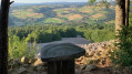
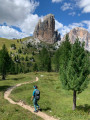
This walk offers the chance to discover the natural and historical heritage around the village of Saint-Julien-d’Ance, particularly the Coulée de la Bourianne.
This walk was organised as part of the ECHO project, which ended on 1 October 2023. It can still be undertaken to explore the local heritage.

Details

34482510
Creation:
Last update:
Last review:
  • Walking
    Activity: Walking
  • ↔
    Distance: 2.33 mi
  • ◔
    Average duration: 1h 35 
  • ▲
    Difficulty: Moderate

  • ⚐
    Back to start: Yes
  • ↗
    Ascent: + 636 ft
  • ↘
    Descent: - 640 ft

  • ▲
    Highest point: 3,048 ft
  • ▼
    Lowest point: 2,428 ft

Photos

Description of the walk

From Craponne-sur-Arzon, take the D9 towards Saint-Georges-Lagricol. Turn left here onto the D352 towards Saint-Julien-d’Ance. Park near the town hall.

(S/E) With your back to the town hall, follow the road to the left, then take the first left at the church. Go past the church, turn right onto the street and follow it to the second junction.

(1) Take the path on the left and follow it until you reach the first path coming from the same direction.

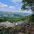
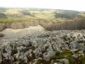
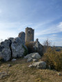
(2) Take this path. Then follow the path to the left to reach the Bourianne scree slope.

(3) Continue along the path, then turn left at the fork and carry on until you rejoin the road.

(4) Cross over to the opposite side and enter the hamlet of Bourianne. Then take the second left and follow the path until you reach the road you crossed earlier.

(5) Follow it to the right for about 200 m, then turn onto a path on the right which leads onto a small road not far from the sewage treatment plant. Turn left and follow the road to the town hall (S/E).
Waypoints

  1. S/E : mi 0 - alt. 2,513 ft - Town Hall
  2. 1 : mi 0.17 - alt. 2,595 ft - Intersection
  3. 2 : mi 0.85 - alt. 3,048 ft - Turn left at the fork
  4. 3 : mi 1.1 - alt. 3,022 ft - Coulée de la Bourianne
  5. 4 : mi 1.54 - alt. 2,638 ft - Road junction
  6. 5 : mi 1.83 - alt. 2,648 ft - D352 overlooking the - Ance du Nord (rivière)
  7. S/E : mi 2.33 - alt. 2,513 ft - Town Hall

Notes

This route is suitable for everyone, from experienced walkers to beginners, but you will still need good walking shoes to ensure comfort and prevent any potential injuries.
Throughout the route, woods and forests provide shade for you to take a break.
In Saint-Julien-d’Ance, there are bars and bakeries where you can top up your water supplies.
ÉCHO. Street & Land Art in Velay

Worth a visit

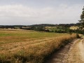
During the walk, you’ll have the chance to enjoy the peace and a change of scenery offered by this ancient landscape.
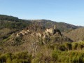
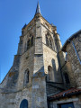
You can also admire the architectural heritage in Saint-Julien-d’Ance, notably its 16th-century Gothic church, built on the foundations of a Romanesque church.

Reviews and comments

4 / 5
Based on 4 reviews

Reliability of the description
4 / 5
Ease of following the route
3.8 / 5
Route interest
4.3 / 5
Marion VR
Marion VR ★

Hello Robert, yes, the difficulty level has been set to ‘medium’.

Machine-translated

bonnefoy robert
bonnefoy robert

Overall rating : 3 / 5

Date of your route : Sep 06, 2024
Reliability of the description : ★★★☆☆ Average
Ease of following the route : ★★★☆☆ Average
Route interest : ★★★☆☆ Average
Very busy route : No

Rated as ‘easy’, but I’d say it’s ‘moderate’ – very stony, not easy on the descents and ascents.
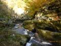
The stream is magnificent
The route isn’t very well marked near the viewpoint where you rejoin the path; there’s an uprooted tree on the trail.

Machine-translated

Oroch
Oroch

Overall rating : 4 / 5

Date of your route : Oct 28, 2023
Reliability of the description : ★★★★☆ Good
Ease of following the route : ★★★★☆ Good
Route interest : ★★★★☆ Good
Very busy route : No

Too late for Echo: there’s no trace left of the exhibited works!

Machine-translated

patounette42
patounette42

Overall rating : 5 / 5

Date of your route : Oct 02, 2023
Reliability of the description : ★★★★★ Very good
Ease of following the route : ★★★★★ Very good
Route interest : ★★★★★ Very good
Very busy route : No

With the sun shining brilliantly, we were absolutely blown away!!!!
We extended the walk using another guidebook……stunning views

Machine-translated

hwehrlin
hwehrlin

Overall rating : 4 / 5

Date of your route : Aug 14, 2023
Reliability of the description : ★★★★☆ Good
Ease of following the route : ★★★☆☆ Average
Route interest : ★★★★★ Very good
Very busy route : No

The directions at the start of the walk aren’t entirely clear, but as there are ‘Echo’ signposts, it doesn’t matter. The highest point, with its view of the lava flow, is magnificent, as is the descent through a deciduous forest. This rocky descent isn’t exactly easy. An ideal walk when you only have half a day to spare. Thanks to the hiker who brought this route to our attention.

Machine-translated

Other walks in the area

For more walks, use our search engine .

The GPS track and description are the property of this route's author. Please do not copy them without permission.