


Refine your search for walks in Allèves
Allèves walks


 The Saint-Jacques Towers loop
 Visorando Member
 5.77 mi
 +2,431 ft
 -2,411 ft
 4h 45
4h 45
 Moderate
 Departure from Allèves (Haute-Savoie)
The Saint-Jacques Towers are a group of three monoliths that have broken away from the cliff and continue to slide 2 to 3 cm per year.
The suggested route allows you to see them from different angles, from above and below.
Along the way, note the paved road and the massive log barns.
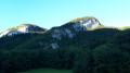
Tour of the Montagne de Bange
 12.60 mi
+4,094 ft
-4,072 ft
9h 20
12.60 mi
+4,094 ft
-4,072 ft
9h 20
 Difficult
Departure from Cusy (Haute-Savoie)
Difficult
Departure from Cusy (Haute-Savoie)
This walk takes you round this mountain, situated between the Semnoz to the north and the Revard massif to the south. Initially, you’ll follow theGRP® trail, which will take you to the summit (Crêt de la Dolca) and on to the Col de la Cochette (orientation table).
Moderator’s note : reviews of this walk indicate that from (14) onwards, the path no longer exists. The only alternative is to follow the D911 for 4 km. See details in the description
The Prérouge Cave, the Granges du Crêt and the Chapel of Montagny
 5.55 mi
+1,217 ft
-1,220 ft
3h 35
Moderate
Departure from Arith (Savoie)
5.55 mi
+1,217 ft
-1,220 ft
3h 35
Moderate
Departure from Arith (Savoie)
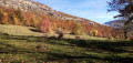
When the peaks are shrouded in cloud or snow, this is an unpretentious hike through the Arith countryside. At the start of the hike, the Prérouge Cave and the resurgence near the mill are beautiful points of interest. You will also see beautiful houses and old barns.
From the Pont du Diable to the sawmills
 7.13 mi
+1,332 ft
-1,335 ft
4h 25
Moderate
Departure from Bellecombe-en-Bauges (Savoie)
7.13 mi
+1,332 ft
-1,335 ft
4h 25
Moderate
Departure from Bellecombe-en-Bauges (Savoie)
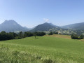
From the spectacular canyon at the Pont du Diable, this hike takes you to the sawmills, one of which has been restored by local heritage enthusiasts. The return route takes you through the pretty village of Bellecombe-en-Bauges
Prérouge caves from the chocolate factory
1.65 mi
+135 ft
-135 ft
0h 50
 Easy
Departure from Bellecombe-en-Bauges (Savoie)
Easy
Departure from Bellecombe-en-Bauges (Savoie)
A short round-trip walk to discover two very pretty spots, following paths through the woodland.
Update: a review dated 10/08/2026 indicates that the path between (S/E) and (1) is eroded. However, it is still possible to visit the site via a short walk starting from the car park located at (1).
The Semnoz
 9.24 mi
+2,513 ft
-3,406 ft
6h 25
Moderate
Departure from Leschaux (Haute-Savoie)
9.24 mi
+2,513 ft
-3,406 ft
6h 25
Moderate
Departure from Leschaux (Haute-Savoie)
Crossing the Semnoz between the villages of Leschaux and Machevaz.
Tour of the Semnoz plateau
 5.07 mi
+1,204 ft
-1,201 ft
3h 25
Moderate
Departure from Leschaux (Haute-Savoie)
5.07 mi
+1,204 ft
-1,201 ft
3h 25
Moderate
Departure from Leschaux (Haute-Savoie)
A beautiful, easy hike on the Semnoz plateau. Numerous panoramic views throughout the hike.
 Le creux de Lachat via Le Mariet
 5.25 mi
+1,575 ft
-1,578 ft
4 hrs
Moderate
Departure from Arith (Savoie)
5.25 mi
+1,575 ft
-1,578 ft
4 hrs
Moderate
Departure from Arith (Savoie)
A snowshoe hike enhanced by a stop at the Creux de Lachat refuge. It's always an opportunity to meet someone, even if it's just the caretaker.
Panoramic views of Les Bauges and, further away, Les Aravis and Mont Blanc.
Circuit around the Col de la Cochette and the Altar of the Priest in Arith
 7.54 mi
+2,415 ft
-2,405 ft
5h 35
Moderate
Departure from Arith (Savoie)
7.54 mi
+2,415 ft
-2,405 ft
5h 35
Moderate
Departure from Arith (Savoie)
This circular route allows you to explore the north-eastern tip of the Revard Plateau. The gentle, undulating terrain offers views of the Bauges massif and Lake Bourget, and, at the highest point, a wider vista of the Alpine arc and Mont Blanc.A short detour to the Autel du Curé will take you in the footsteps of the Reign of Terror in Savoie.
Lake Mariet in the Bauges massif
 4.55 mi
+518 ft
-518 ft
2h 35
Easy
Departure from Arith (Savoie)
4.55 mi
+518 ft
-518 ft
2h 35
Easy
Departure from Arith (Savoie)
Lake Mariet owes its existence to the impermeable glacial moraines of Montagne de Bange.
It’s an easy, short walk that takes you through the mountain pastures, dotted with numerous well-maintained chalets.
Suitable for beginners and young people given the elevation gain and distance.
Don’t go looking too hard for a ‘lake’ – it’s more of a pond covering a few hundred square metres at the northern end of the mountain pasture.
Alpine pastures and Lake Mariet
 5.99 mi
+928 ft
-909 ft
3h 35
Moderate
Departure from Arith (Savoie)
5.99 mi
+928 ft
-909 ft
3h 35
Moderate
Departure from Arith (Savoie)
A pleasant and easy hike in the heart of the Bauges Natural Park, mainly through the woods, allowing you to discover the Mariet mountain pastures dotted with pretty chalets and a small lake... a touch of water in a sea of flower-filled meadows.
GPS recommended!
The Crêt de la Dolca on snowshoes
7.65 mi
+2,077 ft
-2,054 ft
5 hrs
Moderate
Departure from Arith (Savoie)
The Crêt de la Dolca via La Revêche and Les Trois Bornes. This description leads to the Crêt de la Dolca; this peak is not marked as such on the IGN map—there is only an altitude of 1434—but on the ground it is signposted with this name.
This is a route that often strays from the marked paths, so you really need to use the map to find your way.
Les Pendants, La Culaz and Les Creusates in a circular loop from Montagny
 12.00 mi
+2,776 ft
-2,762 ft
7h 55
Difficult
Departure from Arith (Savoie)
12.00 mi
+2,776 ft
-2,762 ft
7h 55
Difficult
Departure from Arith (Savoie)
Large circular loop visiting the areas between Montagne de Bange and the Nordic areas of Saint-François-de-Sales. The ascent is via Mariet dessus to Creux de Lachat, then via the refuge, a climb to Les Pendants and back down via the ridge and its orientation table to Col de la Cochette. Climb back up to La Culaz and take a short detour to discover a curious altar dedicated to a refractory priest and a cross in the middle of the forest, before descending to the Chalet de la Plate and further down to the GR® trail to climb back up to the Tourbière des Creusates and the Croix des Bergers. The return journey is still long through the forest and then down the seemingly endless descent from La Plate to Montagny.A varied route between forests and mountain pastures, don't overlook the number of ascents and descents, but the views are well worth the effort.
Circular walk in the Montagne de Bange, via Le Mariet and Le Creux de Lachat
 10.05 mi
+3,225 ft
-3,222 ft
7h 25
Difficult
Departure from Arith (Savoie)
10.05 mi
+3,225 ft
-3,222 ft
7h 25
Difficult
Departure from Arith (Savoie)
This wide circular loop explores several features of the Montagne de Bange, including the Pic de Bange, the natural arch, Lac du Mariet and the Crête de la Revêche at Dolca and then at the Creux de Lachat. As the route mainly follows forest paths and, in part, mountain pastures, unobstructed views are only available at the top of the cliffs and at the Crêt de Dolca. Whilst there are no technical difficulties, several sections are off-trail and require particular care with regard to navigation.
Creux de Lachat and viewpoints from Montagny
7.29 mi
+2,392 ft
-2,388 ft
5h 25
Moderate
Departure from Arith (Savoie)
A circular route allowing you to quickly gain altitude to visit the cows and horses that occupy the high pastures in the summer. Passes by a few lookout points offering beautiful views.The Visorando app is useful for certain sections.
Chalet du Trousset via the Sentier des Renards
9.28 mi
+2,608 ft
-2,638 ft
6h 30
Difficult
Departure from Cusy (Haute-Savoie)
Right from the start, there is a steep climb from Cusy to reach the Chalet du Trousset. The route then mostly follows beautiful trails and paths through the woods, offering lovely views in places.
The Visorando app is highly recommended.
South-facing slope of the Semnoz ski resort
 2.47 mi
+696 ft
-709 ft
1h 45
Easy
Departure from Leschaux (Haute-Savoie)
2.47 mi
+696 ft
-709 ft
1h 45
Easy
Departure from Leschaux (Haute-Savoie)
Descent to the bottom of the Semnoz ski resort on the south side from the Crêt de Chatillon car park.
Pissieux waterfall starting from Lescheraines
7.89 mi
+702 ft
-696 ft
4h 15
Moderate
Departure from Lescheraines (Savoie)
A loop with a variety of landscapes to discover the lakes of Lescheraines, the banks of the Chéran and the beautiful Pissieux waterfall. The route then climbs higher for beautiful views of the surrounding peaks.