


Refine your search for walks in Algund - Lagundo
Algund - Lagundo walks


 Algunder Waalweg
 Visorando Member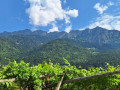
 5.44 mi
 +883 ft
 -899 ft
 3h 15
3h 15
 Easy
Easy
 Departure from Algund - Lagundo (South Tyrol)
A "Waalweg" in South Tyrol is a path that runs alongside a small irrigation canal. These irrigation canals, often well hidden, were created on the hillsides to water the vineyards, orchards and fields; they operate thanks to a sophisticated system of slopes and sluice gates where each farmer can use the water for their crops.The Algund Waalweg is certainly the most iconic and offers a magnificent panorama of Algund, Meran and Dorf Tirol.
Circular route from Obergurgl via the Nedersee and Sahnestüberl
9.46 mi
+3,251 ft
-3,274 ft
7h 10
 Difficult
Departure from Sölden (Bezirk Imst)
Difficult
Departure from Sölden (Bezirk Imst)
This alpine walk climbs to 2,500 metres, with beautiful views and sections through stunning larch forests.
The route presents no particular difficulties but requires a good level of fitness.
The Sigmund Freud Promenade from Oberbozen to Klobenstein
 3.40 mi
+213 ft
-322 ft
1h 45
Easy
Departure from Ritten - Renon (South Tyrol)
3.40 mi
+213 ft
-322 ft
1h 45
Easy
Departure from Ritten - Renon (South Tyrol)
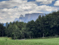
A pleasant little walk through the woods from Oberbozen to Klobenstein. Return to the cable car station at Oberbozen by the tourist train.
Tour of the Burkhard and Aglsbodenalm waterfalls
 4.32 mi
+1,362 ft
-1,362 ft
3h 10
4.32 mi
+1,362 ft
-1,362 ft
3h 10
 Moderate
Departure from Ratschings - Racines (South Tyrol)
Moderate
Departure from Ratschings - Racines (South Tyrol)
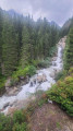
This is a must-do circuit in the Ridanna Valley. This beautiful hike follows the Burkhard torrent at the bottom of the Ridanna Valley, near the old mines, climbing up towards the glacial cirque. The waterfall trail is well maintained, with wooden walkways, bridges and superb views along the way. The circuit passes by the Aglsbodenalm inn, where you can stop for a bite to eat during the summer. A pleasant and varied loop with magnificent scenery.
Wogelweide Rundweg
4.64 mi
+1,276 ft
-1,296 ft
3h 15
Easy
Departure from Lajen - Laion (South Tyrol)
Walther von der Wogelweide was a renowned minstrel of the German Middle Ages. His statue stands in one of Bolzano's main squares. He is said to have been born in the village of Ried, in the municipality of Lajen/Laion, and the route traced there commemorates his life and work. The route is marked by signs bearing the words "Wogelweide runweg" and an orange logo decorated with a bust of a medieval woman, and is embellished with metal works, some of which are very beautiful.
Kaunertal Red Rock Loop
 3.68 mi
+1,043 ft
-1,037 ft
2h 35
Moderate
Departure from Kaunertal (Bezirk Landeck)
3.68 mi
+1,043 ft
-1,037 ft
2h 35
Moderate
Departure from Kaunertal (Bezirk Landeck)
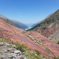
This loop takes you through red rocks eroded by glaciers and offers beautiful views of the Kaunertal valley and the snow-capped peaks. At the end of June, rhododendrons and alpine flowers are in full bloom.
A circular walk to the Marinzenhütte starting from Castelrotto
 7.23 mi
+1,857 ft
-1,834 ft
4h 55
Moderate
Departure from Kastelruth - Castelrotto (South Tyrol)
7.23 mi
+1,857 ft
-1,834 ft
4h 55
Moderate
Departure from Kastelruth - Castelrotto (South Tyrol)
Castelrotto is a village situated at the foot of the Alpe di Siusi. This mountain pasture, the largest in Europe, offers breathtaking views of the Dolomites in the Italian South Tyrol.
A superb circular walk starting from this beautiful village. During this hike, you’ll be able to admire the majestic Punta di Santner at the far end of the Schlern massif. At Marinzen, you’ll look down over Castelrotto.
Circular around Castelrotto via Schafstall
6.46 mi
+1,969 ft
-1,969 ft
4h 40
Moderate
Departure from Kastelruth - Castelrotto (South Tyrol)
Start and finish at the village cable cars with some lovely views around Casterotto.
A beautiful, fairly steep climb alongside the cable cars through pastures, then into the woods for most of the ascent. Very pleasant on a hot, sunny day.
No great difficulty until you reach the highest point of this circular. There are small inns to choose from in Marinzen or at the Schafstall hütte.
There is a slight variation from the route shown on tourist maps when descending towards St Michael. The descent is quite steep.
The rest of the route follows a tarmac road with no traffic, passing through a charming hamlet with beautiful views of the mountains and the village.
10 km in total and a variety of terrain that allows you to enjoy the whole route.
Val di Peio from the Prabon car park
 10.21 mi
+3,593 ft
-3,612 ft
7h 50
Difficult
Departure from Peio (Provincia di Trento)
10.21 mi
+3,593 ft
-3,612 ft
7h 50
Difficult
Departure from Peio (Provincia di Trento)
A magnificent mountain hike in the Stelvio National Park to the Cevedale ‘G. Larcher’ mountain hut, starting from the Prabòn car park.
On the outward journey, the route passes Malga Mare (reservoir, mountain restaurant, etc.), the splendid Salt dei Gembri waterfall and Plan Venezia.
On the return journey, the route takes you past the Marmotte, Nero and Careser lakes before descending back to Malga Mare.
The outward and return journeys between the starting point and Malga Mare follow different paths on either side of the Noce Bianco stream.
The walk around Lago di Tovel starting from Tuenno
8.84 mi
+1,670 ft
-1,683 ft
5h 30
Moderate
Departure from Ville d'Anaunia (Provincia di Trento)
A lovely walk that climbs up to a lake, which you walk round before heading back down the same path. There are a few sections that require a bit of care, but nothing too difficult. The lake is a magnificent blue!
From Volderau to Mischbachalm
4.41 mi
+2,326 ft
-2,323 ft
4h 05
Moderate
Departure from Neustift im Stubaital (Bezirk Innsbruck-Land)
A steep climb of over 700 metres to an authentic and welcoming farm-inn with an incredible view of the Glücksgrat and the Stubai Valley.
You can continue on to the Glücksgrat and descend towards the Backerwandalm before returning to Volderau. The total time required for this route is between 6 and 7 hours, including breaks.