Circular route from Obergurgl via the Nedersee and Sahnestüberl

This alpine walk climbs to 2,500 metres, with beautiful views and sections through stunning larch forests.

The route presents no particular difficulties but requires a good level of fitness.

Details

101496533
Creation:
Last update:
Last review:
  • Walking
    Activity: Walking
  • ↔
    Distance: 9.46 mi
  • ◔
    Average duration: 7h 10 
  • ▲
    Difficulty: Difficult

  • ⚐
    Back to start: Yes
  • ↗
    Ascent: + 3,251 ft
  • ↘
    Descent: - 3,274 ft

  • ▲
    Highest point: 8,232 ft
  • ▼
    Lowest point: 5,446 ft

Description of the walk

A good first two-hour climb, with a gradient of +15 per cent.

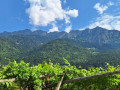
Various viewpoints over the surrounding 3,000-metre peaks.

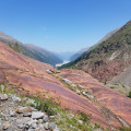
Pleasant scree slopes (relatively short to cross and well-stabilised).

A lake where you can cool your feet before tackling the descent, which is dotted with a few welcome benches.

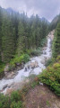
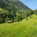
Beautiful larch forests to walk through.

As for the road you follow at the end of the walk, it’s barely visible (hidden by a tunnel, the surrounding terrain and the torrent flowing over it).

Visorando estimated time: 7:10; my actual time: 9:07, due to the initial ascent at 1 km/h and the occasional slightly lengthy breaks to enjoy the scenery.

Waypoints

  1. S/E : mi 0 - alt. 6,214 ft - Obergurgl
  2. 1 : mi 0.45 - alt. 6,286 ft - Start of the climb
  3. 2 : mi 1.35 - alt. 7,759 ft - End of the climb
  4. 3 : mi 3.4 - alt. 7,995 ft - Lake with visitor stamp
  5. 4 : mi 4.45 - alt. 6,841 ft - Start of the larch forests
  6. 5 : mi 5.12 - alt. 6,201 ft - Restaurant
  7. 6 : mi 6.24 - alt. 5,551 ft - Tunnel obscuring the road
  8. S/E : mi 9.46 - alt. 6,207 ft - Obergurgl

Other walks in the area

For more walks, use our search engine .

The GPS track and description are the property of this route's author. Please do not copy them without permission.