Wildes Mannle

Discover a superb peak overlooking the valley of the village of Vent. There are several ways to reach this peak:
- set off from Vent,
- or take the chairlift, which saves you about 400 metres of climbing.

Details

n°653016
Creation:
Last update:
Last review:
  • Walking
    Activity: Walking
  • ↔
    Distance: 5.90 mi
  • ◔
    Average duration: 4h 50 
  • ▲
    Difficulty: Difficult

  • ⚐
    Back to start: No
  • ↗
    Ascent: + 2,405 ft
  • ↘
    Descent: - 3,973 ft

  • ▲
    Highest point: 9,846 ft
  • ▼
    Lowest point: 6,168 ft
  • ⚐ Country: Austria
  • ⚐
    Area: Alps
  • ⚐ City: Sölden 
  • ⚑
    Start: N 46.863913° / E 10.903948°
  • ⚑
    End: N 46.859945° / E 10.914363°
  • Hour-by-hour weather

Photos

Description of the walk

Park in the car park next to the chairlift station; parking costs €5 for the day. Alternatively, turn right at the entrance to the car park and park on a large meadow, which is still free of charge.
Take the chairlift (€10.50 one way, €13.00 return). Get off at the top station.

(S) Take the wide track opposite, pass under the T-bar lift, begin a steep climb and reach the path junction.

(1) Turn right onto the Red-White-Red (RBR) marked trail, follow numerous short, tight hairpin bends to cross the T-bar lift again and reach the area around the top station of this lift.

(2) Continue to the right, passing two paths leading up to the summit in turn. Reach the junction at the moraine.

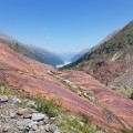
(3) Carry on along the moraine ridge until you reach a large rocky scree slope. Turn 90° to the right, still following the RBR markings. You will soon reach a section secured by cables.

(4) Use your hands to help you through this section, taking particular care. Continue along the ridge, remaining very vigilant at all times. Proceed with great caution to reach the summit of Wildes Mannle.

(5) Begin the return journey via the same route to the moraine junction.

(3) Descend to the right to quickly reach the glacial lake.

(6) Begin another ascent, followed by a short descent, to cross the Rofenbach stream. Continue along the side of the moraine, emerging once more onto its ridge.

(7) Leave this ridge to reach a low point. Tackle a short but steep climb which ends at the Breslauer Hutte lodge.

(8) Begin the direct descent and, via a series of wide hairpin bends, reach the junction at Rofen and Vent.

(9) Follow the signpost for Rofen. Descend steeply, keeping to the path on the right bank of the River Rofenbach. Reach and pass through Rofen. Head for the Himalayan-style footbridge over the River Rofenache.

(10) Cross via this footbridge, then turn left onto the wide track which leads easily to Vent and the car park (E).

Waypoints

  1. S : mi 0 - alt. 7,736 ft - Top station of the chairlift
  2. 1 : mi 0.5 - alt. 8,317 ft - Trail junction
  3. 2 : mi 0.78 - alt. 8,701 ft - Arrival at the ski lift
  4. 3 : mi 1.35 - alt. 9,446 ft - Moraine junction
  5. 4 : mi 1.6 - alt. 9,829 ft - Rope-assisted section
  6. 5 : mi 1.78 - alt. 9,829 ft - Summit of Wildes Mannle
  7. 6 : mi 2.35 - alt. 9,209 ft - Glacial lake
  8. 7 : mi 2.63 - alt. 9,062 ft - Moraine ridge
  9. 8 : mi 3.04 - alt. 9,311 ft - Breslauer Hutte
  10. 9 : mi 3.51 - alt. 8,619 ft - Rofen Vent junction
  11. 10 : mi 4.61 - alt. 6,519 ft - Himalayan-style footbridge
  12. E : mi 5.9 - alt. 6,181 ft - Vent car park

Notes

There is no water on this route except at the stream flowing from the glacial lake (please use it sparingly).
Shelter available at the Breslauer Hutte mountain hut.

Worth a visit

The Vent valley is a beautiful one.
Make the most of the return journey between Rofen and Vent to admire the artistic stone sculptures lining the wide path.
Also take in the first cross erected on Austria’s second-highest peak, the Wildspitze, where a stone with a hole in it, shaped like a telescope, allows you to see the summit.

Reviews and comments

5 / 5
Based on 1 review

Reliability of the description
5 / 5
Ease of following the route
5 / 5
Route interest
5 / 5
User 26834813

Overall rating : 5 / 5

Date of your route : Aug 18, 2025
Reliability of the description : ★★★★★ Very good
Ease of following the route : ★★★★★ Very good
Route interest : ★★★★★ Very good
Very busy route : No

A very beautiful route, quite challenging. In my opinion, the suggested route starts from the first chairlift (first section) because the second section is rarely operational in summer. The first part of the climb is through alpine pastures. At one point, you can climb directly to Wildes Mannle or follow the route suggested in this hike. I took the direct route and followed the suggested route for the descent. The entire central part of the hike is very rocky (quite rugged) with beautiful views of the surrounding mountains (Wildspitze in particular) and waterfalls.
The streams that run alongside this hike also add to its charm.
I recommend this hike for the beauty and variety of the landscapes you will encounter.

Machine-translated

Other walks in the area

For more walks, use our search engine .

The GPS track and description are the property of this route's author. Please do not copy them without permission.