Country:

 City:


Park at car park C at the “Stubaier Gletscher” ski resort.
(S/E) Return to the road, turn right to cross the bed of the River Ruetz.
(1) Follow the path to the left, which leads upstream to a junction.
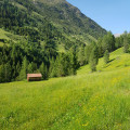
(2) Then take the path that climbs to the right towards Mutterberger See. The path ascends through the forest, on a fairly steep slope. After a short climb, you’ll reach a mountain pasture.
Signposts indicate the car park behind you. Carry on straight ahead, ignoring the almost invisible path branching off to your left. The path then climbs steeply, offering fairly unobstructed views of the surrounding mountains. There is only one path, so there are no signposts for the next three kilometres. You will eventually reach alpine pastures and signposts.
(3) Continue along the path on the left towards Mutterberger See, signposted as a 30-minute walk. Cross the small streams on the mountain pasture via two small wooden bridges and reach a junction about 500 m further on.
(4) Take the path climbing to the right towards Mutterberger See, signposted as a 20-minute walk. Take care to follow the track climbing north-east, marked with the Austrian trail markings (red-white-red), as there are small side tracks leading off in other directions. After 20 minutes, you’ll reach Mutterberger See.
(5) Walk round the eastern side of the lake, heading south, and further down you’ll reach another junction with signposts.
(6) Continue to the right towards the Dresdner-Hütte. The path descends along a ledge towards the south-west until it joins the forest track after just over a kilometre.
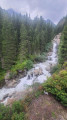
(7) Then turn left onto the forest track towards Mutterbergeralm, signposted as a 1-hour walk. The track runs alongside the crystal-clear River Ruetz until it reaches the car park (S/E)

 Visorando Member
 Moderate