A circular walk to the Marinzenhütte starting from Castelrotto

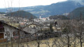
Castelrotto is a village situated at the foot of the Alpe di Siusi. This mountain pasture, the largest in Europe, offers breathtaking views of the Dolomites in the Italian South Tyrol.
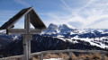
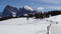
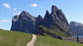
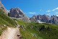
A superb circular walk starting from this beautiful village. During this hike, you’ll be able to admire the majestic Punta di Santner at the far end of the Schlern massif. At Marinzen, you’ll look down over Castelrotto.

Details

1871887
Creation:
Last update:
Last review:
  • Walking
    Activity: Walking
  • ↔
    Distance: 7.23 mi
  • ◔
    Average duration: 4h 55 
  • ▲
    Difficulty: Moderate

  • ⚐
    Back to start: Yes
  • ↗
    Ascent: + 1,857 ft
  • ↘
    Descent: - 1,834 ft

  • ▲
    Highest point: 4,997 ft
  • ▼
    Lowest point: 3,458 ft

Photos

Description of the walk

Getting to Castelrotto: Take the Brenner motorway and exit at Ponte Gardena if approaching from the north, or at Bolzano Nord if coming from the south.
In the centre of Castelrotto, head to Panider Straße, near the Marinzen chairlift station and the COOP mini-market.

(S/E) To the right of the COOP, take the small road until you reach a junction by the Schlernhex inn.

(1) Turn right onto Tioslerweg, pass under the chairlift and continue to another junction by a farm.

(2) Go round the farm and follow the south-bound path until you reach a small road.

(3) Continue along this small road until you reach a small roundabout on the road leading to the Alpe di Siusi.

(4) Walk a few metres along the road to the Alpe di Siusi, then find a good path at the start of the hairpin bend.

(5) Follow this path to rejoin the Alpe di Siusi road, continue along it, then take the path on the left to reach Gschtatsch, just below the Alpe di Siusi cable car.

(6) Head north along the Roander track, following the signs for Marinzen.

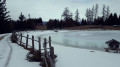
(7) The track joins another path; continue northwards, passing a small lake called Wasserspeicher. Stay on this track, ignoring the next two junctions. You’ll reach athird junction with a signpost for San Michele.

(8) Turn left to reach the Marinzenhütte, which is clearly visible from the lake.

(9) Retrace your steps back to the San Michele signpost.

(8) Continue straight ahead along the Marinzen track, until you reach the small Ribidui–Schafstall road further on.

(10) Turn left onto this road and follow it until you reach the junction with the Tioslerweg or Via Tosler.

(11) Walk to the right along this small road. Cut across two bends using two shortcuts, pass the tennis courts at Wasserebene, and cross through the hamlet of Tiosels. On leaving the hamlet, turn right at the junction to return to the original crossroads by the Schlernhex inn.

(1) Turn right and follow the route you took on the way there to reach the COOP mini-market (S/E)..


Waypoints

  1. S/E : mi 0 - alt. 3,458 ft - Coop mini-market
  2. 1 : mi 0.5 - alt. 3,694 ft - Schlernhex junction
  3. 2 : mi 0.79 - alt. 3,842 ft - Crossroads – Farm
  4. 3 : mi 1.13 - alt. 4,190 ft - Junction with a minor road
  5. 4 : mi 2.18 - alt. 4,281 ft - Roundabout on the Siusi–Alpe di Siusi road
  6. 5 : mi 2.32 - alt. 4,327 ft - Path at the entrance to the hairpin bend.
  7. 6 : mi 2.89 - alt. 4,816 ft - Gschtatsch
  8. 7 : mi 4.09 - alt. 4,810 ft - Towards Marinzen
  9. 8 : mi 4.54 - alt. 4,852 ft - San Michele marker
  10. 9 : mi 4.6 - alt. 4,862 ft - Marinzenhütte
  11. 10 : mi 5.15 - alt. 4,718 ft - Ribidui–Schafstall junction
  12. 11 : mi 5.72 - alt. 4,232 ft - Junction with the Tiosels road
  13. S/E : mi 7.23 - alt. 3,458 ft - Coop mini-market

Worth a visit

  • Castelrotto.
  • Schlern Massif.
  • Punta di Santner.
  • Alpe di Siusi.
  • Marizen.

Reviews and comments

4.5 / 5
Based on 2 reviews

Reliability of the description
4.5 / 5
Ease of following the route
4.5 / 5
Route interest
4.5 / 5
rck
rck

A superb walk through the mountain pastures of CastelRotto. No difficulty. A 19 km walk in the great outdoors, to the sound of cowbells. Plenty of very well-signposted paths.

Machine-translated

Morgane S
Morgane S

Overall rating : 4.7 / 5

Date of your route : Apr 15, 2024
Reliability of the description : ★★★★★ Very good
Ease of following the route : ★★★★★ Very good
Route interest : ★★★★☆ Good
Very busy route : No

A lovely walk – easy and with varied scenery. A great way to explore the area around Castelrotto for the first time

Machine-translated

rck
rck

Overall rating : 4.3 / 5

Date of your route : Jul 23, 2023
Reliability of the description : ★★★★☆ Good
Ease of following the route : ★★★★☆ Good
Route interest : ★★★★★ Very good
Very busy route : No

A lovely, straightforward walk. Very well signposted.

Machine-translated

Other walks in the area

For more walks, use our search engine .

The GPS track and description are the property of this route's author. Please do not copy them without permission.