


alphapyx

 Visorando Member
Sign up:
Published route(s)
 The Aiguille Grive from Les Lanches
 9.23 mi
 +4,327 ft
 -4,318 ft
 8h 00
8h 00
 Difficult
 Departure from Peisey-Nancroix (Savoie)
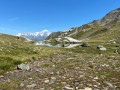
Starting from the bottom of the valley, at the hamlet of Les Lanches, there’s a lovely climb to reach Lac des Moutons, skirting the Crête des Lanchettes via a wild valley on the edge of the Vanoise National Park.Take a quick detour via the Col de la Chal or Chail to avoid lingering at the arrival point of the cable cars at Les Arcs resort, and reach the summit of the Aiguille Grive and its orientation table.Enjoy a 360° panorama of Mont Blanc, Mont Pourri, the Bellecôte massif and Piera Menta, the distinctive peak of the Beaufortain.Descend via the Col d’Entreporte with a splendid view of the Aiguille Rousse, then follow the alpine trails through the Vallon des Rossets and the Combe du Barmail.