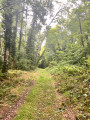
Villecien to Saint-Aubin-sur-Yonne circular route

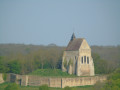
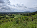
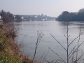
A very lovely walk above the River Yonne, passing through Villecien. Much of the route is through woodland, then along the River Yonne. Suitable for all seasons.

Details

4622960
Creation:
Last update:
Last review:
  • Walking
    Activity: Walking
  • ↔
    Distance: 5.88 mi
  • ◔
    Average duration: 3h 05 
  • ▲
    Difficulty: Moderate

  • ⚐
    Back to start: Yes
  • ↗
    Ascent: + 390 ft
  • ↘
    Descent: - 390 ft

  • ▲
    Highest point: 679 ft
  • ▼
    Lowest point: 243 ft

Description of the walk

Park in the car park opposite the town hall.

(S/E) Head down to the left.

(1) Turn left onto Rue de la Vallée. At the bend, leave the road and carry on straight ahead along the path, which curves widely to the right and then leads to a junction where it meets theGR®® 213 (marked in white and red).

(2) Keep to the left on the GR®. At the junction, turn left uphill, then right a good hundred metres further on. You’ll come out onto the access road to La Tuilerie.

(3) Cross it and carry on straight ahead on the GR®. Follow the markings carefully, ignoring the paths branching off on either side.
(4) Carry on straight ahead, letting theGR®® branch off to the right. First walk along the edge of the woodland, then enter it. Keep heading generally north-west until you reach a junction.

(5) Carry on to the right to go round the Fond de Moraille. Leave the woodland and walk alongside it on your left.

(6) Pass between the Villecien sports ground and the cemetery, then head straight on to enter the village via Rue de Moraille.

(7) Cross the D959 at the pedestrian crossing and continue straight ahead along Rue du Port.

(8) When you reach the River Yonne, turn left and follow the river along the towpath. Carry on until you reach the canal bridge.

(9) Turn left without crossing the bridge, keep left at the junction and join the D959.

(1) Turn left; the car park is 80 m away (S/E).

Waypoints

  1. S/E : mi 0 - alt. 312 ft - Car park opposite the town hall
  2. 1 : mi 0.09 - alt. 285 ft - Junction of the circular loop
  3. 2 : mi 1.06 - alt. 427 ft - Junction °°GR®°°
  4. 3 : mi 1.75 - alt. 636 ft - Dirt track
  5. 4 : mi 2.2 - alt. 659 ft - Junction, end of the °°GR®°° route
  6. 5 : mi 2.99 - alt. 466 ft - Junction, on the right
  7. 6 : mi 4.18 - alt. 295 ft - Sports ground and cemetery
  8. 7 : mi 4.5 - alt. 262 ft - D959
  9. 8 : mi 4.63 - alt. 246 ft - Riverbanks of the - Yonne (l')
  10. 9 : mi 5.56 - alt. 266 ft - Canal bridge, on the left.
  11. S/E : mi 5.88 - alt. 312 ft - Car park opposite the town hall

Always be cautious and plan ahead when you're outdoors. Visorando and the author of this route cannot be held responsible for any accidents occurring on this route.

The GR® and PR® markings are the intellectual property of the Fédération Française de Randonnée Pédestre.

Reviews and comments

4.3 / 5
Based on 2 reviews

Reliability of the description
4 / 5
Ease of following the route
4.5 / 5
Route interest
4.5 / 5
Wanderung89
Wanderung89

Overall rating : 3.7 / 5

Date of your route : Apr 06, 2026
Reliability of the description : ★★★☆☆ Average
Ease of following the route : ★★★★☆ Good
Route interest : ★★★★☆ Good
Very busy route : Yes

A lovely walk with varied scenery and a few steep sections that require a bit more effort.
However, there are many paths and some junctions are not easy to spot.

Machine-translated

jijir
jijir

Overall rating : 5 / 5

Date of your route : Oct 02, 2025
Reliability of the description : ★★★★★ Very good
Ease of following the route : ★★★★★ Very good
Route interest : ★★★★★ Very good
Very busy route : No

A beautiful and varied hike through valleys, plateaus and along the banks of the Yonne River

Machine-translated

Other walks in the area

For more walks, use our search engine .

The GPS track and description are the property of this route's author. Please do not copy them without permission.