Exploring the area around Tranzault

This pleasant walk follows an old route, allowing you to explore the rural surroundings of Tranzault in the Indre.

Details

1471884
Creation:
Last update:
Last review:
  • Walking
    Activity: Walking
  • ↔
    Distance: 6.17 mi
  • ◔
    Average duration: 3h 05 
  • ▲
    Difficulty: Easy

  • ⚐
    Back to start: Yes
  • ↗
    Ascent: + 289 ft
  • ↘
    Descent: - 285 ft

  • ▲
    Highest point: 771 ft
  • ▼
    Lowest point: 581 ft
  • ⚐ Country: France
  • ⚐ City: Tranzault (36230)
  • ⚑
    Start/End: N 46.630671° / E 1.850655°
  • ❏
    IGN map(s): Ref. 2226SB, 2227O
  • Hour-by-hour weather

Photos

Description of the walk

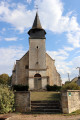
The starting point is in the centre of Tranzault, at the junction of the D38 and D19 departmental roads, near the church.

(S/E) Take the D19 south-east and follow the blue markings, which will take you along Allée de la Bascule behind the church, then turn left into Allée de la Cure.

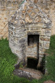
(1) At the next junction (crossroads), turn right and walk down alongside a low wall belonging to a large building to reach the Fontaine de la Cure.

(2) At the fork in the road, take the path on the right. Then ignore a path leading uphill to the right and continue straight on. Turn left (blue signpost) onto the Chemin des Moines, continue straight on, ignoring two paths on your left, cross the Gourdon via a footbridge, then head up towards the hamlet of Chantome. The path then joins a road (Chemin du Gourdon).

(3) At the junction, take the road on the left. About 500 metres further on, take the street on the left (Chemin du Domaine).

(4) As you come out of the bend, at the corner of the first house, turn onto a path on the right (small blue arrow in the hedge). After crossing the Gourdon again via a footbridge, continue straight on (blue signpost) and head uphill to the first houses of the hamlet of Trisset.

(5) You can make a quick detour to see the Saint-Léonard Fountain on your left (indicated by an arrow). Then return to the small road that crosses the hamlet heading east.

(6) Ignore the blue signposting on your left and carry on straight ahead along the road, following the red and white signposting forthe GR®46. Turn right onto the D19, then left onto a small road.

(7) Leave theGR®46by taking a path on the left which runs alongside a private pond. Carry on straight ahead at the next junction and head towards the hamlet of Les Grands Pâtureaux. The path then leads onto a small road which you follow to the left: you may come across green markings here, but these are for the opposite direction. At the next junction (Green Cross), carry on straight ahead towards Les Préaux.

(8) Take the road to the left for 20 metres and turn right onto a path. Then turn left: the path rejoins the previous small road, which you should take to the right.

(9) About 200 metres after crossing the Presles stream, take a grassy path on the left which runs alongside the grounds of the first houses and leads onto a track suitable for vehicles, which you should take on the left. Continue straight on towards the west, passing a path on your right, then on your left. Carefully cross the D38 slightly to the left to take the path opposite.

(10) At a place called La Croix de la Lande, carry on straight ahead, passing the road on your left, then at the Fork in the road (electricity substation), stay on the track on the left. When you reach the D19, turn left, walk past the cemetery and then carry on straight ahead to the starting point (S/E).

Waypoints

  1. S/E : mi 0 - alt. 748 ft - Tranzault Church
  2. 1 : mi 0.15 - alt. 758 ft - At the cross, turn right
  3. 2 : mi 0.28 - alt. 699 ft - Turn right at the fork in the road
  4. 3 : mi 1.4 - alt. 686 ft - Junction, take the road on the left
  5. 4 : mi 1.76 - alt. 636 ft - Path on the right, towards the - Gourdon (cours d'eau) - Affluent de la Bouzanne
  6. 5 : mi 2.31 - alt. 748 ft - Return walk to the Fontaine de Saint-Léonard
  7. 6 : mi 2.59 - alt. 768 ft - Straight ahead, GR 46
  8. 7 : mi 2.89 - alt. 751 ft - Take the path on the left, off the GR
  9. 8 : mi 3.75 - alt. 699 ft - Turn left
  10. 9 : mi 4.6 - alt. 676 ft - A grassy path on the left running alongside a fence
  11. 10 : mi 5.55 - alt. 738 ft - Go straight on to the hamlet known as La Croix de la Lande
  12. S/E : mi 6.17 - alt. 748 ft - Tranzault Church

Notes

Toilets and a water point behind Tranzault Church.
No special equipment is required, but I think some areas may be overgrown with brambles depending on the time of year, so long-sleeved tops and trousers are advisable...
This walk is easy, but there is a steep climb between points (4) and (5).

Note: the suggested route was marked in yellow by the FFRP but no longer exists. The markings you may encounter are for guidance only, as they were being updated at the time I went on this walk...

Worth a visit

Always be cautious and plan ahead when you're outdoors. Visorando and the author of this route cannot be held responsible for any accidents occurring on this route.

The GR® and PR® markings are the intellectual property of the Fédération Française de Randonnée Pédestre.

Reviews and comments

4.2 / 5
Based on 3 reviews

Reliability of the description
4 / 5
Ease of following the route
4.7 / 5
Route interest
4 / 5
User 28564005

Overall rating : 3.7 / 5

Date of your route : Feb 23, 2026
Reliability of the description : ★★★★☆ Good
Ease of following the route : ★★★★☆ Good
Route interest : ★★★☆☆ Average
Very busy route : No

Very muddy paths in February 2026.
Total silence. Birds, nutria and passing cranes add to the enjoyment of the hike!

Machine-translated

c23
c23

Overall rating : 4.3 / 5

Date of your route : Jun 02, 2025
Reliability of the description : ★★★★☆ Good
Ease of following the route : ★★★★★ Very good
Route interest : ★★★★☆ Good
Very busy route : No

It’s a shame that so many of the paths aren’t maintained........

Machine-translated

Choiupette
Choiupette

Overall rating : 4.7 / 5

Date of your route : Oct 26, 2020
Reliability of the description : ★★★★☆ Good
Ease of following the route : ★★★★★ Very good
Route interest : ★★★★★ Very good
Very busy route : No

There was just one point where we found ourselves wondering which direction to take.

Machine-translated

Other walks in the area

For more walks, use our search engine .

The GPS track and description are the property of this route's author. Please do not copy them without permission.