


 Country:
 City:
City:


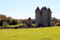
Park in the small car park near the town hall, behind the church, alongside the D51.
You’ll find an information board detailing the various routes on offer: follow the yellow markings.
(S/E) Return to the D51 and turn left (yellow markings andGR®® 46). At the road junction, keep to the right to stay on the D51.
(1) Turn left towards the stadium (yellow markings) and continue along the track until you reach the D41.
(2) Follow the road to the right and, immediately after the bridge, turn left towards Les Sadets. At the next crossroads, turn right, then, as the road curves, take the grassy track furthest to the left.
(3) Turn left again, then continue right along the small road to the junction at the entrance to the hamlet of Les Sadets du Haut.
(4) Turn onto the farm track on the right. At the end, turn left and, 100 metres further on, turn right onto a grassy track (yellow markings). Then follow the small road to the left as far as Les Loges.
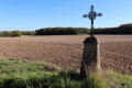
(5) At the junction (cross), carefully follow the D51 to the right as far as Les Loges des Bois.
(6) At the road junction, turn left onto a farm track which joins a small road.
(7) At the cross, follow the small road to the right for 40 metres and turn left towards Bellevue Farm. Carry on straight ahead at the next two junctions.
(8) On the descent (elevation 213), at the junction of four tracks, turn right onto the grassy track, then left onto a track suitable for vehicles which leads to Le Pondron.
(9) Turn left onto the Route des Coutures.
(10) Head downhill to the right along Route de la Fontaine to join the D51a and reach Fontaine Sainte-Madeleine.
(11) Retrace your steps. Head back up the Route de la Fontaine.
(10) Turn right. Continue uphill along the grassy track until you reach the crossroads you passed on the way out.
(8) Take the path leading down to the right to join the D51a and follow this road to the left until you reach the first house in Vignonnet.
(12) Then turn left onto the street which branches off to the right further on. Follow it straight on at the next junction.
(13) At the end of the street, turn right and go downhill at the second junction. Take the D51a to the left and, at the crossroads, take the path on the right which leads to a picnic area on the banks of the Vauvre.
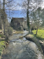
(14) Cross the ford via a footbridge and follow the path on the right (yellow markings andGR®® 654).
(15) After the climb, at the junction of four paths, turn left and join the D41. Follow it to the left towards the castle entrance. At the D51–D41 junction, go round the cemetery on the left and return to the starting point (S/E).

 Visorando Member
 Easy
Easy 
 Association / Club / Walk leader
