Circular walk around the ponds at Mers-sur-Indre

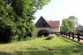
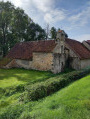
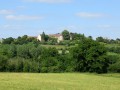
This route allows you to explore the area around Mers-sur-Indre, between the Indre and the Vauvre. It winds its way along paths and small roads through a network of hedgerows and varied meadows, landscapes characteristic of the southern Boischaut bocage. It ends amongst a number of private ponds.

Details

8898289
Creation:
Last update:
Last review:
  • Walking
    Activity: Walking
  • ↔
    Distance: 5.78 mi
  • ◔
    Average duration: 2h 50 
  • ▲
    Difficulty: Easy

  • ⚐
    Back to start: Yes
  • ↗
    Ascent: + 203 ft
  • ↘
    Descent: - 187 ft

  • ▲
    Highest point: 709 ft
  • ▼
    Lowest point: 558 ft

Photos

Description of the walk

The start point is at the Mers-sur-Indre motorhome site.

The trail is marked in yellow.

(S/E) Head north and follow the D38 towards the church.

(1) Turn left and walk past the church, continuing to follow the D38 (Rue George Sand). At the Fork in the road, turn right, cross the old railway line and continue along the D38. Pass a street on your left.

(2) Just before a bridge, turn left onto a grassy track (signposted). Turn left near a pond. The track becomes passable by vehicle at a sewage treatment plant and joins the D69. Follow this road to the right.

(3) At an old wooden cross, turn left onto Allée du Petit Orme. The small road leads, at the last house, onto a track suitable for vehicles. Follow it until you reach a small road, which you cross to continue straight ahead (signposted).
Pass two tracks on the left, then carry on straight ahead along the small road.

(4) Cross the D38 carefully and continue opposite along a wide grassy track.
Pass a track on your left, then head down to the left towards the first houses in the hamlet of Courtioux. Follow the small road to the left, then turn right into a farmyard.

(5) Head down the sunken track, then climb back up to the left along a track suitable for vehicles, which soon becomes grassy.

(6) Turn right twice to go round a pond, then head down a sunken, grassy track.
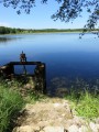
Then walk alongside several small ponds fed by the Ruisseau des Presles.

(7) The path leads out onto a small road at Le Pontet. Turn left and continue along a track suitable for vehicles, which soon becomes grassy. At a further pond, the track becomes suitable for vehicles again.

(8) After passing a cross, turn sharply right onto a small road, then veer right onto the grassy track. Carry straight on at the next junction along a track suitable for vehicles, which becomes grassy, running alongside another pond.

(9) At the Cacoterie crossroads, carefully cross the D38 and turn slightly left onto the Allée de la Cacoterie. Turn right at the next two junctions to return to the D38. Turn left to return to the motorhome site (S/E).


Waypoints

  1. S/E : mi 0 - alt. 594 ft - Motorhome area
  2. 1 : mi 0.12 - alt. 594 ft - Église Saint-Martin (Mers-sur-Indre)
  3. 2 : mi 0.62 - alt. 564 ft - Start of the trail
  4. 3 : mi 1.26 - alt. 587 ft - Allée du Petit Orme, on the left
  5. 4 : mi 2.58 - alt. 709 ft - Le Tivoli – Crossing the D38
  6. 5 : mi 3.23 - alt. 676 ft - Sunken path
  7. 6 : mi 3.52 - alt. 659 ft - Courtioux Ponds
  8. 7 : mi 4.26 - alt. 614 ft - Le Pontet
  9. 8 : mi 4.82 - alt. 686 ft - Cross - Road junction
  10. 9 : mi 5.52 - alt. 646 ft - Crossroads – Allée de la Cacoterie
  11. S/E : mi 5.78 - alt. 594 ft - Motorhome site

Notes

No water points.

Wear waterproof shoes and long trousers (paths may be damp and overgrown with tall grass if not mown).

Worth a visit

Reviews and comments

4.4 / 5
Based on 3 reviews

Reliability of the description
4.7 / 5
Ease of following the route
4.7 / 5
Route interest
4 / 5
ducastelcb
ducastelcb

Overall rating : 4.7 / 5

Date of your route : May 24, 2026
Reliability of the description : ★★★★★ Very good
Ease of following the route : ★★★★★ Very good
Route interest : ★★★★☆ Good
Very busy route : No

A pleasant walk in warm weather as most of the route is through woodland.

No difficulty. The path around the Buzerie pond isn’t very well maintained, but we managed to find a way round it.

This walk is suitable for children.

Machine-translated

Lafalla
Lafalla

Overall rating : 4 / 5

Date of your route : Dec 09, 2024
Reliability of the description : ★★★★☆ Good
Ease of following the route : ★★★★☆ Good
Route interest : ★★★★☆ Good
Very busy route : No

A pleasant walk, but best done in dry weather as some of the paths were very muddy or had been completely cut off by flooding. Otherwise, the scenery is lovely, with a mix of wide and narrower paths and very little tarmac, which is good. We’ll do it again in a different season.

Machine-translated

Ed36
Ed36

Overall rating : 4.7 / 5

Date of your route : Nov 06, 2023
Reliability of the description : ★★★★★ Very good
Ease of following the route : ★★★★★ Very good
Route interest : ★★★★☆ Good
Very busy route : No

A very easy walk
No difficulty, suitable for children
Very well signposted
Eric

Machine-translated

Other walks in the area

For more walks, use our search engine .

The GPS track and description are the property of this route's author. Please do not copy them without permission.