


Refine your search for walks in Ottenhöfen im Schwarzwald
Ottenhöfen im Schwarzwald walks


 Genießerpfad Karlsruher Grat (official tour) – Ottenhöfen in the Black Forest
 Tourist office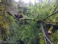
 8.47 mi
 +2,362 ft
 -2,336 ft
 5h 55
5h 55
 Moderate
 Departure from Ottenhöfen im Schwarzwald (Regierungsbezirk Freiburg)
A varied circular hike through the Edelfrauengrab waterfalls and over the Karlsruhe ridge with beautiful views of the Achertal valley and the Rhine valley.
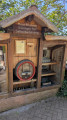
Mühlenweg (Mill Trail) in Ottenhöffen im Schwarzwald
 Visorando Member
 7.91 mi
+1,581 ft
-1,588 ft
5h 00
Moderate
Departure from Ottenhöfen im Schwarzwald (Regierungsbezirk Freiburg)
7.91 mi
+1,581 ft
-1,588 ft
5h 00
Moderate
Departure from Ottenhöfen im Schwarzwald (Regierungsbezirk Freiburg)
On this circuit around the village of Ottenhöffen, you will see five mills, a water-powered forge and... numerous self-service schnapps fountains (Schnappsbrunnen). You are asked to pay for what you consume by putting your money in the box provided. Various non-alcoholic drinks are also available.The route passes through low mountain meadows and forests.
 Mummelsee Tour starting from Ottenhöfen
26.93 mi
+3,839 ft
-3,839 ft
2.5 hrs
Moderate
Departure from Ottenhöfen im Schwarzwald (Regierungsbezirk Freiburg)
A short 44 km route with over 1,000 metres of ascent. The scenery is typical of the Black Forest and offers views overlooking the Rhine plain. A challenging taste of the region. Refreshments are available at Mummelsee or Untersmatt.
Circular loop: Edelfrauengrab Wasserfälle and Karlsruher Grat
 10.25 mi
+2,415 ft
-2,385 ft
6h 50
10.25 mi
+2,415 ft
-2,385 ft
6h 50
 Difficult
Departure from Ottenhöfen im Schwarzwald (Regierungsbezirk Freiburg)
Difficult
Departure from Ottenhöfen im Schwarzwald (Regierungsbezirk Freiburg)
This route will take you from Ottenhöffen to Eichkopf, the Edelfrauengrab waterfalls, the Karlsruher Grat rocky ridge, the Scherzfelsen rock and back along the Acker river.
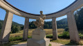
Allerheiligen waterfall and Schliffkopf in the Black Forest
 11.00 mi
+2,205 ft
-2,188 ft
7h 00
Moderate
Departure from Oppenau (Regierungsbezirk Freiburg)
11.00 mi
+2,205 ft
-2,188 ft
7h 00
Moderate
Departure from Oppenau (Regierungsbezirk Freiburg)
A beautiful circular hike starting at the foot of the Allerheiligen waterfall. Discover the old convent in the village. The route then climbs gradually to the heights above Ottenhöfen and finally loops back to Schliffkopf.
Allerheiligen waterfall and visit to the hamlet and abbey ruins
2.34 mi
+518 ft
-499 ft
1h 30
 Easy
Departure from Oppenau (Regierungsbezirk Freiburg)
Easy
Departure from Oppenau (Regierungsbezirk Freiburg)
A pleasant short hike along the gorges, which are home to a series of waterfalls.
The hike can be done in either direction of the circular route.The direction of the circular loop shown is the ascent of the gorges and waterfalls. The path consists of steps to make the ascent easier.
Once you arrive in the hamlet of Allerheiligen, you will find amenities and places to eat.The ruins of an ancient abbey are open to visitors.
The return journey is along a forest road.There is a dedicated car park at the start/finish point.
Please note that this hike can be very popular and can get quite crowded, both in the car park and along the route.
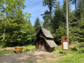
The Felsenweg or Rock Trail from Kappelrodeck.
 10.30 mi
+2,569 ft
-2,569 ft
7h 00
Moderate
Departure from Kappelrodeck (Regierungsbezirk Freiburg)
10.30 mi
+2,569 ft
-2,569 ft
7h 00
Moderate
Departure from Kappelrodeck (Regierungsbezirk Freiburg)
A series of ten porphyry or granite rock formations offering superb views of the Simmerbach valley, the village of Ottenhöfen, the summit of the Hornisgrinde, the Rhine plain and Strasbourg.
Mummelsee – Hornisgrinde – Ochsenstall – Unterstmatt – Dreifürstenstein
 6.93 mi
+1,135 ft
-1,132 ft
4h 10
Moderate
Departure from Seebach (Regierungsbezirk Freiburg)
6.93 mi
+1,135 ft
-1,132 ft
4h 10
Moderate
Departure from Seebach (Regierungsbezirk Freiburg)
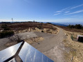
Hike to the highest peak in the northern Black Forest, the Hornisgrinde (1,164 m), which you climb twice, first from the south and then from the north. Superb panoramic view of the Rhine plain. You pass the TV transmitter with its impressive 206 m high transmission tower.
The route then passes through Ochsenstall, from where you reach the Unterstmatt ski resort. You return via another climb up the Hornisgrinde, then cross the peat bogs before passing the Dreifürstenstein.
Circular at Mummelsee and Hornisgrinde
 7.04 mi
+978 ft
-968 ft
4h 05
Moderate
Departure from Seebach (Regierungsbezirk Freiburg)
7.04 mi
+978 ft
-968 ft
4h 05
Moderate
Departure from Seebach (Regierungsbezirk Freiburg)
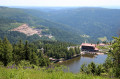
A hike in the Black Forest mountains, culminating in the glacial lake of Mummelsee and, on a clear day, a breathtaking view from the summit of Hornisgrinde over the Rhine Valley, Strasbourg and the Vosges mountains.
Panoramic walk around Kappelrodeck
 7.81 mi
+1,778 ft
-1,759 ft
5h 10
Moderate
Departure from Kappelrodeck (Regierungsbezirk Freiburg)
7.81 mi
+1,778 ft
-1,759 ft
5h 10
Moderate
Departure from Kappelrodeck (Regierungsbezirk Freiburg)
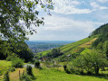
A pleasant walk around Kappelrodeck, alternating between woodland and meadows with beautiful scenery. Suitable for warm weather too, as there are quite a few shaded sections.
Boucle de Seibelseckle par Hinterer Langenbach et Wildsee
 8.15 mi
+1,558 ft
-1,555 ft
5h 05
Moderate
Departure from Seebach (Regierungsbezirk Freiburg)
8.15 mi
+1,558 ft
-1,555 ft
5h 05
Moderate
Departure from Seebach (Regierungsbezirk Freiburg)
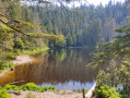
Un circuit facile dans la forêt. Passage le long d'un torrent. Le clou est le lac d'origine glaciaire Wildsee, l'un des plus beau et plus sauvage de la Forêt Noire. Au retour, nous empruntons le sentier en balcon sur la plaine du Rhin et passons devant le monument commémoratif de la tempête "Lothar" de 1999.
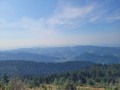
Hornisgrinde and Mummelsee Circular Loop
 3.70 mi
+741 ft
-741 ft
2h 20
Easy
Departure from Baiersbronn (Regierungsbezirk Karlsruhe)
3.70 mi
+741 ft
-741 ft
2h 20
Easy
Departure from Baiersbronn (Regierungsbezirk Karlsruhe)
Are you looking for a short, scenic yet challenging hike less than an hour from Strasbourg? This circular route offers panoramic views of the Alsace plain and, on the other side, the Black Forest mountain range. It partly follows a route marked by the Schwarzwälder Genießerpfade (Black Forest Gourmet Trail), but in the opposite direction, so you’ll come across a few other walkers. It doesn’t follow this route exactly either, taking a few detours to make the walk shorter and offer more panoramic views.
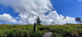
Between Hornisgrinde and Hochkopf
 9.29 mi
+2,021 ft
-2,011 ft
6h 00
Moderate
Departure from Regierungsbezirk Karlsruhe
9.29 mi
+2,021 ft
-2,011 ft
6h 00
Moderate
Departure from Regierungsbezirk Karlsruhe
This hike in the Black Forest National Park takes you along the ridges between the Hornisgrinde and Hochkopf moors and passes by the high-altitude Mummelsee lake. It largely follows the Westweg long-distance hiking trail, which crosses the Black Forest from north to south.
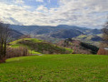
Route Lautenbach – Schauenburg Castle
 6.64 mi
+1,358 ft
-1,378 ft
4h 15
Moderate
Departure from Lautenbach (Regierungsbezirk Freiburg)
6.64 mi
+1,358 ft
-1,378 ft
4h 15
Moderate
Departure from Lautenbach (Regierungsbezirk Freiburg)
Explore the ruins of Schauenburg Castle, perched atop a hill spur at an altitude of 367 m, overlooking the Renchtal valley and the town of Oberkirch. In fine weather, there’s a magnificent view of the Alsace plain and Strasbourg Cathedral!
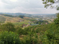
The Teufelsteig trail starting from Lautenbach
 7.33 mi
+1,611 ft
-1,627 ft
4h 45
Moderate
Departure from Lautenbach (Regierungsbezirk Freiburg)
7.33 mi
+1,611 ft
-1,627 ft
4h 45
Moderate
Departure from Lautenbach (Regierungsbezirk Freiburg)
A beautiful hike to do in warm weather as most of it is shaded, with beautiful views. Picnics can be enjoyed at various locations. There are numerous benches along the route.