Country:

 City:
City:


The starting point is listed online as “Parkplatz Skilift Seibelseckle”, the Seibelseckle car park. To get there, see the “Practical Information” section.
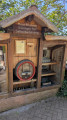
(S/E) Take the path leading uphill at the far end of the car park, behind the Rasthütte: there’s a drinking water spring on the left at the start of the path. Walk 150 metres to reach the junction where three different paths meet.
(1) Take the middle one, signposted with white text on a mauve background reading “Mummelsee-Hornisgrindepfad”, accompanied by a small navy blue logo bearing the words “Schwarzwald Genießerpfade”. You’ll come to a steep, uphill path where it’s easy to slip if you’re distracted or not paying attention to other walkers. Take care!
(2) Carry on straight up, following the mauve sign at this junction. Further up, you’ll reach a crossroads.
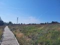
(3) You have now completed the longest and steepest climb of the hike. Continue to follow the purple sign as you circle the Hornisgrinde, the highest peak in the Northern Black Forest, along a path that is partly paved, wooden or tarmacked.
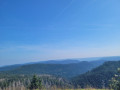
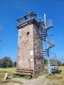
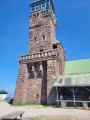
(4) At this junction, turn left, still following the purple sign. A little further on, you can climb the observation tower (Bismarckturm) for a breathtaking view of the Alsace plain and the other side of the Black Forest. On a clear day, you can see Strasbourg Cathedral. On your way back down, continue along the flat path leading to the Grinde-Hütte.
Once you reach the Hornisgrinde Tower (Hornisgrindeturm), carry straight on without following the path indicated by the purple sign, so that you end up facing the Grinde-Hütte. You can grab a bite to eat at this little restaurant, either inside or at the counter just outside. After stopping there, turn left or right as you leave the building.
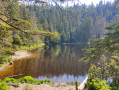
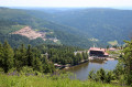
(5) Take the small path leading down from the road and you’ll soon reach a junction where you can go left or right. Turn right to reach, 50 metres further on, a viewpoint overlooking the Mummelsee, your next stop.
(6) Continue along the same path and, after about 400 metres, you’ll join a path shaded by trees. From here, follow the Red Diamond markings which appear on some of the trees. After taking a wide bend to the left, you’ll come within sight of the Mummelsee inn.
(7) This is a very busy spot, especially at lunchtime, which runs from 11.15 am to 3 pm. You can choose to walk round the lake, as shown on the map: a short, flat walk that’s much busier than anything you’ve seen so far, but which is nonetheless very pleasant, with its many small beaches and the Ondine sculpture. To do this, head down to the water’s edge and follow the lake’s shoreline, ignoring the road that branches off to the left. At the end of the walk, by the car park, follow the road to the left. If you don’t want to walk around the lake, walk straight past the inn. Then walk along the left-hand side of the car park so that you’re on the pavement to the left of the road.
(8) Take the dirt track on the left which climbs towards a car park and continue along the path at the end of the car park.
(9) Continue along the track, keeping to the right, to return to the junction you passed at the start of the walk.
(1) Head back down to the right; you can already see the Seibelseckle car park (S/E).


 Visorando Member
 Moderate
 Tourist office