


Refine your search for walks in Cherier
Cherier walks


 The Monts de la Madeleine near Cherier
 Association / Club / Walk leader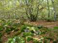
 16.13 mi
 +2,484 ft
 -2,470 ft
 4 hrs
4 hrs
 Difficult
 Departure from Cherier (Loire)
A very varied route linking two villages, climbing to the highest point (1,155 m), alternating between long, steady climbs and flat, rolling sections at altitude, with stunning views. Red mountain bike markings on a white background.
 The Michonnette route starting from Les Moulins Cherier
 6.53 mi
+1,312 ft
-1,329 ft
4h 10
6.53 mi
+1,312 ft
-1,329 ft
4h 10
 Moderate
Departure from Cherier (Loire)
Moderate
Departure from Cherier (Loire)
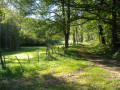
Explore three hamlets to the south and east of the village of Cherier: Le Bouchet, Tour and Mézire. The route follows the valleys of the Isable and the very pretty Michonnette valley, a small stream renowned for its trout and crayfish. There are beautiful viewpoints at the Croix du Bouchet and above Mézire. The elevation changes are quite steep: a 100-metre climb to reach the Croix du Bouchet and, in particular, the ascent of the ‘Trapillon’, which has been fitted with 35 steps.
Circular loop starting from Les Moulins Chérier
 Visorando Member
 11.13 mi
+1,696 ft
-1,680 ft
6h 35
Moderate
Departure from Cherier (Loire)
11.13 mi
+1,696 ft
-1,680 ft
6h 35
Moderate
Departure from Cherier (Loire)
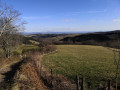
A beautiful walk alternating between open views and paths along the Isable river.
Les Monts de la Madeleine (Villemontais)
 5.59 mi
+1,188 ft
-1,188 ft
3h 35
5.59 mi
+1,188 ft
-1,188 ft
3h 35
 Easy
Departure from Villemontais (Loire)
Easy
Departure from Villemontais (Loire)
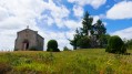
Walk through the Monts de la Madeleine between Villemontais and Chérier.
Roannaise coast and mountains
 50.15 mi
+7,923 ft
-7,907 ft
4 days
Difficult
Departure from Cherier (Loire)
50.15 mi
+7,923 ft
-7,907 ft
4 days
Difficult
Departure from Cherier (Loire)
A 4-day hiking tour from lodge to lodge in the Monts de la Madeleine (low mountain range) west of the town of Roanne. Immerse yourself in nature, often still wild, by taking as many small paths as possible.
From Point du Jour to Saint-Haon-le-Châtel
 14.49 mi
+1,686 ft
-3,130 ft
8h 10
Difficult
Departure from Cherier (Loire)
14.49 mi
+1,686 ft
-3,130 ft
8h 10
Difficult
Departure from Cherier (Loire)
Departure from a high point in the Monts de la Madeleine, in Cherier, at a place called Le Point du Jour (870 m, 14-bed stopover lodge with meals) to descend to the Côte Roannaise, cross its vine-covered hillsides and arrive at the medieval village of Saint-Haon-le-Châtel (14-bed stopover lodge with meals). This route gives priority to small paths with no motor vehicle traffic and beautiful views of the Roanne plain.
From Cherier (Le Point du Jour) to the campsite at Saint-Just-en-Chevalet
13.04 mi
+1,788 ft
-2,667 ft
7h 35
Difficult
Departure from Cherier (Loire)
First stage of a 5-day route through the Monts de la Madeleine, the Bois Noirs and the northern Livradois. Most of the day is spent on the lovely paths of the commune of Cherier, offering a range of views from the tops of its hills, amidst unspoilt countryside. At the end of the route, the path descends to Saint-Just-en-Chevalet, after passing through the charming hamlet of Fonthieur.
The Gorge du Désert and the Châtelus from Saint-Alban-les-Eaux
 4.32 mi
+1,181 ft
-1,161 ft
3h 00
Moderate
Departure from Saint-Alban-les-Eaux (Loire)
4.32 mi
+1,181 ft
-1,161 ft
3h 00
Moderate
Departure from Saint-Alban-les-Eaux (Loire)
Starting from the village of Saint-Alban-les-Eaux, known for its sparkling mineral springs, this route passes via La Madone and the Montouse Dam to reach the Gorges du Désert and the waterfall. Views from Le Châtelus and the viewpoint on the way back.
The Gorge du Désert, starting from Saint-Alban-les-Eaux
 2.72 mi
+636 ft
-614 ft
1h 50
Easy
Departure from Saint-Alban-les-Eaux (Loire)
2.72 mi
+636 ft
-614 ft
1h 50
Easy
Departure from Saint-Alban-les-Eaux (Loire)
Starting from the village of Saint-Alban-Les-Eaux, known for its carbonated springs, this route passes via La Madone and the Montouse Dam before continuing on to the Gorge du Désert. It allows you to reach the waterfall without too much difficulty and then return to the village via Le Châtelus.
A hilly circular walk starting from Le Ménard
 7.53 mi
+1,309 ft
-1,286 ft
4h 35
Moderate
Departure from Saint-Jean-Saint-Maurice-sur-Loire (Loire)
7.53 mi
+1,309 ft
-1,286 ft
4h 35
Moderate
Departure from Saint-Jean-Saint-Maurice-sur-Loire (Loire)
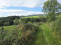
This varied walk offers some stunning views over the Roannaise plain and the Beaujolais hills.
Isable Valley and Padègue Viaduct in Saint-Polgues
 6.93 mi
+774 ft
-791 ft
3h 50
Moderate
Departure from Saint-Polgues (Loire)
6.93 mi
+774 ft
-791 ft
3h 50
Moderate
Departure from Saint-Polgues (Loire)
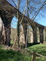
A pleasant hike along the Isable river, passing by the Padègue viaduct.
From the Loge des Gardes to Point du Jour
11.96 mi
+1,368 ft
-2,044 ft
6h 40
Moderate
Departure from Laprugne (Allier)
Departure from the Loge des Gardes sports centre. Start the day in the beautiful beech undergrowth of the Assise State Forest, above 1,000 metres altitude, before descending to the more open plateaus of La Tuilière and Cherier, with beautiful views. End at the Refuge du Point du Jour lodge (overnight stay and meals made with farm produce) (altitude 870 metres).
Walk in Saint-Haon-Châtel via Saint-Haon-le-Vieux
 3.83 mi
+636 ft
-607 ft
2h 20
Easy
Departure from Saint-Haon-le-Châtel (Loire)
3.83 mi
+636 ft
-607 ft
2h 20
Easy
Departure from Saint-Haon-le-Châtel (Loire)
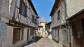
The walk takes you through Saint-Haon-le-Vieux along the Chemin Rouge, then on to the site of Saint-Haon-le-Châtel, a veritable open-air museum where you can relive ten centuries of civilisation with its remains of high walls, 17 towers and 4 gates. These fortifications were built in the mid-14th century to protect the town from bands of looters. A magnificent village where every street is worth exploring.
From Saint-Haòn-le-Châtel to leat
10.63 mi
+2,461 ft
-1,348 ft
7h 00
Difficult
Departure from Saint-Haon-le-Châtel (Loire)
Morning: crossing the northern part of the Roanne coast vineyards, with little elevation gain, and two beautiful historic villages: Saint-Haon-le-Châtel and Ambierle, with a rich heritage open to visitors. The afternoon is more challenging with the climb to leat (altitude 765 m) through meadows and forest. Most of the route is on dirt tracks with no traffic.
Circular walk through the Cierve woods via the Pêt de l'Âne, starting from Dancé.
 3.45 mi
+636 ft
-617 ft
2h 10
Easy
Departure from Dancé (Loire)
3.45 mi
+636 ft
-617 ft
2h 10
Easy
Departure from Dancé (Loire)
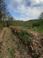
Starting from Dancé church, head for the Pêt de l'Âne, a magnificent viewpoint over the longest meander of the Loire. Here you will find the marked hiking trails along the banks of the Loire. You can return via the Cierve woods, which have beautiful undergrowth. From the path leading to La Madone, there is a beautiful panoramic view: to the east, the Monts du Lyonnais; to the south, the Monts du Pilat; and to the west, the Monts du Forez with Pierre-sur-Haute and the Monts de la Madeleine.
 La Verrerie-Le plateau
More walks in Cherier
Select a point of interest below: