


Refine your search for walks in Isable (rivière)
Isable (rivière) walks


 Isable Valley and Padègue Viaduct in Saint-Polgues
 Visorando Member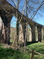
 6.93 mi
 +774 ft
 -791 ft
 3h 50
3h 50
 Moderate
 Departure from Saint-Polgues (Loire)
A pleasant hike along the Isable river, passing by the Padègue viaduct.
Circular loop starting from Les Moulins Chérier
 11.13 mi
+1,696 ft
-1,680 ft
6h 35
Moderate
Departure from Cherier (Loire)
11.13 mi
+1,696 ft
-1,680 ft
6h 35
Moderate
Departure from Cherier (Loire)
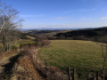
A beautiful walk alternating between open views and paths along the Isable river.
Roannaise coast and mountains
 Association / Club / Walk leader
 50.15 mi
+7,923 ft
-7,907 ft
4 days
50.15 mi
+7,923 ft
-7,907 ft
4 days
 Difficult
Departure from Cherier (Loire)
Difficult
Departure from Cherier (Loire)
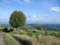
A 4-day hiking tour from lodge to lodge in the Monts de la Madeleine (low mountain range) west of the town of Roanne. Immerse yourself in nature, often still wild, by taking as many small paths as possible.
From Cherier (Le Point du Jour) to the campsite at Saint-Just-en-Chevalet
13.04 mi
+1,788 ft
-2,667 ft
7h 35
Difficult
Departure from Cherier (Loire)
First stage of a 5-day route through the Monts de la Madeleine, the Bois Noirs and the northern Livradois. Most of the day is spent on the lovely paths of the commune of Cherier, offering a range of views from the tops of its hills, amidst unspoilt countryside. At the end of the route, the path descends to Saint-Just-en-Chevalet, after passing through the charming hamlet of Fonthieur.
The Michonnette route starting from Les Moulins Cherier
 6.53 mi
+1,312 ft
-1,329 ft
4h 10
Moderate
Departure from Cherier (Loire)
6.53 mi
+1,312 ft
-1,329 ft
4h 10
Moderate
Departure from Cherier (Loire)
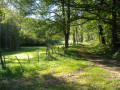
Explore three hamlets to the south and east of the village of Cherier: Le Bouchet, Tour and Mézire. The route follows the valleys of the Isable and the very pretty Michonnette valley, a small stream renowned for its trout and crayfish. There are beautiful viewpoints at the Croix du Bouchet and above Mézire. The elevation changes are quite steep: a 100-metre climb to reach the Croix du Bouchet and, in particular, the ascent of the ‘Trapillon’, which has been fitted with 35 steps.
From Point du Jour to Saint-Haon-le-Châtel
 14.49 mi
+1,686 ft
-3,130 ft
8h 10
Difficult
Departure from Cherier (Loire)
14.49 mi
+1,686 ft
-3,130 ft
8h 10
Difficult
Departure from Cherier (Loire)
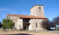
Departure from a high point in the Monts de la Madeleine, in Cherier, at a place called Le Point du Jour (870 m, 14-bed stopover lodge with meals) to descend to the Côte Roannaise, cross its vine-covered hillsides and arrive at the medieval village of Saint-Haon-le-Châtel (14-bed stopover lodge with meals). This route gives priority to small paths with no motor vehicle traffic and beautiful views of the Roanne plain.
 The Monts de la Madeleine near Cherier
 16.13 mi
+2,484 ft
-2,470 ft
4 hrs
Difficult
Departure from Cherier (Loire)
16.13 mi
+2,484 ft
-2,470 ft
4 hrs
Difficult
Departure from Cherier (Loire)
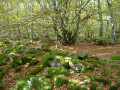
A very varied route linking two villages, climbing to the highest point (1,155 m), alternating between long, steady climbs and flat, rolling sections at altitude, with stunning views. Red mountain bike markings on a white background.