


Vincent Delcroix

 Visorando Member
 Premium user
 Sign up:
Published route(s)
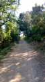
 Circular route on the heights of Manosque and Saint-Martin-les-Eaux
 3.93 mi
 +512 ft
 -486 ft
 2h 15
2h 15
 Easy
Easy
 Departure from Saint-Martin-les-Eaux (Alpes-de-Haute-Provence)
In a single walk on the heights of Manosque, you can see Mont Ventoux, the Lure mountain, the Southern Alps, the Valensole plateau, Sainte-Baume and Sainte-Victoire; with superb panoramic views, a reasonable elevation gain, accessible to all, half in the sun, half in the shade.
Please note: the start of the route has been altered to avoid crossing pig pens that have appeared in recent months.
As the route is not signposted, we recommend following it using GPS and the Visorando app.
A bucolic route for lovers, contemplative types and wine enthusiasts
 2.50 mi
+341 ft
-335 ft
1h 25
Easy
Departure from Manosque (Alpes-de-Haute-Provence)
2.50 mi
+341 ft
-335 ft
1h 25
Easy
Departure from Manosque (Alpes-de-Haute-Provence)
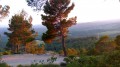
A short walk best done on a summer evening, not at all strenuous, doable in sandals, but with incredible charm. After passing through a forest of pine and oak trees with views of the Durance valley and the eastern Luberon, you will come to a path where you will get a good idea of what a perfect landscape looks like.
Quimiac, between sea and marsh
 9.98 mi
+30 ft
-30 ft
4h 35
9.98 mi
+30 ft
-30 ft
4h 35
 Moderate
Departure from Mesquer (Loire-Atlantique)
Moderate
Departure from Mesquer (Loire-Atlantique)
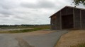
The hike begins with three beaches and ends at Pointe de Merquel, which marks the entrance to the Bassin du Mès, famous for its salt marshes, mussels and oysters. The landscapes are magical, whether on the sea or marsh side.
Quimiac, between sea and marsh (2)
 5.49 mi
+66 ft
-66 ft
2h 35
Easy
Departure from Mesquer (Loire-Atlantique)
5.49 mi
+66 ft
-66 ft
2h 35
Easy
Departure from Mesquer (Loire-Atlantique)
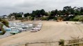
One-third salt marsh, one-third countryside and one-third sea: a superb recipe for a salty cocktail!
Circuit along the Colostre
 4.79 mi
+535 ft
-522 ft
2h 40
Moderate
Departure from Saint-Martin-de-Brômes (Alpes-de-Haute-Provence)
4.79 mi
+535 ft
-522 ft
2h 40
Moderate
Departure from Saint-Martin-de-Brômes (Alpes-de-Haute-Provence)
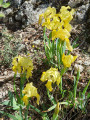
This walk near Gréoux-les-Bains allows you to discover a tributary of the Verdon, the Colostre, a charming little river that flows all year round in a small, fairly steep-sided valley. Also on the programme are an oppidum and the magnificent village of Saint-Martin-de-Brômes.
Volcanoes and granite in the heart of the Boutières
 5.94 mi
+1,076 ft
-1,066 ft
3h 40
Moderate
Departure from Mariac (Ardèche)
5.94 mi
+1,076 ft
-1,066 ft
3h 40
Moderate
Departure from Mariac (Ardèche)
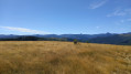
On the ridges of the Ardèche mountains in a sumptuous setting, this walk is also geological. On the programme: granite piles over ten metres high, five superimposed basalt flows and a view of some of the most famous volcanoes in France: Mont Gerbier-de-Jonc and Mézenc. A change of scenery guaranteed.
Around Le Serre de la Farre from Girond
 7.38 mi
+1,388 ft
-1,391 ft
4h 35
Moderate
Departure from Mariac (Ardèche)
7.38 mi
+1,388 ft
-1,391 ft
4h 35
Moderate
Departure from Mariac (Ardèche)
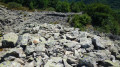
Highlights of this walk include forests of chestnut, oak, beech and pine trees, two volcanoes, three types of lava, three typical hamlets and a 360° view across the Boutières region (with at least twenty volcanoes in sight).24/10/2023: The walk has been altered to avoid the Oppidum de la Farre, which is private property classified as a historic monument and closed to the public (see practical information).
Les Hauts de Villemus
 3.56 mi
+725 ft
-719 ft
2h 15
Easy
Departure from Villemus (Alpes-de-Haute-Provence)
3.56 mi
+725 ft
-719 ft
2h 15
Easy
Departure from Villemus (Alpes-de-Haute-Provence)
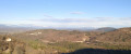
A short but invigorating walk. From Villémus, a charming village in the Luberon region of Manosque, you will climb up to a ridge which you will follow before descending back down to the village. Magnificent landscapes and views of all the mountain ranges in the region, the Forcalquier plain, and the Durance and Encrême valleys.
The Balconies of Manosque: the Thomassine Water Trail
 5.90 mi
+938 ft
-909 ft
3h 30
Easy
Departure from Manosque (Alpes-de-Haute-Provence)
5.90 mi
+938 ft
-909 ft
3h 30
Easy
Departure from Manosque (Alpes-de-Haute-Provence)
"Les Balcons de Manosque" is the title of a series of walks organised by the Manosque Heritage Committee (CPM) that allow visitors to discover the town’s heritage “beyond the walls”.
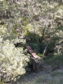
This first route broadly follows the Thomassine watercourse, one of the springs that once supplied Manosque. The route includes the remains of an aqueduct, a sulphurous spring, a 15th-century bridge, animal footprints dating back 30 million years, an asphalt mine and a water mine.
The Balconies of Manosque: the Blue Grotto and the Luberon ridge
 4.80 mi
+945 ft
-965 ft
3h 00
Easy
Departure from Manosque (Alpes-de-Haute-Provence)
4.80 mi
+945 ft
-965 ft
3h 00
Easy
Departure from Manosque (Alpes-de-Haute-Provence)
Les Balcons de Manosque is the title of a series of walks organised by the Manosque Heritage Committee (CPM) that allow you to discover the town’s heritage beyond its walls.
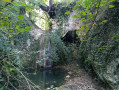
This route takes us along the Luberon ridge and then descends through the "Ravin des Couquières". Amidst a magnificent landscape dominated by woodland, you will discover a troglodyte dwelling, the remains of a clay quarry, the "source des maquisards", a water mine and the mysterious Blue Cave.
The Balconies of Manosque: the mines
 4.64 mi
+856 ft
-840 ft
2h 55
Easy
Departure from Manosque (Alpes-de-Haute-Provence)
4.64 mi
+856 ft
-840 ft
2h 55
Easy
Departure from Manosque (Alpes-de-Haute-Provence)
“Les Balcons de Manosque” is the title of a series of walks organised by the Manosque Heritage Committee (CPM), which allow you to discover the town’s heritage “beyond the walls”.
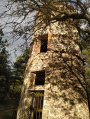
This route sets off from the former Gaude lignite mine, crosses the Luberon ridge (magnificent views), and continues down the northern slope to explore a former underground gypsum quarry. It then returns along the southern slope to a dovecote, all set amidst two magnificent forests.
The Balcons de Manosque: the drystone shelters and the Gaude water trail
 4.77 mi
+817 ft
-797 ft
2h 55
Easy
Departure from Manosque (Alpes-de-Haute-Provence)
4.77 mi
+817 ft
-797 ft
2h 55
Easy
Departure from Manosque (Alpes-de-Haute-Provence)
"Les Balcons de Manosque" is the title of a series of walks organised by the Manosque Heritage Committee (CPM) that allow you to discover the town’s heritage “beyond the walls”.
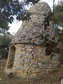
In an enchanting setting, you will admire a bori shaped like a sugar loaf. The second part of the route follows the path that runs alongside the Chemin de l’eau de Gaude, which once carried water from the spring of the same name to the outskirts of Manosque, a distance of over 3 km.