Country:

 City:
City:


The route begins on Chemin Louis Denis-Valvéranne in Manosque, at the Géométhane public car park, just past the 90° bend to the left.
(S/E) Take the road heading north, to the left of the Géométhane facilities (natural gas storage). Leave this road shortly afterwards and turn left onto a path running parallel to the road. Join a track and continue straight on until you reach the Géométhane reservoir.
(1) A few dozen metres further on, take the track on the left (signposted ‘Chemin de l’eau de Gaude’ by the CPM). After about 1.3 km and two hairpin bends, you’ll reach a junction of tracks.
(2) Turn right and carry on until you reach a junction of several tracks and paths.
(3) Take the one directly opposite, which climbs steeply. The forest gradually gives way to heath. After about 200 m, take the path on the left which leads onto a tarmac road; follow this down to the middle of the hairpin bend.
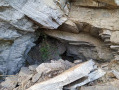
(4) Take the path on the right: sign for the CPM “Les Gipières”. 200 m further on, you will see some ruins on the left. The path then turns left at a 90° angle. At the bend, take the barely visible path on the right which climbs up the embankment and quickly leads to the entrance to the underground gypsum quarry.
(5) Do not attempt to enter the quarry, as rockfalls are very common. You may notice traces of gypsum (a crumbly white rock) amongst the scree. Retrace your steps back to the path and take it to the right towards a relatively well-preserved ruined house.
Continue along the path for about 500 metres until you reach an open, treeless section (marked by a green-ringed signpost), which you follow to the right up to the ridge.
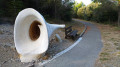
(6) Head left towards the entrance to the “Chemins de Bellevue”, walking routes adapted for people with disabilities. Follow the tarmac path on the right for about 300 m until you reach a multi-way junction. Take the track on the right, then, 100 m further on, follow the path on the right which soon leads onto a track that you take on the right.
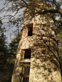
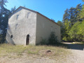
(7) Just over 100 m further on, take the path on the right and follow it to the Montaigu dovecote, situated at the side of the path on the left. Continue along the path to the magnificent well (now usually dry) and head down to the track below, which you take to the right.
(8) Just past the cistern, take the path on the right (signpost with a green ring). Follow it until it joins the track, which you then follow to the first Géométhane facilities (under construction in early 2021). These cover the Gaude spring, which has supplied Manosque with water since 1497.
(1) Continue along the track that runs alongside the Géométhane facilities. Join the road and follow it to the right. On your right, you will successively see the entrance to a tunnel of the Gaude mine, then the descent shaft, which was dismantled and bricked up when the mine closed.
Return to the car park (S/E).

 Visorando Member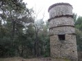

 Moderate