


OT Puisaye-Forterre

 Tourist office
PRO  Premium user
Premium user - 3, Place de la République 89170 SAINT-FARGEAU
- Tel:03 86 45 61 31
- Website: https://www.puisaye-tourisme.fr/
Sign up:
Published route(s)
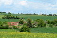
 Panoramic route starting from Bouhy
 7.83 mi
 +787 ft
 -794 ft
 4h 15
4h 15
 Average
 Departure from Bouhy (Nièvre)
Marked trail No. 33.
Geologically, the commune of Bouhy belongs to the Forterre, a region neighbouring the Puisaye. Its village is at an altitude of 355 metres. For walkers in search of vast horizons, this dominant position gives this route its panoramic interest, to which is added the architectural interest of the many chapels encountered along the way.
The Chemin des Deux Visages
 8.56 mi
+659 ft
-646 ft
4h 30
Average
Departure from Dampierre-sous-Bouhy (Nièvre)
8.56 mi
+659 ft
-646 ft
4h 30
Average
Departure from Dampierre-sous-Bouhy (Nièvre)
Marked route No. 101.
The area of Dampierre-sous-Bouhy spans two natural regions: the Forterre and the Puisaye. Numerous flint tools found near the Moulin Bléneau bear witness to the presence of humans during the Neolithic period. In the hamlet of Les Pasquiers, the discovery of the remains of a Gallo-Roman villa also attests to human occupation during this period.
The Path Along the Water
 8.52 mi
+528 ft
-535 ft
4h 25
Average
Departure from Dampierre-sous-Bouhy (Nièvre)
8.52 mi
+528 ft
-535 ft
4h 25
Average
Departure from Dampierre-sous-Bouhy (Nièvre)
Marked route No. 45.
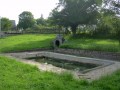
The Year 5 and 6 class from Dampierre-sous-Bouhy has created a walking route for you. This route will allow you to discover the landscapes of Puisaye and its many water sources.
We wish you a lovely walk and hope you enjoy exploring this route as much as they enjoyed creating it.
It can be completed in its entirety or with two alternative routes (see ‘Practical Information’ section).
Medieval Walk in Saint-Vérain
 0.67 mi
+75 ft
-75 ft
0h 25
0.67 mi
+75 ft
-75 ft
0h 25
 Easy
Departure from Saint-Vérain (Nièvre)
Easy
Departure from Saint-Vérain (Nièvre)
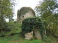
Follow the castle path to discover the keep and the remains of the13th-century feudal town.
The Vérinoise Circular
 2.99 mi
+213 ft
-184 ft
1h 35
Easy
Departure from Saint-Vérain (Nièvre)
2.99 mi
+213 ft
-184 ft
1h 35
Easy
Departure from Saint-Vérain (Nièvre)
Marked route No. 34.
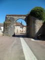
The village of Saint-Vérain, built on a hillside, was surrounded by fortified walls in the Middle Ages, making it one of the most powerful feudal cities in the region. Numerous remains bear witness to the city's importance, including ramparts, towers, gates, wells, a keep, etc.
Circuit de La Chapelle aux Rois
 8.91 mi
+771 ft
-771 ft
4h 45
Average
Departure from Bitry (Nièvre)
8.91 mi
+771 ft
-771 ft
4h 45
Average
Departure from Bitry (Nièvre)
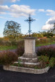
Marked trail No. 35.The commune of Bitry covers 1,746 hectares. The Ramois boundary marker is at an altitude of 326 metres, while the La Maloise river flows at the lowest point, 189 metres above sea level.Between the village and the hamlet of Les Beauchats, you can visit a chapel dedicated to Saint Marc and Saint Roc, which was restored in the 20th century.
Discover Toucy with your family
 2.31 mi
+151 ft
-151 ft
1h 10
Easy
Departure from Toucy (Yonne)
2.31 mi
+151 ft
-151 ft
1h 10
Easy
Departure from Toucy (Yonne)
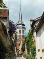
Starting from the central car park on Place des Frères Genêt, you will discover the fishing lake and leisure centre very close to the town centre, offering a magnificent panorama. Crossing woods and medieval streets, stop at the promontory overlooking Place de la République, dominated by the bust of Pierre Larousse, and enjoy exceptional views of this village, whose existence has been documented since the middle ofthe 3rd century.
The Parly's Chestnut Grove
 3.76 mi
+266 ft
-282 ft
2h 00
Easy
Departure from Parly (Yonne)
3.76 mi
+266 ft
-282 ft
2h 00
Easy
Departure from Parly (Yonne)
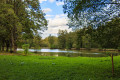
All along the route, you will discover centenaries trees, educational signs about the chestnut tree.
The Charny Ponds Walk
2.18 mi
+10 ft
-10 ft
1h 00
Easy
Departure from Charny (Yonne) (Yonne)
This is a lovely short walk to enjoy with the family, especially with young children. Just over 3 kilometres, it’ll introduce you to the wildlife around the lakes. The playground is sure to delight the little ones!
The Moulin Rouge and the Château du Fort
 5.45 mi
+308 ft
-299 ft
2h 45
Easy
Departure from Mézilles (Yonne)
5.45 mi
+308 ft
-299 ft
2h 45
Easy
Departure from Mézilles (Yonne)
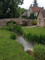
Signposted route N°69.In this village, known for bric-a-brac, the sunken paths are all the rage! A guaranteed immersion in nature.Mézilles is one of the "Cités de caractères de Bourgogne - Franche-Comté" villages.
 By bike, from Toucy to Grandchamp Castle and back
30.55 mi
+1,004 ft
-984 ft
5 hrs
Average
Departure from Toucy (Yonne)
This cycle tourism route invites you to discover the architectural and natural heritage of this verdant Puisaye region, offering beautiful views of the surrounding villages, the Yonne valley and the very distinctive Tholon hills.
Arthé circular
 7.65 mi
+630 ft
-610 ft
4h 05
Average
Departure from Toucy (Yonne)
7.65 mi
+630 ft
-610 ft
4h 05
Average
Departure from Toucy (Yonne)
Signposted route N° 76This route starts from Toucy, birthplace of Pierre Larousse, 19th-century grammarian, lexicographer and educator. It offers multiple viewpoints and panoramas along ridge lines. The sunken paths winding under a dense canopy of vegetation create a romantic atmosphere that you're sure to enjoy. Then, at the bend in the path, you'll fall under the spell of the magnificent Château d'Arthé.
The Seven Locks of Henri IV.
 6.08 mi
+82 ft
-82 ft
2h 50
Easy
Departure from Rogny-les-Sept-Écluses (Yonne)
6.08 mi
+82 ft
-82 ft
2h 50
Easy
Departure from Rogny-les-Sept-Écluses (Yonne)
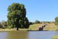
Marked hike N°71.
A whole new way to discover the story of the construction of the Canal de Briare! With this hike you can follow a part of its water supply system and come back along the old route to the incredible monument that we today know as the Seven Locks.