The Chemin des Deux Visages

Marked route No. 101.
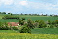
The area of Dampierre-sous-Bouhy spans two natural regions: the Forterre and the Puisaye. Numerous flint tools found near the Moulin Bléneau bear witness to the presence of humans during the Neolithic period. In the hamlet of Les Pasquiers, the discovery of the remains of a Gallo-Roman villa also attests to human occupation during this period.

Details

40985
Creation:
Last update:
Last review:
  • Walking
    Activity: Walking
  • ↔
    Distance: 8.56 mi
  • ◔
    Average duration: 4h 30 
  • ▲
    Difficulty: Moderate

  • ⚐
    Back to start: Yes
  • ↗
    Ascent: + 659 ft
  • ↘
    Descent: - 646 ft

  • ▲
    Highest point: 1,119 ft
  • ▼
    Lowest point: 669 ft

Photos

Description of the walk

(S/E) Opposite the church in Dampierre-sous-Bouhy, take the road on the left which runs alongside the grounds of Dampierre Castle. At the corner of the grounds, continue straight ahead along the path. At thefirst Y-junction, take the path on the left which climbs up to the hamlet of Bois Pille.

(1) In the hamlet, take the road on the left. At thefirst bend, take the path on the right.

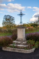
(2) At the next junction with the wayside cross, cross the road and continue along the path opposite. At thefirst junction, take the path on the left which leads down to the village of Cosme. When you reach the road, head up it on the left, ignoring the adjacent streets. At the road that runs above, turn right and continue straight on to the Sainte-Anne Chapel.

(3) Carry on straight ahead.

(4) Take thefirst road on the left, towards Bois Vaugerin, then thefirst track on the right as you round the bend. Ignore all turnings to the right and left (some of which are marked on the IGN map but no longer exist).

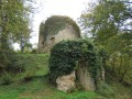
(5) At the crossroads of four tracks, turn left. Pass the ruins of the outbuildings of the former Château d’Angelier, which no longer stands.

(6) Take the road on the right. At the junction with the D114, turn left, then take thefirst track on the right. In the hamlet, turn right, then carry on straight ahead along the track that continues from the road.

(7) Where the track joins the road, turn left for about a hundred metres, then take the track on the right as it curves. Atthe first junction of four tracks, continue straight ahead.

(8) Take the track on the left before the hamlet of Les Cordes. Take the road on the right and, at the junction of four roads, go straight on towards Saint-Amand. Cross the Malaise via the road bridge and climb up to the level of a house.

(9) Take the path on the left. You’ll come to a ford.

(10) Cross it via the stone footbridge, pass the few houses in Les Forges and follow the road uphill to the junction. Cross carefully and head towards Les Marandes for about a hundred metres until you find the start of a path on the right.

(11) Set off along this path, which climbs, until you reach a road.

(12) Just before this road, turn right onto a hard-packed track. You’ll reach the D114. Cross it carefully and take the track on the opposite side. At the crossroads, turn right; the track ends in a path. As you go, take in the lovely view over the village of Dampierre.

(13) Head off to the right and walk downhill to the first houses of Dampierre-sous-Bouhy. At the road, turn left; the view of the church will mark your return journey (S/E).

Waypoints

  1. S/E : mi 0 - alt. 771 ft - Église Saint-Pierre (Dampierre-sous-Bouhy)
  2. 1 : mi 1.28 - alt. 1,106 ft - Bois Pille, turn left
  3. 2 : mi 1.76 - alt. 1,119 ft - Calvaire, the path opposite
  4. 3 : mi 2.56 - alt. 1,073 ft - Picnic area - Chapelle Sainte-Anne (Bouhy)
  5. 4 : mi 3.05 - alt. 1,043 ft - Turn left
  6. 5 : mi 4.08 - alt. 876 ft - Path on the left
  7. 6 : mi 4.63 - alt. 801 ft - Turn right
  8. 7 : mi 5.28 - alt. 804 ft - Exit onto the road
  9. 8 : mi 6 - alt. 738 ft - Path on the left
  10. 9 : mi 6.58 - alt. 673 ft - Bridge, then path to the left
  11. 10 : mi 7.32 - alt. 692 ft - Ford - Malaise (rivière)
  12. 11 : mi 7.46 - alt. 732 ft - Leave the road and take the path uphill
  13. 12 : mi 7.82 - alt. 850 ft - Curving road ahead
  14. 13 : mi 8.19 - alt. 892 ft - Cross-country path
  15. S/E : mi 8.56 - alt. 771 ft - Église Saint-Pierre (Dampierre-sous-Bouhy)

Notes

This route features some elevation changes, shortly after the start and after the ‘13 ’. In the event of heavy rain, muddy patches may be present in certain sections; please wear appropriate footwear.
For car parks:

  • Place de l’Église (only a few spaces)
  • If you take Rue de la Croix Bernot on the right-hand side from the foot of the fire station, there are more parking spaces available.

This marked route, which complies with the marking guidelines of the Puisaye-Forterre Community of Communes, is marked with the number 101 on yellow-backed signs.
The signposting was carried out by the association ‘À chacun son chemin en Puisaye-Forterre’ in January 2022.
If you encounter any issues, please complete this questionnaire (it only takes 1 to 2 minutes).
Take care when crossing roads.
However, even though the route is signposted, you must set off with at least this route description and the accompanying IGN map and/or the Visorando app.

Worth a visit

Places of interest: the town hall, built in 1858; the Saint-Denis Fountain; Angelier Pond; and the contrasting landscapes of Puisaye and Forterre.

Reviews and comments

4.2 / 5
Based on 3 reviews

Reliability of the description
4 / 5
Ease of following the route
4 / 5
Route interest
4.7 / 5
Bruno58
Bruno58

Overall rating : 3.7 / 5

Date of your route : May 21, 2018
Reliability of the description : ★★★☆☆ Average
Ease of following the route : ★★★★☆ Good
Route interest : ★★★★☆ Good

A lovely walk that follows a mix of yellow and orange-and-yellow signposting; unfortunately, the ‘yellow line and green dot’ markings are very old and have almost faded away in places, so you need to be very careful right from the start! Keep left wherever you see the Yellow Crosses….!!!
Otherwise, fantastic panoramic views from the ridge!!
We ended up in Bouhy, but we managed to make up the distance afterwards, so it came to 16 km!
Get your walking boots on!
Bruno

Machine-translated

CatherineA
CatherineA

Overall rating : 4.7 / 5

Date of your route : Aug 21, 2017
Reliability of the description : ★★★★☆ Good
Ease of following the route : ★★★★★ Very good
Route interest : ★★★★★ Very good

I can’t really comment on the walk as I only did part of it. However, I can comment on the first section: I wish the steep climb at the start had been better signposted.

Machine-translated

chogui
chogui

Overall rating : 4.3 / 5

Date of your route : Oct 30, 2016
Reliability of the description : ★★★★★ Very good
Ease of following the route : ★★★☆☆ Average
Route interest : ★★★★★ Very good

A lovely walk with beautiful scenery and magnificent panoramic views on a clear day.
Please note! The signposting is no longer very visible...
It’s a good idea not to forget your map.

Machine-translated

Other walks in the area

For more walks, use our search engine .

The GPS track and description are the property of this route's author. Please do not copy them without permission.