


OT Cœur des Collines Cathares

 Tourist office
 Premium user
Sign up:
Published route(s)
 Les Dédales du Temps starting from Villasavary
 6.33 mi
 +804 ft
 -801 ft
 3h 35
3h 35
 Moderate
 Departure from Villasavary (Aude)
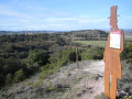
Follow in the footsteps of Théodore Denille and discover the landscapes of Lauragais, the hills of Piège du Lauragais and the people who shaped its history. Find your way through the maze of wooded paths, take a few breaks to read the signs and admire the panoramic views, while learning to recognise orchids.
Red markings
Hounoux ridge trail
 5.02 mi
+545 ft
-551 ft
2h 45
5.02 mi
+545 ft
-551 ft
2h 45
 Easy
Departure from Hounoux (Aude)
Easy
Departure from Hounoux (Aude)
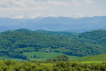
On the ridge line that marks the watershed between the Atlantic and the Mediterranean, there is a fascinating interpretive trail on the geology and formation of these rolling landscapes of Razès, Lauragais and the foothills of the Pyrenees.
Yellow + yellow and red markings for the section on theGR®®78
Historic trail of Laurac-le-Grand
 2.80 mi
+538 ft
-509 ft
1h 45
Easy
Departure from Laurac (Aude)
2.80 mi
+538 ft
-509 ft
1h 45
Easy
Departure from Laurac (Aude)
The stronghold of the powerful lords who gave their name to the Lauragais, the ancient fortified village of Laurac has retained its dominant position, its medieval silhouette and its authentic stone buildings. The route reveals breathtaking panoramas and allows you to observe the village and nature from the surrounding hills. The information panels along the route tell its eventful history, from the Cathars to the religious wars of the Renaissance.
Yellow markings
Landscapes and vineyards of Bas-Razès
 10.78 mi
+840 ft
-830 ft
5h 40
Moderate
Departure from Lasserre-de-Prouille (Aude)
10.78 mi
+840 ft
-830 ft
5h 40
Moderate
Departure from Lasserre-de-Prouille (Aude)
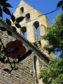
Starting from Laserre-de-Prouille, set off along the paths through the vineyards of the Malepère appellation to discover four villages perched on their hills: Brézilhac, Ferran, Mazerolles-du-Razès and Lasserre-de-Prouille. Several panoramic views provide an insight into the landscape, which is marked by a wide variety of agricultural activities.
Yellow markings
The Way of Saint Dominic from Montreal
 9.58 mi
+528 ft
-541 ft
4h 50
Moderate
Departure from Montréal (Aude) (Aude)
9.58 mi
+528 ft
-541 ft
4h 50
Moderate
Departure from Montréal (Aude) (Aude)
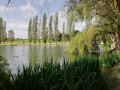
Between vineyards and hills, hike in the footsteps of Saint Dominic: a shortened version of this legendary hike using theGR®® 78, the Piedmont Way of Saint James, starting from the pretty village of Montréal, renowned for its majestic collegiate church.
Yellow markings
The Way of St Dominic from Fanjeaux
 9.13 mi
+984 ft
-984 ft
5h 05
Moderate
Departure from Fanjeaux (Aude)
9.13 mi
+984 ft
-984 ft
5h 05
Moderate
Departure from Fanjeaux (Aude)
Set off on the path once taken by Saint Dominic to reach the first monastery he founded in Prouille. Crossing the hills, the route reveals the wine-growing village of Lasserre-de-Prouille, a small "circulade" with a remarkable heritage.
This is a shortened version of the long route linking Fanjeaux to Montréal (30 km) via the GR® 78, the Piedmont route of the legendary pilgrimage to Santiago de Compostela.
Yellow markings
The countryside of today and yesterday
 7.64 mi
+866 ft
-889 ft
4h 15
Moderate
Departure from Plavilla (Aude)
7.64 mi
+866 ft
-889 ft
4h 15
Moderate
Departure from Plavilla (Aude)
Today’s rural world is very different from that of centuries past. Whilst agriculture remains the driving force and an indelible feature of the Piège hills, the people and practices have changed. Following in the footsteps of Bertrand, the grocer from Mirepoix, this interpretive trail offers a dialogue between rural life today and in the past. You’ll learn more about the ‘traditional’ trades that once kept the heart of the countryside beating and the agriculture that still shapes the landscape.
Follow the blue markings
Dessin trail and chapels of La Piège
 6.07 mi
+915 ft
-915 ft
3h 35
Moderate
Departure from Cazalrenoux (Aude)
6.07 mi
+915 ft
-915 ft
3h 35
Moderate
Departure from Cazalrenoux (Aude)
Learn to draw while walking and observing the landscapes of the Piège hills, in unusual places such as the Serre des Enchantées or among the sheep on a wild hilltop. This is an original hike between the unspoilt villages of Cazalrenoux and Génerville.
Yellow markings + 7 wooden easels
Les Collines du Vent de Mas-Saintes-Puelles à Fendeille
 5.85 mi
+623 ft
-965 ft
3h 15
Moderate
Departure from Mas-Saintes-Puelles (Aude)
5.85 mi
+623 ft
-965 ft
3h 15
Moderate
Departure from Mas-Saintes-Puelles (Aude)
part2 of the "Les Collines du Vent" route:The exceptional views amply reward the effort of climbing the pechs (hills in Occitan). The Collines du Vent route then takes on its full spectacular dimension: the pechs are swept by winds blowing alternately from the Mediterranean (the autan or marin) and the Atlantic (cers). There are few trees on the hills, which also means that there is little shade in summer, so the sun beats down hard on the hills.
A spectacular and iconic 48.2 km online route in the Lauragais region, the "Collines du Vent" connects Avignonet-Lauragais and Fanjeaux. Numerous windmills are dotted across these first hills of La Piège, taking advantage of the generous winds that blow alternately from the Mediterranean (the Autan or marine wind) and the Atlantic (the Cers). The view stretches far beyond the hills to the Pyrenees and the Montagne Noire. Eleven information panels provide details about the area's heritage.
Yellow and blue markings
Hille and Mont Carrière circular in Fanjeaux
 7.51 mi
+1,115 ft
-1,096 ft
4h 25
Moderate
Departure from Fanjeaux (Aude)
7.51 mi
+1,115 ft
-1,096 ft
4h 25
Moderate
Departure from Fanjeaux (Aude)
In the Aude Cathar Country, the unspoilt village of Fanjeaux, perched on a hill (pech in Occitan), offers spectacular views of the countryside. The undulating route winds its way over the hills, dotted with numerous viewpoints, including Mont Carrière with its four orientation tables.
Red markings and "Circular de la Hille" sign.
 Bram - Mirepoix Greenway
 23.11 mi
+876 ft
-305 ft
2.5 hrs
Moderate
Departure from Bram (Aude)
23.11 mi
+876 ft
-305 ft
2.5 hrs
Moderate
Departure from Bram (Aude)
Starting from the Circulade in Bram (a lovely warm-up ride through this unique and well-preserved heritage site), this route follows the path of an old railway line that once linked Bram to Mirepoix and Lavelanet, passing through the charming countryside of the Razès. The section between Bram and Mirepoix is fairly easy for all types of bike (a hybrid bike is best suited), and its high-quality surface is fairly new. However, thesecond section from Moulin Neuf to Lavelanet, which is older, is best tackled on a mountain bike.
Along the water and mills along the Lampy River
 3.45 mi
+446 ft
-430 ft
2h 00
Easy
Departure from Cenne-Monestiés (Aude)
3.45 mi
+446 ft
-430 ft
2h 00
Easy
Departure from Cenne-Monestiés (Aude)
On the lower slopes of the Montagne Noire, the Lampy River powered numerous textile factories in Cenne-Monestiés from the 17th to the 20th century. Downstream from the well-restored dam, beautiful remains are still visible in this rolling, green landscape. This route will show them to you with a series of information panels, taking you to some surprising places: along an old irrigation channel, at the end of the lake or in a panoramic spot in the middle of the pastures.
Blue markings
The Collines du Vent from Fendeille to Laurac
 6.99 mi
+971 ft
-748 ft
4h 05
Moderate
Departure from Fendeille (Aude)
6.99 mi
+971 ft
-748 ft
4h 05
Moderate
Departure from Fendeille (Aude)
Part3 of the ‘Les Collines du Vent’ route:
A heritage-themed stage on the Collines du Vent featuring two fairly well-preserved medieval villages: Mireval-Lauragais and Laurac. And, as always, spectacular paths opening out onto a rolling landscape of countryside and hills covered in fields and pastures.
A spectacular and iconic online route through the Lauragais region, stretching 48.2 km, the “Collines du Vent” links Avignonet-Lauragais and Fanjeaux. Dotted across these first hills of the Piège are numerous windmills, making the most of the generous winds that blow alternately from the Mediterranean (the autan or marin) and the Atlantic (the cers). The view stretches far beyond the hills, towards the Pyrenees and the Montagne Noire. Eleven information boards provide details about the local heritage.
Yellow and blue signposting
Circular of Fount Picou
 3.60 mi
+374 ft
-374 ft
2h 00
Easy
Departure from Fanjeaux (Aude)
3.60 mi
+374 ft
-374 ft
2h 00
Easy
Departure from Fanjeaux (Aude)
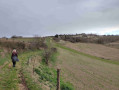
This circular loop, which starts along the tramway path, opens onto the hills of La Piège. It encircles a narrow valley that has always been farmland shared by the farmers living in the village. Each of the fields lined up in this way had access or a "step" from the path. A stone hut, flanked by the traditional cypress tree, allowed the farmer and his team to take a well-deserved rest once the "junte" was finished.
Blue markings
Orchid trail in Villasavary
 5.90 mi
+853 ft
-846 ft
3h 25
Easy
Departure from Villasavary (Aude)
5.90 mi
+853 ft
-846 ft
3h 25
Easy
Departure from Villasavary (Aude)
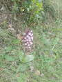
The wild orchid discovery trail winds its way from the slopes of Mont Carrière to those of Les Canonges, offering a succession of hills and valleys where undergrowth, forests, cultivated areas, short, dry grasslands on limestone soil and wetlands alternate.
Wild orchids have made their home in this setting. However, few walkers pay attention to these sometimes tiny flowers, which rarely grow taller than 20 centimetres, in the early days of spring. Some are very concentrated, others much rarer, growing alone or scattered.
Picto Yellow Flower Markings
The Windy Hills of Avignonet-Lauragais in Fanjeaux
29.22 mi
+3,156 ft
-2,628 ft
4 days
Moderate
Departure from Avignonet-Lauragais (Haute-Garonne)
A spectacular and iconic 48.2 km online route through the Lauragais region, the "Collines du Vent" (Windy Hills) connect Avignonet-Lauragais and Fanjeaux. Numerous windmills are dotted across these first hills of the Piège, taking advantage of the generous winds that blow alternately from the Mediterranean (the autan or marin) and the Atlantic (the cers). The view stretches far beyond the hills to the Pyrenees and the Montagne Noire. Eleven information panels provide details about the local heritage.
Yellow and blue markingsPlease note: follow the yellow and pink markings (those of the Tour de Lauragais) from Laurac to Fanjeaux.