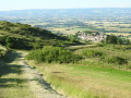
The Collines du Vent from Fendeille to Laurac

Part3 of the ‘Les Collines du Vent’ route:
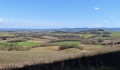
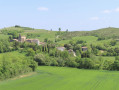
A heritage-themed stage on the Collines du Vent featuring two fairly well-preserved medieval villages: Mireval-Lauragais and Laurac. And, as always, spectacular paths opening out onto a rolling landscape of countryside and hills covered in fields and pastures.

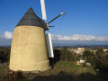
A spectacular and iconic online route through the Lauragais region, stretching 48.2 km, the “Collines du Vent” links Avignonet-Lauragais and Fanjeaux. Dotted across these first hills of the Piège are numerous windmills, making the most of the generous winds that blow alternately from the Mediterranean (the autan or marin) and the Atlantic (the cers). The view stretches far beyond the hills, towards the Pyrenees and the Montagne Noire. Eleven information boards provide details about the local heritage.

Yellow and blue signposting

This walk is part of a multi-day hike: The Windy Hills of Avignonet-Lauragais in Fanjeaux

Details

n°23376570
Creation:
Last update:
Last review:
  • Walking
    Activity: Walking
  • ↔
    Distance: 6.99 mi
  • ◔
    Average duration: 4h 05 
  • ▲
    Difficulty: Moderate

  • ⚐
    Back to start: No
  • ↗
    Ascent: + 971 ft
  • ↘
    Descent: - 748 ft

  • ▲
    Highest point: 1,283 ft
  • ▼
    Lowest point: 594 ft
  • ⚐ Country: France
  • ⚐ City: Fendeille (11400)
  • ⚑
    Start: N 43.27028° / E 1.943291°
  • ⚑
    End: N 43.227652° / E 1.975317°
  • ❏
    IGN map(s): Ref. 2245E, 2245O
  • Hour-by-hour weather

Photos

Description of the walk

Blue and yellow signposting as far as the Pierre Levée in Laurac, then the red and yellow signposting for the Tour du Lauragais.

(S) At the entrance to the village of Fendeille, set off from the public weighbridge and cross the Route de Castelnaudary (RD6) at the pedestrian crossing (take care) to take the street called Chemin de l’Épicier.

(1) At the junction with the stream, turn left onto the Chemin du Moulin Cros. At the next junction, keep right, still on the Chemin du Moulin Cros. After the last houses, continue straight ahead along the path as it winds down into the countryside.

(2) After the Galines farm, take the small road on the right. At the stream, continue straight on along the path which climbs towards the village of Mireval-Lauragais. At the top of the path, in front of the war memorial, enter the village via the Grande Rue, walk past the church and carry on straight ahead.

(3) Once past the medieval gateway, keep left, and, after 20 m, take the path to the right and then to the left. At the end of the path, turn onto the small road to the right.

(4) After 400 m, take the path straight ahead. On the plain, keep to the right, then, after 200 m, head down to the left to cross the stream. On the other side, take the small road on the right and follow it to the village of Laurabuc.

(5) At the junction in front of Laurabuc church, follow Rue de l’Arcade, which runs alongside the church on the right, then head down Rue de l’Église. At the bottom of this street, take Rue Centrale (with a gutter down the middle) to the left. At the wayside cross in Place de la Liberté, turn right onto Rue Neuve.

(6) Walk past the grocery shop and continue straight on down to the cemetery. At the end of the path, take the small road to the right, then head up the path on the right. At the junction with a small road, carry on straight ahead along the dirt track.

(7) At the large junction of dirt tracks, take thesecond track on the left, which climbs between two embankments. At the top, enjoy the stunning view over the village of Laurac and carry on straight ahead.

(8) At the end of the track, take the small road on the right twice and cross the farmyard. Then turn left onto the track running alongside the brick building towards the Pierre Levée. On the climb, keep to the left.

(9) At the end of the track, take the road on the right for 50 metres, then the track on the left which cuts across the road in a hairpin bend. At the top, follow the edge of the hill to take in the panoramic view, then keep left twice to stay on the path along the hillside.

(10) Before the path leading up to the mast (you can take a short detour to see the views from higher up), take the road leading down to the left. After 400 m, turn left onto the wide path.

(11) At the crossroads, turn left and head straight down to the village of Laurac (E), the entrance to which is marked by the old public weighbridge and the town hall square.


Waypoints

  1. S : mi 0 - alt. 689 ft - Fendeille public scales
  2. 1 : mi 0.15 - alt. 646 ft - Chemin du Moulin Cros
  3. 2 : mi 1.13 - alt. 650 ft - Small road on the right
  4. 3 : mi 1.89 - alt. 840 ft - Medieval gate
  5. 4 : mi 2.25 - alt. 705 ft - A straight path across the plain
  6. 5 : mi 3.19 - alt. 673 ft - Rue de l’Arcade - Eglise de Laurabuc
  7. 6 : mi 3.31 - alt. 623 ft - Laurabuc Town Hall
  8. 7 : mi 4.29 - alt. 778 ft - Major crossroads
  9. 8 : mi 4.98 - alt. 945 ft - Ferme des Rougeous
  10. 9 : mi 5.68 - alt. 1,204 ft - D116 road
  11. 10 : mi 6.11 - alt. 1,280 ft - D15 road
  12. 11 : mi 6.54 - alt. 1,171 ft - Crossroads
  13. E : mi 6.99 - alt. 902 ft - Laurac Town Hall Square

Notes

- in Fendeille: a bakery, picnic tables and a car park at the village hall.
- in Mireval-Lauragais: toilets and drinking water point in front of thesecond medieval gate.
- in Laurabuc: café and grocery shop.
- in Laurac: drinking fountain next to the war memorial.

Worth a visit

- in Fendeille: 18th-century castle and medieval keep.
- in Mireval-Lauragais: two medieval gates of the old fortified village; a square, half-timbered dovecote 500 metres away.
- in Laurabuc: a Romanesque church with a 19th-century bell tower and an old medieval gate.
- in Laurac: a well-preserved old fortified village, with typical narrow streets and beautiful stone houses.

Reviews and comments

4.5 / 5
Based on 2 reviews

Reliability of the description
4.5 / 5
Ease of following the route
5 / 5
Route interest
4 / 5
OT Cœur des Collines Cathares

Hello,

Thank you for your feedback.

We look forward to seeing you again on one of our circular trails.

Kind regards

Machine-translated

Shrando31410
Shrando31410

Overall rating : 4.7 / 5

Date of your route : Jun 21, 2024
Reliability of the description : ★★★★★ Very good
Ease of following the route : ★★★★★ Very good
Route interest : ★★★★☆ Good
Very busy route : No

We walked the section between Mireval Lauragais and Laurabuc. A lovely little walk through the countryside. We visited the unique Stations of the Cross in Laurabuc.

Machine-translated

jp11
jp11

Overall rating : 4.3 / 5

Date of your route : Oct 16, 2022
Reliability of the description : ★★★★☆ Good
Ease of following the route : ★★★★★ Very good
Route interest : ★★★★☆ Good
Very busy route : No

An interesting tour of the villages along the walk. Don’t forget Fendeille Park. Watch out for the wind, which is often strong on the ridges.

Machine-translated

OT Cœur des Collines Cathares

It’s a signposted route: you can go whenever you like… or whenever you can.
The weather is milder now.
Kind regards

Machine-translated

RANDO1VISO2
RANDO1VISO2

Something came up and I wasn’t able to go on this hike. It’s a shame we didn’t go!
Thank you for your interest in improving or correcting the route guides based on the issues reported by walkers.
All the best, kind regards.

Machine-translated

OT Cœur des Collines Cathares

In other words, what is the problem you’re having?
I’m here to help; best regards.
Dominique

Machine-translated

RANDO1VISO2
RANDO1VISO2

I couldn’t make it to that hike!

Machine-translated

Other walks in the area

For more walks, use our search engine .

The GPS track and description are the property of this route's author. Please do not copy them without permission.