


Michelle34

 Visorando Member
 Premium user
 - Location: Montpellier (34080|34070|34000|34090)
Sign up:
Published route(s)
 From Max Nègre to the Fairy Cave
 9.10 mi
 +1,394 ft
 -1,407 ft
 5h 25
5h 25
 Moderate
 Departure from Montpeyroux (Hérault) (Hérault)
This hike follows small paths and forest tracks to reach Max Nègre, a remarkable geological site. The return route passes through the wild Joncas valley, where the Grotte des Fées cave opens up: a good torch allows you to visit the entrance for about thirty metres (stalactites and draperies).This route should be avoided in hot weather.
Loop starting from Saint-Bauzille-de-la-Sylve
 9.09 mi
+906 ft
-886 ft
5h 00
Moderate
Departure from Saint-Bauzille-de-la-Sylve (Hérault)
9.09 mi
+906 ft
-886 ft
5h 00
Moderate
Departure from Saint-Bauzille-de-la-Sylve (Hérault)
This hike requires attention and monitoring of the GPX track, especially between points (11) and (12).Alternating between beautiful open views and wild valleys, often away from marked trails. It follows forest tracks and unmarked paths.
Circular Crozes in Neffiès
9.08 mi
+1,247 ft
-1,266 ft
5h 15
Moderate
Departure from Neffiès (Hérault)
An easy hike combining open areas with views of the Pyrenees and wooded areas.
Along the route, you will see a coal mine shaft and the ruins of Tibéret, behind which is a multi-level mill powered by gravity from a water basin (now abandoned).
The Pas de Laïrette starting from Fozières
 7.41 mi
+1,348 ft
-1,339 ft
4h 35
Moderate
Departure from Fozières (Hérault)
7.41 mi
+1,348 ft
-1,339 ft
4h 35
Moderate
Departure from Fozières (Hérault)
A beautiful hike in the Parlatges forest. The entire climb is in the first part of the route. From Pas de Laïrette, the view is stunning, stretching as far as the Mediterranean and even the Pyrenees in good weather.The route sometimes follows unmarked paths. The large number of small trail junctions makes the use of a GPS device advisable.
Le Bois de Latude et la Bruyère de la Rouquette depuis Saint-Jean
9.63 mi
+1,122 ft
-1,138 ft
5h 25
Moderate
Departure from Saint-Jean-de-la-Blaquière (Hérault)
Randonnée sans difficulté, sur de larges pistes, avec quelques beaux points de vue.
Entre (D/A) et (5) autre option de départ par le GR®.
Around Les Cougnets from Aniane
 7.81 mi
+745 ft
-735 ft
4h 15
Moderate
Departure from Aniane (Hérault)
7.81 mi
+745 ft
-735 ft
4h 15
Moderate
Departure from Aniane (Hérault)
Part of the hike is unmarked, following an old railway line and then tracks or paths.
The return journey takes you through beautiful wild valleys, along a dry stream. Technically, the hike is not difficult. However, given the multitude of crossroads, a GPS is essential. Not recommended for novice hikers.
Plateau and forests above Labeil
 8.58 mi
+1,181 ft
-1,181 ft
5h 00
Moderate
Departure from Lauroux (Hérault)
8.58 mi
+1,181 ft
-1,181 ft
5h 00
Moderate
Departure from Lauroux (Hérault)
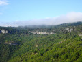
The hike combines sections of well-known routes (Haute Vallée de la Lergue, Corniches de Lauroux, Forêt de l'Escandorgue) with unmarked paths. A GPS is highly recommended. In clear weather, the views are superb, overlooking the Cirque de Labeil. There is a wide variety of landscapes and environments.
Pioch Farrus mine, Church of Saint-Gély-d'Arques from Cabrières
 9.51 mi
+1,368 ft
-1,381 ft
5h 35
Moderate
Departure from Cabrières (Hérault) (Hérault)
9.51 mi
+1,368 ft
-1,381 ft
5h 35
Moderate
Departure from Cabrières (Hérault) (Hérault)
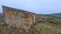
Hike with varied terrain and a beautiful view of the Pic de Vissou. The ruins of the Church of Saint-Gély d'Arques are a lovely spot for a picnic.Some sections are not marked and require the use of a GPS.
Villecun route via the Col de la Défriché and Lavalette
9.80 mi
+1,312 ft
-1,306 ft
5h 40
Moderate
Departure from Olmet-et-Villecun (Hérault)
A pleasant walk, starting with unobstructed views of the highest peaks, then shaded after Lavalette. A short stretch of tarmac at the start and halfway along the route.
The Causse and the banks of the Sorgue from Cornus
9.90 mi
+1,093 ft
-1,106 ft
5h 30
Moderate
Departure from Cornus (Aveyron)
A very beautiful spring walk (May, if possible) to enjoy the flowers on the Causse, but it is best to avoid days that are too hot. Beautiful green landscapes. The paths are varied, sometimes through woodland, sometimes open. The elevation gain does not seem significant but is spread over two or three steep sections, with the rest following the contour lines more or less.
La Boissière circular
8.98 mi
+1,391 ft
-1,388 ft
5h 20
Moderate
Departure from La Boissière (Hérault) (Hérault)
Hiking on tracks and trails. This outing, sometimes in the undergrowth, sometimes under the pines, does not present any particular difficulty for occasional hikers. In good weather, there are beautiful views from Puech Bartelié or over the Séranne.
From Sahuc to the Col de l’Homme
4.47 mi
+928 ft
-912 ft
2h 50
Moderate
Departure from Serres-sur-Arget (Ariège)
A walk through woods and meadows, passing through small hamlets. A GPS is essential as the route follows paths not shown on IGN maps.
From Saint-Pierre-de-Rivière to Saint-Martin-de-Caralp
 7.57 mi
+951 ft
-922 ft
4h 20
Moderate
Departure from Saint-Pierre-de-Rivière (Ariège)
7.57 mi
+951 ft
-922 ft
4h 20
Moderate
Departure from Saint-Pierre-de-Rivière (Ariège)
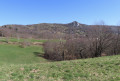
An easy hike with beautiful views of the Pyrenees. No difficulty apart from some old markings or sections overlapping local routes, and a section requiring GPS guidance at the point (8).
La Soureille d'Izarne
 8.06 mi
+1,348 ft
-1,319 ft
4h 55
Moderate
Departure from Cabrières (Hérault) (Hérault)
8.06 mi
+1,348 ft
-1,319 ft
4h 55
Moderate
Departure from Cabrières (Hérault) (Hérault)
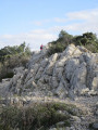
The path to the top of La Soureille d'Izarne is quite steep, but the effort is rewarded with a superb view of the Pyrenees on a clear day. Walking along the ridges requires a little care, but there are no vertiginous passages. The rest of the route is easy.
The Roquefort waterfalls from Roquefixade
 7.01 mi
+1,647 ft
-1,647 ft
4h 40
Moderate
Departure from Roquefixade (Ariège)
7.01 mi
+1,647 ft
-1,647 ft
4h 40
Moderate
Departure from Roquefixade (Ariège)
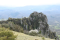
A beautiful hike, mostly through woods and without difficulty. Various routes are listed in a booklet available at the stopover lodge. At the start, our route is marked as No. 6.
Between Lavérune and Truc Pelat
 6.68 mi
+407 ft
-381 ft
3h 25
Moderate
Departure from Pignan (Hérault)
6.68 mi
+407 ft
-381 ft
3h 25
Moderate
Departure from Pignan (Hérault)
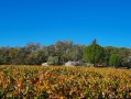
To explore the area around Lavérune, take the small tarmac or stone paths, as well as the trails that cross the Truc Pela woods.
The hike is easy overall, but requires a little attention in the woods, or even a GPS.
Circular starting from Les Matelles
 5.74 mi
+285 ft
-285 ft
2h 55
5.74 mi
+285 ft
-285 ft
2h 55
 Easy
Departure from Les Matelles (Hérault)
Easy
Departure from Les Matelles (Hérault)
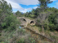
This walk takes you through the pretty village of Les Matelles and past two Romanesque bridges. It winds its way through vineyards and pine forests.
Best avoided in summer.
Saint-Clément de Rivière, entre le Grand Patus et la source du Lez
8.25 mi
+574 ft
-545 ft
4h 20
Moderate
Departure from Saint-Clément-de-Rivière (Hérault)
Randonnée au tracé très complexe nécessitant l'utilisation d'un GPS. La carte IGN au 1/25000 n'est pas suffisante. En contrepartie, vous découvrirez de nombreux petits sentiers non balisés et peu fréquentés, à l'écart des pistes et en sous-bois. Vous atteindrez la source du Lez, secteur bien aménagé pouvant faire l'objet d'une pause et reviendrez vers le parking, toujours par des chemins isolés.