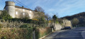
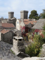
The Causse and the banks of the Sorgue from Cornus

A very beautiful spring walk (May, if possible) to enjoy the flowers on the Causse, but it is best to avoid days that are too hot. Beautiful green landscapes. The paths are varied, sometimes through woodland, sometimes open. The elevation gain does not seem significant but is spread over two or three steep sections, with the rest following the contour lines more or less.

Details

11457379
Creation:
Last update:
Last review:
  • Walking
    Activity: Walking
  • ↔
    Distance: 9.90 mi
  • ◔
    Average duration: 5h 30 
  • ▲
    Difficulty: Moderate

  • ⚐
    Back to start: Yes
  • ↗
    Ascent: + 1,093 ft
  • ↘
    Descent: - 1,106 ft

  • ▲
    Highest point: 2,582 ft
  • ▼
    Lowest point: 1,614 ft

Description of the walk

Park in the hikers’ car park, below the village of Cornus.

(S/E) Walk back up into the village and follow the D7 (Avenue Louis-Alexis Delmas) southwards to a bus shelter.

(1) Take the road opposite the bus shelter, which winds sharply to the right. A few metres further on, turn onto the tarmac track on the left leading to a few houses. Continue to the end of this track and reach the end of the tarmac at a fork. Turn right onto thePR® path marked in yellow and continue to a ruin. Open the gate on the right and you will soon reach the junction withthe GR® 71C.

(2) Turn left onto it and follow the red and white markings. Walk across the plateau, on a completely flat stretch, until you reach a crossroads of paths.

(3) Leave theGR® and take the path on the left, skirting the fields to reach the edge of the forest.

(4) As you enter the forest, begin a clearly marked descent. You will then reach the junction of the path leading to the Bergerie du Cros.

(5) Turn right to reach the crossroads at the entrance to the hamlet of Le Bosc (marked by a cross).

(6) Turn left onto the wide path. Continue until you reach the D7 at the hamlet of Antignes.

(7) Carefully turn right onto the D7 and, a few hundred metres further on, reach the junction where a sign indicates “Labadié”.

(8) Leave the D7 and turn left. Cross the bridge over the Sorgue to reach a wine cellar. Turn left and then follow the Sorgue along its left bank, skirting the edge of the Saint-Véran woods. Continue along this path, which ends at the junction withthe GR®71C.

(9) Turn left onto it and follow the red and white markings to rejoin the D7. Continue carefully along this road to return to the junction you passed on the way out.

(1) Retrace your steps along the route you took on the way out to reach the Cornus hikers’ car park (S/E).

Waypoints

  1. S/E : mi 0 - alt. 2,126 ft - Cornus hikers’ car park
  2. 1 : mi 0.33 - alt. 2,087 ft - Bus shelter
  3. 2 : mi 1.92 - alt. 2,556 ft - GR71C
  4. 3 : mi 3.14 - alt. 2,575 ft - Junction
  5. 4 : mi 3.86 - alt. 2,543 ft - Edge of the forest
  6. 5 : mi 4.47 - alt. 1,939 ft - Sheepfold crossroads
  7. 6 : mi 4.84 - alt. 1,864 ft - Croix
  8. 7 : mi 6.05 - alt. 1,690 ft - Antignes
  9. 8 : mi 6.39 - alt. 1,660 ft - Labadié sign
  10. 9 : mi 8.52 - alt. 1,726 ft - GR71C
  11. S/E : mi 9.9 - alt. 2,126 ft - Cornus hikers’ car park

Worth a visit

Visit the pretty village of Cornus.
La Couvertoirade, La Cavalerie, Templar towns.

Always be cautious and plan ahead when you're outdoors. Visorando and the author of this route cannot be held responsible for any accidents occurring on this route.

The GR® and PR® markings are the intellectual property of the Fédération Française de Randonnée Pédestre.

Reviews and comments

4.2 / 5
Based on 6 reviews

Reliability of the description
4.2 / 5
Ease of following the route
4 / 5
Route interest
4.3 / 5
jf-dadoun
jf-dadoun
• Edited:

Overall rating : 4.7 / 5

Date of your route : May 08, 2025
Reliability of the description : ★★★★★ Very good
Ease of following the route : ★★★★☆ Good
Route interest : ★★★★★ Very good
Very busy route : No

A lovely walk, particularly for its abundance of wildflowers in early spring.
Don’t miss: the tunnels beneath the first Frayssinet ruin (at the foot of the cliff below point 2) (over 70 m of underground tunnels that were once used as a cheese cellar – bring a head torch).
After point 8 (Labadié), the path is just before the Labadié building.

Machine-translated

claude et mich
claude et mich

I’ve looked at the walks but I haven’t done them yet

Machine-translated

vero4030
vero4030

Overall rating : 5 / 5

Date of your route : Nov 10, 2024
Reliability of the description : ★★★★★ Very good
Ease of following the route : ★★★★★ Very good
Route interest : ★★★★★ Very good
Very busy route : No

A lovely walk, perfect for the shoulder season

Machine-translated

Ktor
Ktor

Overall rating : 4.3 / 5

Date of your route : Aug 26, 2024
Reliability of the description : ★★★★☆ Good
Ease of following the route : ★★★★★ Very good
Route interest : ★★★★☆ Good
Very busy route : No

A lovely walk, with very few people about. Varied scenery and a few climbs that really take it out of you! The descent is a bit steep but doesn’t last too long. Not recommended in hot weather, as although there are quite a few shaded sections, it’s hot and muggy in the woods. Up on the plateau, it’s really pleasant and cool. Took 4½ hours including breaks, with GPS.

Machine-translated

Pascaldemeze
Pascaldemeze

Overall rating : 3.7 / 5

Date of your route : Aug 04, 2024
Reliability of the description : ★★★★☆ Good
Ease of following the route : ★★★☆☆ Average
Route interest : ★★★★☆ Good
Very busy route : No

You’ll need a GPS. 17 km, 523 m elevation gain, lovely little streams,
plenty of shade. lovely hike

Machine-translated

LN et JP
LN et JP

Overall rating : 4 / 5

Date of your route : Jan 01, 2024
Reliability of the description : ★★★★☆ Good
Ease of following the route : ★★★★☆ Good
Route interest : ★★★★☆ Good
Very busy route : No

A very pleasant walk in December. A few muddy patches

Machine-translated

Blanc Ludovic
Blanc Ludovic

Overall rating : 3.3 / 5

Date of your route : Aug 14, 2023
Reliability of the description : ★★★☆☆ Average
Ease of following the route : ★★★☆☆ Average
Route interest : ★★★★☆ Good
Very busy route : Yes

It was very hot and very windy!
A nice hike, meeting other hikers and gravel cyclists.
We couldn’t find the path that was supposed to go off to the left and down into the ravine.
We had a good day all the same.
We’ve planned to do it again, using the map this time.

Machine-translated

Other walks in the area

For more walks, use our search engine .

The GPS track and description are the property of this route's author. Please do not copy them without permission.