


eriba-17

 Visorando Member
 Premium user
 Sign up:
Published route(s)
 The southern tip of the Île d'Oléron, starting from Saint-Trojan
 10.15 mi
 +79 ft
 -79 ft
 4h 45
4h 45
 Moderate
 Departure from Saint-Trojan-les-Bains (Charente-Maritime)
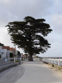
A circular walk that takes you from the village of Saint-Trojan to explore the national forest, the wild Atlantic coast with the impressive Maumusson channel, and Gatseau Bay. A complete panorama to discover this southern tip of the Île d’Oléron, far from the cars and crowds on the beaches.Please note: To walk easily on the hard sand between (4) and (5), you must check the tide times (see the Practical Information section)
The Tonnay-Charente suspension bridge and the Cèpe bridge
 7.97 mi
+108 ft
-108 ft
3h 45
Moderate
Departure from Tonnay-Charente (Charente-Maritime)
7.97 mi
+108 ft
-108 ft
3h 45
Moderate
Departure from Tonnay-Charente (Charente-Maritime)
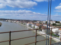
This loop, starting from Tonnay-Charente, will take you across the Charente river twice via two bridges that are completely closed to motor traffic.
You can admire the view from the top of the Tonnay-Charente suspension bridge and explore the quays of its sleepy port.
A circular in the woods around Fenioux
 5.49 mi
+335 ft
-367 ft
2h 50
5.49 mi
+335 ft
-367 ft
2h 50
 Easy
Departure from Fenioux (Charente-Maritime)
Easy
Departure from Fenioux (Charente-Maritime)
A hike through the rolling, wooded landscape of Saintonge. Upon arrival, you can admire the lantern of the dead and the Romanesque portal of the church of Fenioux. Information panels provide details about these two monuments.
You will follow part of theGR®655(a route to Santiago de Compostela, via Tours) and theGR®360, but there are no reliable markings along the route.
The tour of Pointe de Gatseau and Pertuis de Maumusson
 3.11 mi
+10 ft
-10 ft
1h 25
Easy
Departure from Saint-Trojan-les-Bains (Charente-Maritime)
3.11 mi
+10 ft
-10 ft
1h 25
Easy
Departure from Saint-Trojan-les-Bains (Charente-Maritime)
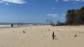
This short 5 km circular takes you around Pointe de Gatseau, the southernmost point of the Île d'Oléron, and allows you to discover the wild Pertuis de Maumusson (passage between the island and the mainland), which is only accessible on foot or by mini train during the season
From Banyuls-sur-Mer station to Collioure station via Cap Béar
 9.59 mi
+1,562 ft
-1,572 ft
5h 45
Moderate
Departure from Banyuls-sur-Mer (Pyrénées-Orientales)
9.59 mi
+1,562 ft
-1,572 ft
5h 45
Moderate
Departure from Banyuls-sur-Mer (Pyrénées-Orientales)
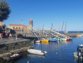
This hike takes you from Banyuls-sur-Mer station to Collioure station. There are frequent trains, allowing you to make the return journey. You can break up the hike at Port-Vendres station.
The route follows the coast from Banyuls to Cap Béar (Cap de Biarra), passing through Anse de Paulilles (Badia de Polilles).Then you cross Port-Vendres to climb up to Fort Saint Elme and descend with a splendid view of Collioure.
⚠️Check whether the coastal path linking Argelès-sur-Mer to Cerbère is open or closed here before starting this hike.
Îlet des Orangers via the canal
 17.14 mi
+4,409 ft
-4,409 ft
8 hrs
17.14 mi
+4,409 ft
-4,409 ft
8 hrs
 Very difficult
Departure from Saint-Paul (La Réunion) (Réunion)
Very difficult
Departure from Saint-Paul (La Réunion) (Réunion)
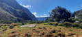
One way to access the Cirque de Mafate is from Sans Souci. The pipeline path may seem long, but the landscape overlooking the Rivière des Galets from a height of 500 m is breathtaking. From above, you can see Deux Bras and the narrow gorge through which the Rivière des Galets flows out of the Cirque de Mafate.
The canal path has a gentle slope. After the water catchment, access to Îlet des Orangers is via a narrow gorge after a steep climb.
Estimated elevation gain: approximately 700 metres.
Around Sablonceaux Abbey - Le Chemin des Prêtres
 7.53 mi
+43 ft
-39 ft
3h 30
Moderate
Departure from Sablonceaux (Charente-Maritime)
7.53 mi
+43 ft
-39 ft
3h 30
Moderate
Departure from Sablonceaux (Charente-Maritime)
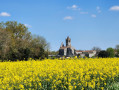
This route allows you to discover Sablonceaux Abbey in the middle of the fields from several angles.
The route passes through woods, fields, vineyards and horse farms, giving you an insight into the diversity of agricultural activities around Sablonceaux.
From Chaniers to Port Hublé via Les Grandes Combes and back via the Charente
5.83 mi
+207 ft
-207 ft
2h 50
Easy
Departure from Chaniers (Charente-Maritime)
This hike will take you to the heights of the commune of Chaniers to discover the view of the hillsides on the other side of the Charente, before returning along the river.
Circular route from Rochefollet to Bussac-sur-Charente
 7.86 mi
+344 ft
-358 ft
3h 55
Moderate
Departure from Bussac-sur-Charente (Charente-Maritime)
7.86 mi
+344 ft
-358 ft
3h 55
Moderate
Departure from Bussac-sur-Charente (Charente-Maritime)
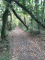
A walk around Bussac-sur-Charente. The route passes through the small gorge carved out by the Rocheffolet. You will also see watermills and a windmill.
Between Saint-Vivien and Thairé
 8.53 mi
+72 ft
-66 ft
4h 00
Moderate
Departure from Saint-Vivien (Charente-Maritime)
8.53 mi
+72 ft
-66 ft
4h 00
Moderate
Departure from Saint-Vivien (Charente-Maritime)
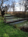
A 13 km circular route in Aunis, on the edge of the Yves Marsh. The route follows many hard-surfaced and very little-used farm tracks, with about a third of the route on dirt tracks.
This route can be covered on foot or by bicycle (with a proper mountain bike on the path along the canal surrounding the marsh).
A circular route through the wild section of the Coubre National Forest
 8.98 mi
+492 ft
-482 ft
4h 35
Moderate
Departure from La Tremblade (Charente-Maritime)
8.98 mi
+492 ft
-482 ft
4h 35
Moderate
Departure from La Tremblade (Charente-Maritime)
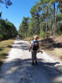
You will be walking between points (2) and (7), running close to the boundary of a private hunting reserve. With a bit of luck, you may spot some large game, but of course you cannot enter the reserve.
At the Tour du Gardour, a former navigation mark, you can enjoy a view of the ocean; a little further on, there is a lovely panorama of the southern tip of Île d’Oléron and the Pertuis de Maumusson.
Around the Phare des Baleines lighthouse
 3.53 mi
+16 ft
-16 ft
1h 40
Easy
Departure from Saint-Clément-des-Baleines (Charente-Maritime)
3.53 mi
+16 ft
-16 ft
1h 40
Easy
Departure from Saint-Clément-des-Baleines (Charente-Maritime)
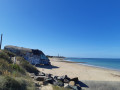
A circular loop to see the Phare des Baleines lighthouse from its best angle. Return via the Conche des Baleines.
La Flotte en Ré and the Rivedoux Forest
 7.38 mi
+36 ft
-36 ft
3h 25
Moderate
Departure from La Flotte (Charente-Maritime)
7.38 mi
+36 ft
-36 ft
3h 25
Moderate
Departure from La Flotte (Charente-Maritime)
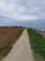
Starting from the ruins of Châteliers Abbey, this route will first take you along the coast at the top of the cliff, then across the Flotte via its small footpaths. You will then return to the starting point through the pine and holm oak forest of Rivedoux, passing by Fort de la Prée.
 Tonnay Suspension Bridge – Rochefort Transhipment Bridge
 13.68 mi
+98 ft
-98 ft
2.5 hrs
Easy
Departure from Rochefort (Charente-Maritime)
13.68 mi
+98 ft
-98 ft
2.5 hrs
Easy
Departure from Rochefort (Charente-Maritime)
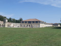
Starting from Rochefort, a short circular cycle route – with no particular difficulties – takes you across the Charente, first via the Tonnay-Charente pedestrian suspension bridge and then via the Rochefort transporter bridge
You’ll also pass through the area of the military arsenal commissioned by Louis XIV and cycle alongside the Corderie Royale.
Please note that the transporter bridge is closed during the winter months from November to March.
From Brouage to Hiers
 6.69 mi
+46 ft
-46 ft
3h 05
Easy
Departure from Hiers-Brouage (Charente-Maritime)
6.69 mi
+46 ft
-46 ft
3h 05
Easy
Departure from Hiers-Brouage (Charente-Maritime)
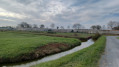
A circular starting from the citadel of Brouage takes you through the marsh to Hiers.If you are quiet enough along the route, you will be able to see herons, egrets, nutria and, in summer, storks up close.Most of the route follows tarmaced marsh roads that are very quiet.
From Trizay Abbey to the Creux Nègre Cave
 6.00 mi
+36 ft
-36 ft
2h 45
Easy
Departure from Trizay (Charente-Maritime)
6.00 mi
+36 ft
-36 ft
2h 45
Easy
Departure from Trizay (Charente-Maritime)
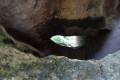
A circular starting from Trizay Abbey towards the cave and the Creux Nègre rock passage. This geological curiosity in the region is carved into the ancient cliffs that line the Arnoult valley.
Half of the route is on tarmac, on very quiet roads, allowing you to discover the market gardens on the rich lands of the Arnoult valley (home of the Pont l'Abbé bean).
Château du Bois Charmant and the Font de Benon sandpit at Les Nouillers
 6.48 mi
+135 ft
-161 ft
3h 05
Moderate
Departure from Les Nouillers (Charente-Maritime)
6.48 mi
+135 ft
-161 ft
3h 05
Moderate
Departure from Les Nouillers (Charente-Maritime)
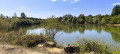
A circular route that takes you round the Château du Bois Charmant and through a curious sandpit landscape. The route can also be done on a mountain bike. There are a few technical sections.
The Cadeuil ponds circular loop from La Gripperie-Saint Symphorien
10.27 mi
+203 ft
-203 ft
4h 55
Moderate
Departure from La Gripperie-Saint-Symphorien (Charente-Maritime)
Near the coast and the Brouage Marsh, a circular route runs along the Massonnerie Nature Reserve and around the large ponds of the Cadeuil sandpit.
From La Chapelle-des-Pots to Saint-Césaire
 6.60 mi
+381 ft
-344 ft
3h 20
Moderate
Departure from La Chapelle-des-Pots (Charente-Maritime)
6.60 mi
+381 ft
-344 ft
3h 20
Moderate
Departure from La Chapelle-des-Pots (Charente-Maritime)
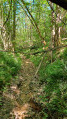
This 10 km circular will show you the very diverse landscapes of Saintonge. Two-thirds of the route is shaded by woods, one-third is through vineyards (we are in the "Fins Bois" area of the Cognac appellation) and a small third (thank you Pagnol) is in the two villages at the start and finish.
The route is sometimes complicated, but the paths are well marked. The route was surveyed on site, so it is very reliable, even if it sometimes seems to stray from the paths marked on the IGN map (especially at the start).
The Seudre Canal to the Charente and "Mauritius Island" from Échillais
 7.00 mi
+30 ft
-30 ft
3h 15
Moderate
Departure from Échillais (Charente-Maritime)
7.00 mi
+30 ft
-30 ft
3h 15
Moderate
Departure from Échillais (Charente-Maritime)
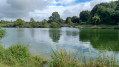
Starting from Échillais, you can first admire the beautiful 12th-century façade of the church. Then you will pass in front of "La Limoise". This residence is described at length by Pierre Loti in "Le Roman d'un Enfant" (A Child's Novel). This house belonged to the Duplais family, friends of the Viaud family (Julien Viaud being Pierre Loti's real name). He would spend his Thursdays there, walking from his house in Rochefort (now Pierre Loti's house) to La Limoise, crossing the Charente by ferry. There was no transporter bridge at the time.
The Seudre Canal to the Charente (also known as the Bridoire Canal) is 27 km long and was dug in the 19th century from Saint-Hippolyte to Marennes. You will also cross Île Maurice, although it is much smaller than the one we usually think of.
The woods, hedgerows and marshes around Geay
 5.77 mi
+105 ft
-135 ft
2h 45
Easy
Departure from Geay (Charente-Maritime)
5.77 mi
+105 ft
-135 ft
2h 45
Easy
Departure from Geay (Charente-Maritime)
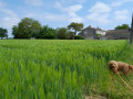
A circular route around the pretty, peaceful little village of Geay. The route takes you along well-maintained paths through forests and wooded countryside. You will also ride alongside the marsh.
The Charente is not far away but remains invisible.
The route has been surveyed on the ground, making it very reliable.
The Pointe du Chay circular walk starting from Aytré station
 6.01 mi
+26 ft
-26 ft
2h 45
Easy
Departure from Aytré (Charente-Maritime)
6.01 mi
+26 ft
-26 ft
2h 45
Easy
Departure from Aytré (Charente-Maritime)
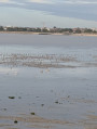
A walk starting very close to the city of La Rochelle. You may still be lucky enough to see herons up close between points (5) and (6).
You’ll also see the region’s iconic fishing huts at the bridge (9) and on Aytré Beach.
From the top of the Pointe du Chay, there’s a lovely panoramic view of the Île d’Oléron, the Île d’Aix, the Île de Ré and the Bay of La Rochelle.
In the footsteps of Hélène de Fonsèque in Surgères
 6.38 mi
+174 ft
-177 ft
3h 05
Easy
Departure from Surgères (Charente-Maritime)
6.38 mi
+174 ft
-177 ft
3h 05
Easy
Departure from Surgères (Charente-Maritime)
Circular route starting from Surgères Castle. After leaving the town, you ride through the countryside on the border between Aunis and Saintonge. The landscape changes with the seasons; the start of the ride takes you through fields of rapeseed, wheat and maize.In the final section, you follow the banks of the Gères and finish by re-entering the town through 1970s-era neighbourhoods, then past the ancient walls of old mansions, ending up along the castle ramparts.