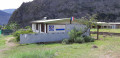
Îlet des Orangers as seen from Maïdo

Le Maîdo is a classic route into the Cirque de Mafate via the famous Roche Plate path. I suggest you take a detour halfway along the route and, instead of heading to the well-known and popular Îlet de Roche Plate, head for the Îlet des Orangers.
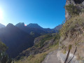
The start of the route follows a steeply sloping path with breathtaking views over the floor of the cirque. Then, from La Brêche, you’ll follow theGR® R3, which winds its way along the bottom of a very narrow and rugged ravine.

Details

n°2831784
Creation:
Last update:
Last review:
  • Walking
    Activity: Walking
  • ↔
    Distance: 6.61 mi
  • ◔
    Average duration: 6h 50 
  • ▲
    Difficulty: Difficult

  • ⚐
    Back to start: Yes
  • ↗
    Ascent: + 4,396 ft
  • ↘
    Descent: - 4,380 ft

  • ▲
    Highest point: 6,660 ft
  • ▼
    Lowest point: 2,972 ft

Photos

Description of the walk

The walk starts at the kiosk, which is 1.8 km before the car park at the summit of Maïdo. It’s a bus stop. Bus route 61 runs three return journeys a day from Saint-Paul station.
If you’re coming by car, park in the spaces further up or further down so as not to obstruct the road.

(S/E) Follow a wide lava track marked in white on the left-hand side of the road as you climb. At the first Fork in the road, turn left through the vegetation to reach Ti’ Col.

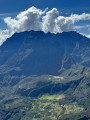
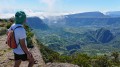
(1) At Ti’ Col, the path begins which descends into the Mafate cirque to reach either Roche Plate or Îlet des Orangers. The view is breathtaking. From left to right, you can see Îlet des Orangers, Cayenne, Grand Place, Aurère, Îlet à Malheur, Îlet à Bourse and La Nouvelle in front of the Trois Salazes.

You begin the very steep descent along a stony path, with a rock face on one side and a sheer drop of over 500 metres on the other. You should therefore descend with caution.

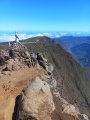
(2) About 50 minutes after setting off, a sign painted in white on the rocks points to a viewpoint 50 metres to the right of the path. We take the detour and, after admiring the view, return to the path and continue down until we reach theGR® R2 R3 at La Brèche.

(3) The view is lovely here too, and the signposting is clear. Leave the path that descends to the right towards Roche Plate and turn left towards Îlet des Orangers on theGR® R3. The path descends via steps made of large stones and is shaded by the vegetation. You’ll reach the junction with the path on the left leading to the Îlet des Orangers cemetery

(4) Carry on straight ahead. The path, still lined with large stone steps, reaches the bottom of a ravine which becomes very narrow.

(5) Carry on straight ahead.

(6) Shortly afterwards, you’ll pass a spring gushing from the rock to the left of the path. The path now climbs in tight hairpin bends to reach the sign marking the entrance to Îlet des Orangers.

Turn right and head uphill up the steps after this sign. You’ll pass a picnic table and a helicopter landing pad. Carry on straight ahead to reach the square at Îlet des Orangers.

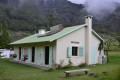
(7) In the square, you’ll find two picnic tables, the school, the clinic and the chapel. Return via the same route to the car park (S/E).

Allow 4 hours 30 minutes for the return journey. The descent was tough, but the climb was even tougher...
Waypoints

  1. S/E : mi 0 - alt. 6,467 ft - Parking is available near the kiosk
  2. 1 : mi 0.24 - alt. 6,660 ft - Ti Col
  3. 2 : mi 0.95 - alt. 5,899 ft - Junction at the viewpoint
  4. 3 : mi 1.82 - alt. 4,239 ft - La Brêche
  5. 4 : mi 2.49 - alt. 3,297 ft - Turn-off towards the cemetery
  6. 5 : mi 2.65 - alt. 3,140 ft - Bottom of the ravine
  7. 6 : mi 2.8 - alt. 3,025 ft - Source
  8. 7 : mi 3.34 - alt. 3,215 ft - Îlet des Orangers
  9. S/E : mi 6.61 - alt. 6,453 ft - Parking is available near the kiosk

Notes

The route has been mapped out on site. The elevation drop on the descent between points (1) and (3) is significant. Don’t forget that you’ll have to climb back up at the end of the hike.
The times given are for a fit hiker who has taken the time to admire the scenery and have a picnic (9 hours in total).

The section of the path from Ti’ Col to La Brêche is very steep and dangerous. The path may be closed due to rockfalls, particularly during the rainy season. Check before setting off.
The crosses found along the trail are not all there to honour the Virgin Mary or Saint Expeditus, but also to mark the fatal accidents that have occurred along this route.

You can reach the start of the walk by taking bus number 61 from Saint-Paul coach station at 5.50 am: alight at the ‘Sentier Maïdo’ terminus at 6.55 am, and return at 5.40 pm to arrive back in Saint-Paul at 6.45 pm.

You’ll find water at Îlet des Orangers; there’s a tap fixed to a large rock behind the school.

The descent is steep, but so is the climb back up. If you’re doing the hike as a day trip, bear in mind that you’ll have to climb back up. Allow 4 hours 30 minutes for the return journey.

Worth a visit

In the morning, you may come across locals from Mafata heading up with empty rucksacks, whom you’ll meet again in the evening as they make their way back down with full rucksacks. Whilst you were out hiking, they’ve been out doing their shopping!

There are some stunning views all along the route, far from the crowds and the traffic of Maïdo.

Always be cautious and plan ahead when you're outdoors. Visorando and the author of this route cannot be held responsible for any accidents occurring on this route.

The GR® and PR® markings are the intellectual property of the Fédération Française de Randonnée Pédestre.

Reviews and comments

5 / 5
Based on 1 review

Reliability of the description
Not used
Ease of following the route
Non utilisé
Route interest
5 / 5
Orando974
Orando974 ★
• Edited:

Overall rating : 5 / 5

Date of your route : May 24, 2020
Reliability of the description : Not used / Not applicable
Ease of following the route : Not used / Not applicable
Route interest : ★★★★★ Very good
Very busy route : Yes

I only walked as far as La Brèche. I then carried on towards Roche Plate. The descent to La Brèche is quite a challenge, and the climb back up is even tougher. But if you take your time, it’s perfectly manageable (it took me 1 hour 45 minutes to climb back up). The views are spectacular all along the way. There are also a few rather vertiginous sections during the first half of the route. This walk is quite busy at the weekend. It’s best to arrive early to secure a parking space before people start turning up for picnics.

Machine-translated

Other walks in the area

For more walks, use our search engine .

The GPS track and description are the property of this route's author. Please do not copy them without permission.