


 Country:
 City:
City:


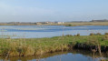

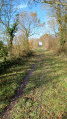
The start of the walk is at Chie Loup, in the commune of Vergeroux, at the end of Rue du Chemin de la Trappe, which is a dead end for cars.
You can park at the other end of Chemin de la Trappe, where it joins Rue de la Tublerie (D214).
(S/E) At the northern end of Chemin de la Trappe, take the dirt track branching off to the right, heading north. Continue along this track for 200 m, then turn left at the first junction. You are now on a marsh embankment that runs alongside a canal and is sometimes situated between two canals. Continue for approximately 1.5 km until you reach a junction with a white track.
(1) Turn left, cross over a canal (Canal de Rochefort) and follow this track up to the junction just before the first bridge; on the right is a wide grassy track, closed off by a barrier, which is off-limits to bicycles, motorbikes and cars and which runs alongside the Canal de Ciré.
(2) Cross the small bridge opposite to cross the first canal, then cross the second via a much larger bridge. After this second bridge, turn left onto the stony track, then immediately right onto a path running alongside the edge of a meadow. Follow this path for 150 m, then turn left and walk alongside a hedge for 50 m until you find a gap in it on the right, leading to one of the ‘Pierres Closes’. The second ‘Pierres Closes’ is believed to be located within the Saint Laurent de la Prée Golf Course, but entry is prohibited.
(3) Turn back. After passing the hedge again, head straight ahead to walk along the edge of the meadow in the opposite direction. Cross the two bridges again and return to the junction.
(2) Turn left onto this wide, well-maintained grassy path which runs alongside the Canal de Ciré on your left. At times, you’ll find yourself between two canals. On your right, you can see a large duck-hunting blind. Continue straight on along this path for 2.2 km until you come out onto a tarmac road.
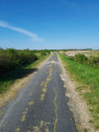
(4) Turn right and continue along this road for approximately 1.7 km. The road bends, climbs slightly and passes a large farm shed on the right. You’ll pass a cluster of houses on either side of the road until you reach a crossroads.
(5) Turn right onto the Route de la Perche. Enter the Bois de Goujaux, staying on the tarmac, and carry on straight ahead until you reach the junction with the Route des Sablières and the Route du Père.
(6) Turn left, staying on the tarmac, and carry on for 300 metres until you reach the junction with a wide dirt track.
(7) Turn right onto this track and carry on straight ahead across the fields until you reach an junction with a small cluster of houses in Cadoret.
(8) Turn left and follow the road for 100 m. Just before the first bend in the road, take a narrow dirt track on the right. The entrance to this track is barely visible beneath the trees. When you come to a ditch and a wall, turn right onto the dirt track. Continue straight on, ignoring the tracks branching off to the left, which are simply entrances to the fields.
At the end of the track, on the left, you will see a double concrete electricity pole. Turn left and retrace your steps for 200 m along the route you took on the way there to return to the starting point (S/E)





 Visorando Member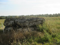
 Moderate

 Association / Club / Walk leader
