


Refine your search for walks in Saulxures
Saulxures walks


 Circular route around Saulxures
 Visorando Member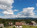
 6.71 mi
 +755 ft
 -764 ft
 3h 45
3h 45
 Moderate
 Departure from Saulxures (Bas-Rhin)
A pleasant walk around Saulxures, much of it in the shade. Beautiful views along the route.
Circular route straddling Alsace and Lorraine, starting from Champenay
13.01 mi
+2,549 ft
-2,539 ft
8h 10
 Difficult
Departure from Plaine (Bas-Rhin)
Difficult
Departure from Plaine (Bas-Rhin)
At the Col du Hantz, we cross into Lorraine; then, after a fairly long stretch along a quiet road, we follow a stream along an impressive medieval cobbled path, adorned with installations by ‘art student’ from the University of Nancy; a little further up, the tranquillity of a secluded peat bog is disturbed only by birdsong. The Chemin des Passeurs then takes us to La Haute-Loge and La Chatte Pendue. A journey for lovers of nature and history.
From Colroy-la-Roche to Stampoumont in a circular.
 5.51 mi
+712 ft
-705 ft
3h 10
5.51 mi
+712 ft
-705 ft
3h 10
 Easy
Departure from Colroy-la-Roche (Bas-Rhin)
Easy
Departure from Colroy-la-Roche (Bas-Rhin)
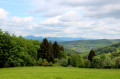
An easy walk to the hamlet of Stampoumont through a beautiful forest, then beautiful views of the pastures, the Donon and the Climont, not to mention the pretty chapel of Stampoumont with its minimalist stained glass windows. A calm and peaceful walk.
The Hang clearing at the foot of Climont
 Tourist office6.95 mi
+860 ft
-876 ft
3h 55
Moderate
Departure from Bourg-Bruche (Bas-Rhin)
Tourist office6.95 mi
+860 ft
-876 ft
3h 55
Moderate
Departure from Bourg-Bruche (Bas-Rhin)
This walk winds through a haven of peace and tranquillity at the foot of one of the valley's legendary peaks: Climont (966 m). The Bruche river rises at an altitude of 660 m and then crosses a vast basin: the Hang clearing. This is where families of glassmakers settled in 1723. Le Hang continued to prosper thanks to the arrival of Mennonite farmers of Swiss origin. They found here a place conducive to their pastoral and community life.
L'Alhan - Le Climont - The source of the Bruche
 9.68 mi
+2,037 ft
-2,031 ft
6h 15
Difficult
Departure from Bourg-Bruche (Bas-Rhin)
9.68 mi
+2,037 ft
-2,031 ft
6h 15
Difficult
Departure from Bourg-Bruche (Bas-Rhin)
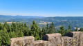
A beautiful hike with stunning views of all the surrounding valleys: the Bruche Valley, Donon, Saint-Dié-des-Vosges, Val de Villé, Sainte-Croix-aux-Mines, Haut-Koenigsbourg, etc.
It is quite difficult due to its length, elevation gain and rough terrain (narrow paths on the edge of the void or muddy forest paths).
Nature, history and habitat around Ranrupt
 8.93 mi
+1,467 ft
-1,467 ft
5h 25
Moderate
Departure from Colroy-la-Roche (Bas-Rhin)
8.93 mi
+1,467 ft
-1,467 ft
5h 25
Moderate
Departure from Colroy-la-Roche (Bas-Rhin)
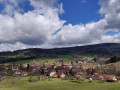
This circular loop, which runs mostly through the woods, offers a pleasant variety of points of interest. Villages and landscapes, nature and habitat, crafts, history and places of worship (ornate chapels, sandstone crosses) all contribute to the appeal of this still little-known region of Alsace.
Le Climont and the source of the Bruche
6.74 mi
+1,250 ft
-1,247 ft
4h 10
Moderate
Departure from Bourg-Bruche (Bas-Rhin)
This walk winds through a haven of peace and tranquillity towards one of the legendary peaks of the Bruche Valley. Surrounded by green, wooded landscapes, Le Climont is the region's water tower. Three rivers originate in its vicinity: the Bruche, Giessen and Fave. This spot is marked by a stele created by sculptor Raymond Keller from a block of sandstone donated by the Champenay quarry.
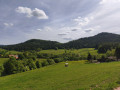
Exploring Climont
 7.66 mi
+1,440 ft
-1,407 ft
4h 45
Moderate
Departure from Bourg-Bruche (Bas-Rhin)
7.66 mi
+1,440 ft
-1,407 ft
4h 45
Moderate
Departure from Bourg-Bruche (Bas-Rhin)
A lovely walk in the Bruche Valley, with the climb up to Climont offering magnificent scenery. The ascent between (2) and (3) follows a footpath and is a bit of a challenge but well worth the effort. The descent is more gradual and follows a forest track.
The Saâles ridges
6.67 mi
+1,063 ft
-1,063 ft
4h 00
Moderate
Departure from Saales (Bas-Rhin)
Set in the centre of a two-kilometre-long plateau, surrounded by mountains, the village of Saâles was built on the Via Salinaria at a convenient crossing point over the Vosges. The village has maintained its role as a market town throughout history. As early as 1743, it was granted the privilege of holding a fair and a market. In 1924, the rebuilt town hall housed the market halls on its ground floor.
The Climont and the Voyemont from Saales
11.83 mi
+2,139 ft
-2,133 ft
7h 20
Moderate
Departure from Saales (Bas-Rhin)
Climont rises to an altitude of 965 metres. The Julius Tower stands atop its summit, offering a 360-degree view of Alsace and the Black Forest. This walk takes you to the summit starting from Saales. Half of the walk is on flat ground. A further quarter is uphill, and another quarter is downhill. The climbs aren’t very long, but they are quite steep, technical and stony. Most of the walk takes place in the forest. The return route takes you past the Voyemont and the Roche des Fées, offering views of the Bruche Valley and the Bas-Rhin on one side, and the Vosges department on the other.
Champ du Feu and Col de la Perheux from Fouday
 13.48 mi
+2,556 ft
-2,552 ft
8h 25
Difficult
Departure from Fouday (Bas-Rhin)
13.48 mi
+2,556 ft
-2,552 ft
8h 25
Difficult
Departure from Fouday (Bas-Rhin)
This hike will take you through Ban-de-la-Roche, a place dear to Pastor Jean-Frédéric Oberlin, who served there for 60 years. The route will take you through magnificent landscapes, past a little-known castle (or what remains of it) and to the highest point in the Bas-Rhin.It is a fairly long hike with a significant elevation gain, classified as difficult, which I completed in about 7 hours of walking.
Loop around Fouday and Belmont
 8.80 mi
+1,519 ft
-1,519 ft
5h 20
Moderate
Departure from Fouday (Bas-Rhin)
8.80 mi
+1,519 ft
-1,519 ft
5h 20
Moderate
Departure from Fouday (Bas-Rhin)
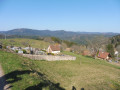
Loop connecting the various villages in the Chirgoutte valley, which were part of the former seigneury of Ban de la Roche.
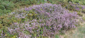
Circuit on the western slope of the Champ du Feu, alternating between forest, pastures and gorse heathland.
Beautiful views of the Donon and Climont mountains.
Les Hauts du Ban de la Roche
 6.71 mi
+1,365 ft
-1,358 ft
4h 15
Moderate
Departure from Fouday (Bas-Rhin)
6.71 mi
+1,365 ft
-1,358 ft
4h 15
Moderate
Departure from Fouday (Bas-Rhin)
This superb walk in the heart of the Vosges mountains is, in itself, an open-air history book. From Foudray, the route climbs towards Solbach and the legendary Col de la Perheux, reaching the green landscapes around Belmont before descending towards Waldersbach and then Foudray. Its church, with its 13th-century Romanesque bell tower, is now a temple, beside which lies the tomb of Pastor Oberlin.
Le Voyemont and the Roche des Fées viewpoint via the Hang shelter
 9.68 mi
+1,450 ft
-1,447 ft
5h 45
Moderate
Departure from Ranrupt (Bas-Rhin)
9.68 mi
+1,450 ft
-1,447 ft
5h 45
Moderate
Departure from Ranrupt (Bas-Rhin)
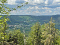
A mix of magnificent cow pastures and beautiful coniferous forests with stunning views. A preserved valley with a few farms and the odd holiday home, at the foot of one of the valley’s legendary peaks, the Climont (966 m). A haven of peace – picture-postcard perfect!The route is suitable for beginner hikers, though the climb to the Refuge du Hang and on to the Belvédère de la Roche des Fées may seem challenging for those less accustomed to hiking and requires a reasonable level of fitness.
Haute Loge route on the Passeurs trail
 4.57 mi
+1,125 ft
-1,125 ft
3h 05
Easy
Departure from Le Saulcy (Vosges)
4.57 mi
+1,125 ft
-1,125 ft
3h 05
Easy
Departure from Le Saulcy (Vosges)
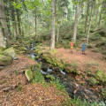
A fun hiking trail where around forty very diverse works produced during previous biennials remain in place. From the start, the ascent runs alongside the Grand Goutte stream and leads to stubble fields halfway along the route, offering a 360° view of breathtaking horizons. We reach the highest point at an altitude of 933 metres. The descent is just as interesting, with many surprises along the way.